BLACKLOCK POINT
Cliffs near Blacklock Point.
Distance: 9.4 miles out and back
Elevation Gain: 400 feet
Trailhead Elevation: 16 feet
Trail High Point: 180 feet
Season: all year
Best: all year
Pass: $5 day use fee
On the traditional lands of: the Tututni and Siletz peoples
Directions from Port Orford:
Drive north from Port Orford on US 101 for approximately 10 miles to a junction with Floras Lake Loop Road. Turn left here.
Drive 0.8 mile and turn left on Floras Lake Road.
Drive 1.4 miles and turn right at a sign for Boice Cope Park.
Drive 0.2 mile to the Day Use area, where you should park.
As of 2022, the day use fee is $5, which is payable at the parking lot.
Drivetime from Port Orford: 20 minutes
Hike: The lonely stretch of coastline between Coos Bay and Port Orford is fun for exploring, but the labyrinth of trails, roads, and beaches can be confusing even for veteran hikers. This fun day trip to the rugged cliffs of Blacklock Point combines the best of this gorgeous area, but be sure to pay attention to tide tables, trail junctions, and your own intuition. More than most hikes in this book, you will need to be aware of where you are at any given point to experience this hike at its best.
From the day use parking area, follow the trail out to Floras Lake. Continue along the north side of the lake until you reach a small sand dune. Cross the dune and head downhill to the beach. This is one of the more scenic beaches along this stretch of the Oregon Coast, but it is best experienced at low tide or close to it; at high tide, the beach disappears altogether. Be sure to check the tide tables before you do this part of the hike (you can avoid it, as you will see later). As you hike along the beach, the sandstone cliffs above the beach grow taller and taller, revealing small coves and weathered layers of rock that rise directly out of the sand. After 1.2 miles along the beach (and 1.7 miles of hiking overall), you’ll reach a small creek flowing into the ocean. Do not cross this creek; instead, locate a very brushy trail heading uphill to your left. The way soon becomes clear, and within 0.2 mile, you’ll reach a junction with the Oregon Coast Trail (OCT). Turn right here.
The OCT drops into the basin holding the same creek mentioned above. The trail crosses the creek at a muddy ford; look downstream to your right for a bridge leading over the creek. The trail then climbs onto the cliffs above the sea as it tunnels through dense forest, and from this point on, it is easy to follow and well-signed. You will follow signs leading you to Blacklock Point. Side trails to the right lead to a view of a natural rock arch on the beach, a tall waterfall tumbling down the cliffs of Blacklock Point, and an attractive meadow full of June wildflowers just above the northern end of Blacklock Point. At about 4 miles from the trailhead, reach a junction in the woods above Blacklock Point; turn right and continue following trails down to Blacklock Point. Just above the point is a campsite if you’re looking to backpack in this area. At 4.7 miles from the trailhead, the rugged cliffs of the point reveal themselves below you! A trail leads up to the highest part of the point but watch your step! Of all the places I visited along the coast working on this book, this was one of my favorites.

The beach on the way to Blacklock Point

Wildflowers at Blacklock Point

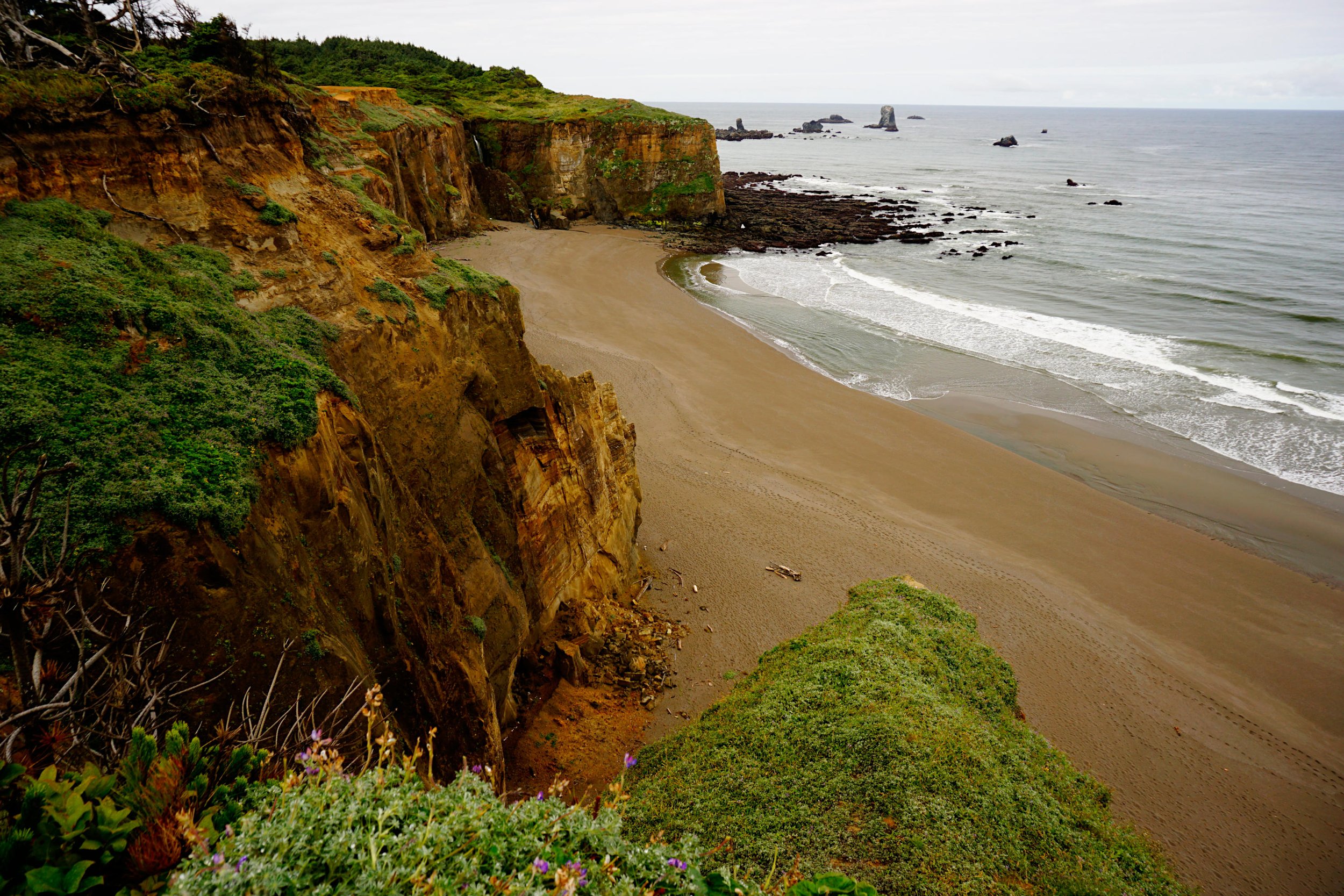
Approaching Blacklock Point from the north

Blacklock Point
On your return trip, you have a lot of options. Without a good map however, you should probably just return the way you came. Skip the beach on the way back (unless you were not able to visit it earlier) and continue following signs towards Floras Lake. When you reach the lake, follow the left shoreline until you reach the trail connecting the day use area and the beach. Turn right to return to the day use area.
