CHINIDERE MOUNTAIN
HIKE STATS:
Distance: 4.8 mile loop
Elevation Gain: 1,300 feet
Trailhead elevation: 3,944 feet
Trail high Point: 4,674 feet
Season: June – October
Best: June – October
Pass: NW Forest Pass
On the traditional lands of: the Cascades, Stl’pulmsh (Cowlitz), and Warm Springs peoples
GPS Track: June 2024
DIRECTIONS:
From Portland, drive east on Interstate 84 to Hood River.
Leave the freeway at Exit 62, immediately after arriving in Hood River.
Just after you exit the freeway, turn right onto Mount Adams Avenue opposite a gas station. This road becomes Country Club Road.
Drive 3.2 miles to a T-junction with Barrett Drive. Turn left.
In just 0.2 mile, keep straight at a stop sign. Continue 1 more mile to a junction with OR 281. Turn right.
Drive 2 miles to a junction on your right, immediately after passing the Apple Valley Country Store, signed “Dee Parkdale Next Right”. Turn right here (do not continue straight uphill).
Drive 2.2 miles on this highway, passing Tucker Park along the way, to another junction on your right, signed for Lost Lake. Veer right here.
Drive 4 miles on this road to a junction with Lost Lake Road. Turn right.
Cross the West Fork of the Hood River and reach a junction with Rainy Lake Road in just 0.3 mile. Keep left to continue towards Lost Lake.
Continue 5 miles to a junction on your right signed for Wahtum Lake. Veer right here.
Drive this one lane paved road 4.3 miles to a junction with FR 13. Keep straight here to continue on FR 1310.
Continue on this one-lane paved road another 5.9 miles to the trailhead at Wahtum Lake’s small campground. A NW Forest Pass is required here.
Trailhead: Wahtum Lake Campground (Google Maps)
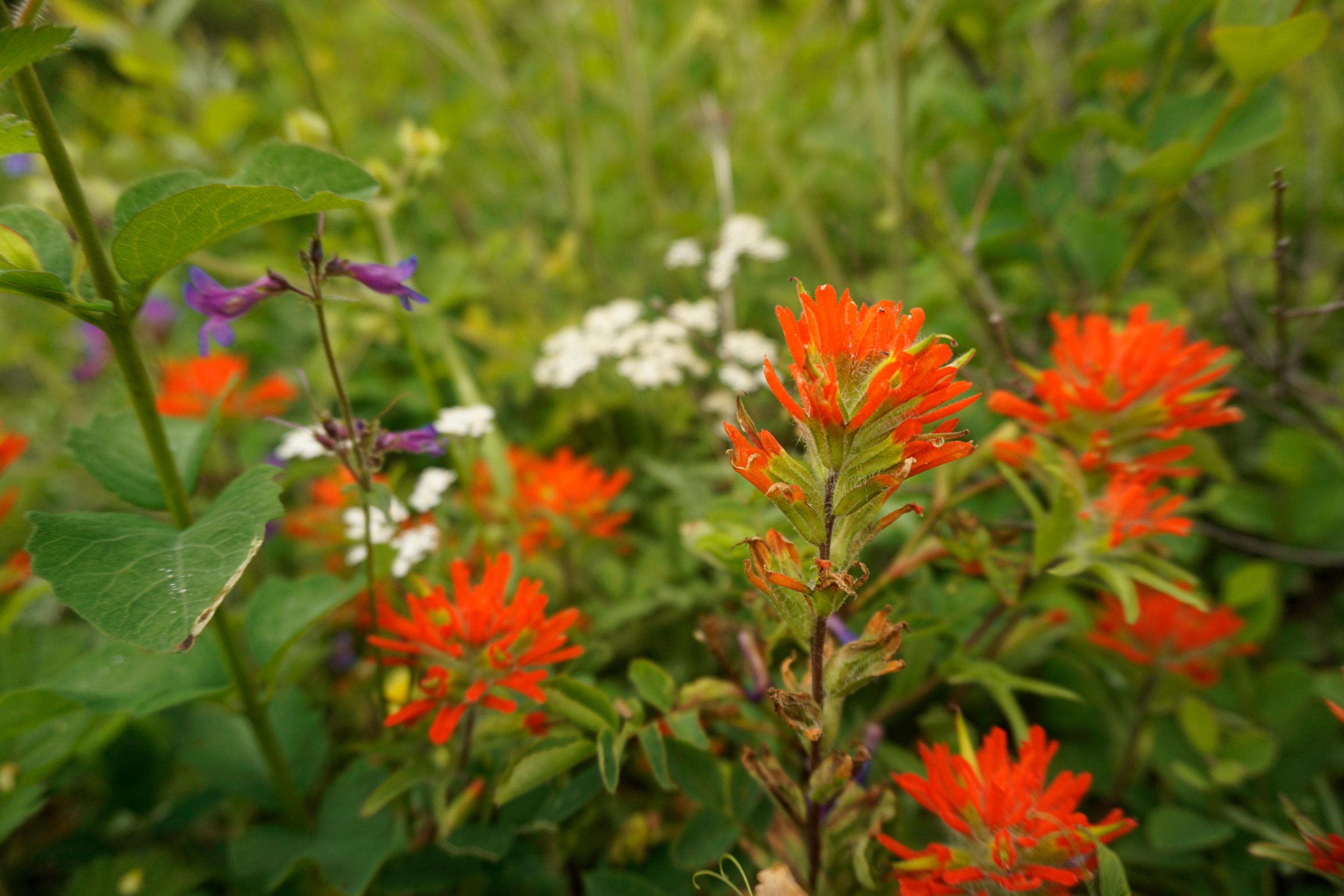
Wildflowers on the summit of Chinidere Mountain
Hike: Wahtum Lake is where the Columbia River Gorge meets the Cascades. Long a destination of many Gorge backpacks, the lake also makes an excellent base camp to explore the area’s many scenic high points. Of these high points, you would be hard-pressed to find a better destination than Chinidere Mountain. From this high vantage, you will be able to see from Mount Rainier to Mount Jefferson, with Mount Hood the star attraction some fifteen miles to the southeast. In summer flowers blanket the rocky summit, offering gorgeous scenery even on days when clouds block the views, which has been the case both times I’ve been here.
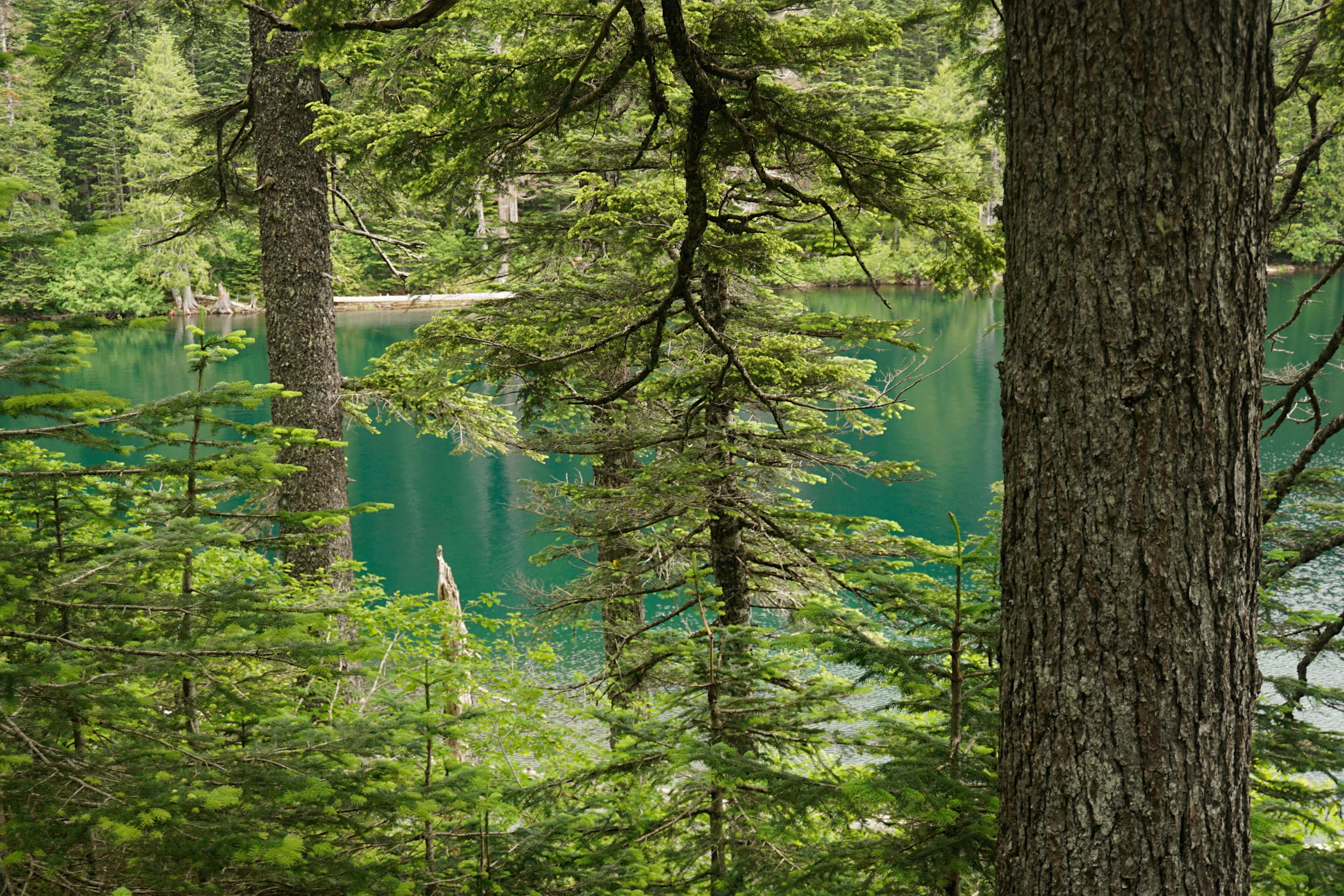
From the trailhead, you have two choices for descending to lake level: you can either hike directly downhill on the steep wooden stairs of the Wahtum Express Trail, or you can turn right on the Wahtum Horse Trail and follow it gradually downhill to 0.4 mile to the lake. Choose this latter option to start, and proceed downhill to the lake, where you will meet the Pacific Crest Trail at a junction. From here, turn right and hike along the lakeshore on the PCT. Before long the trail begins to gradually climb away from the lake, heading north towards the Benson Plateau, the Columbia River, and eventually, Canada. Before we leave the lake, pause for a moment to consider how remarkable it truly is. Wahtum Lake has a maximum depth of 184 feet, making it the deepest lake in the Mount Hood National Forest. This depth is noticeable from the ridgelines above the lake, from which the lake appears the deepest shade of indigo. Wahtum Lake narrowly escaped the wrath of the Eagle Creek Fire, and the ancient timber found along the edges of the lake are some of the most impressive forest in this part of the Cascade.
The PCT climbs above the lake to a junction with the Herman Creek Trail at 2 miles from the trailhead. In June and July, look for showy beargrass blooms along this section of the trail. Continue north on the PCT another 0.2 mile or so to a junction with the Chinidere Mountain Trail on your right. Before you climb to the summit, you should probably continue straight on the PCT another tenth of a mile as it passes under hanging wildflower meadows below the rocky slopes of Chinidere Mountain. The meadows are just a taste of the best yet to come. Return to the Chinidere Mountain junction and turn left (uphill). This spur trail climbs a half-mile through the woods to the summit, where you will have views across the entire region. Wildflowers blanket every green nook and cranny of the rocky summit, while off-trail rock formations beckon the fearless explorer. Directly below you is the grey-green mosaic of Eagle Creek’s famed canyon; keen eyes can even pick out the confluence of the East and West Forks of Eagle Creek in the canyon below. This is one of the finest picnic spots in this corner of the Cascades.
When you’re ready to return, hike back downhill to the PCT. Turn left and almost immediately begin looking for the potentially unsigned junction with the Chinidere Cutoff Trail on your right. If you can’t find the trail there’s no shame in returning the way you came. If you find the trail, follow it steeply downhill to the west end of Wahtum Lake. Along the way you’ll notice a pipe running along the trail; this was the former water line that pumped spring water into a campground along the lake that is now abandoned. At 0.7 mile from the PCT, cross Eagle Creek on downed logs at the lake’s outlet. You will then immediately reach a junction with the Eagle Creek Trail. Continue straight another fifty yards or so to another junction with the PCT, which runs along the lakeshore. Turn left and hike 0.2 mile along the lake to a junction with the Wahtum Express Trail. If the thought of climbing a few hundred stairs seems daunting, locate the horse trail and follow it back uphill to the trailhead. Otherwise, turn right on the Express and scurry up the stairs to the parking lot and your vehicle. This last part of the hike is invigorating, and you will probably feel better for saving it for last!