FIFTEENMILE CREEK
The Fifteenmile Creek Loop is achingly beautiful.
HIKE STATS:
Distance: 10.8 mile loop
Elevation Gain: 2,000 feet
Trailhead elevation: 4,627 feet
Trail high point: 4,627 feet
Season: June - October
Best: June - July
Pass: none needed
On the traditional lands of: the Warm Springs, Wasco and Wishram peoples
GPS Track: Gaia (October 2020)
DIRECTIONS:
From Portland drive US 26 east to a junction with OR 35 on the side of Mt. Hood
Turn onto OR 35 and continue for 13.5 miles to a junction with FR 44 (Dufur Mill Rd.) between mileposts 70 and 71. If you’re coming from Hood River, this junction is 27 miles south on OR 35.
Turn right and continue on FR 44 for 5.2 miles.
At a junction, turn right and continue on FR 44 for 3.1 miles.
Turn right on unsigned but paved FR 4420 and continue for 2.2 miles to a junction.
Drive straight, now on paved FR 2730 for 2.1 miles to rustic but charming Fifteenmile Campground. The trail departs from a sign on the left side of the campground, near the outhouse. The campground is a nice base camp for adventures in the area.
Trailhead: Fifteenmile Creek Campground (Google Maps)
Hike: Hiking is about the experience as much as it is the destination. Not every hike has to lead to a stunning viewpoint or a crashing waterfall; sometimes a scenic meadow, or a stand of tall trees, or a rock pinnacle can be just as awe-inspiring. This long loop down into and then back out of Fifteenmile Creek’s canyon east of Mount Hood does not have any views of the great volcano, but it does have so much else: secret meadows, impressive ponderosa pines, mysterious and intriguing rock hoodoos, and enough variety to keep you wondering what’s around the next turn. This is one of my absolute favorite hikes anywhere, especially in June and July when the flower show along the hike is one of the best in the Mount Hood National Forest. Rather than a lack of views, the major detriment of this hike is that you start at the top; thus, you need to hike downhill, then return uphill. Consider it a fair tradeoff for this hike’s many virtues.

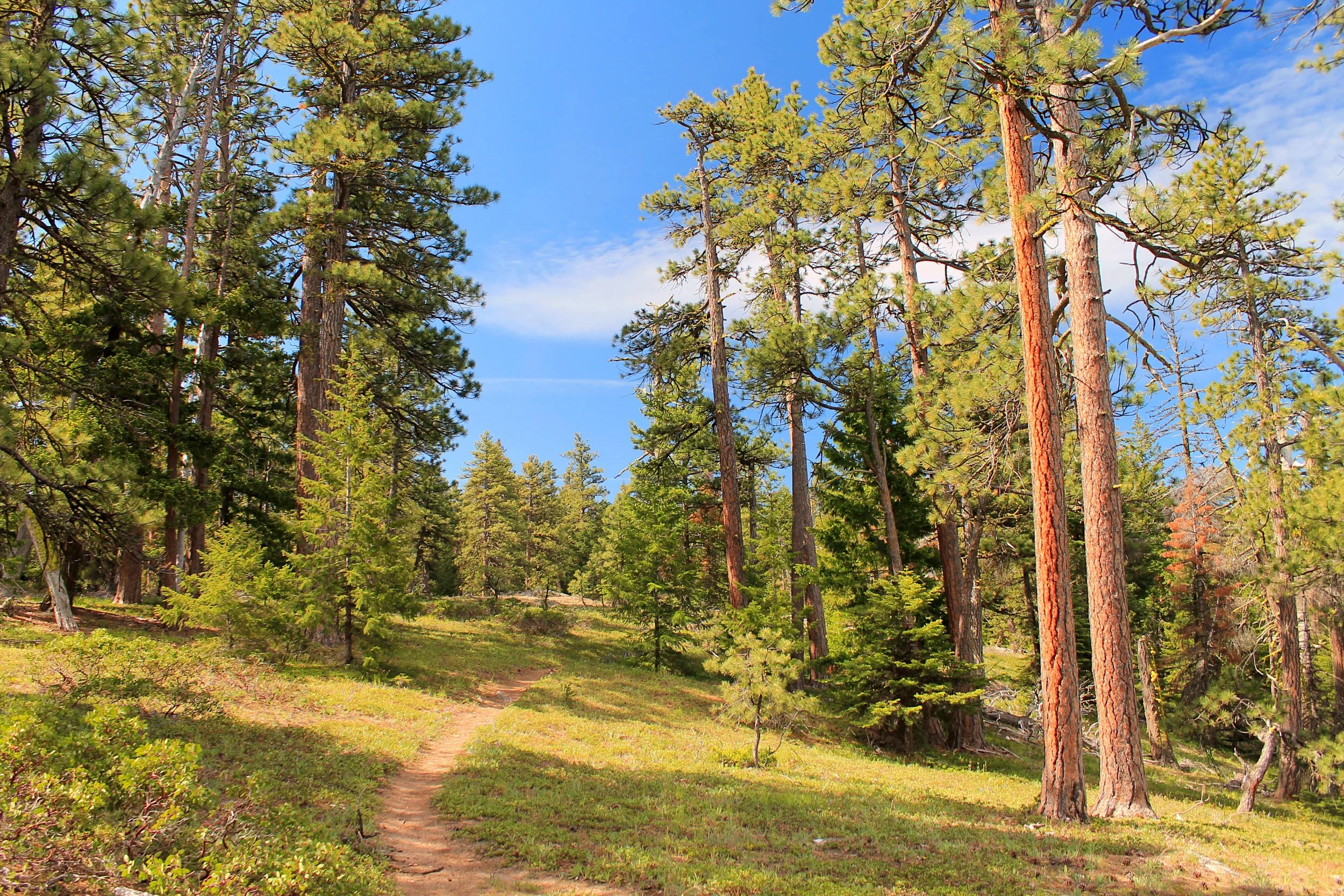
Ponderosa pines tower above the Fifteenmile Creek Loop.
The trail begins by the outhouse and continues slightly downhill through open woods. At a half-mile from the trailhead, you arrive at a junction with the Cedar Creek Trail at the start of the loop. Turn right here and quickly drop down to a bridge over rushing Fifteenmile Creek. The Cedar Creek Trail never approaches Cedar Creek, instead opting to climb back to the rim of Fifteenmile Creek’s canyon. You’ll have glimpses across the canyon here; see if you can spot the trail on the other side! The trail passes through Onion Flat’s stand of ancient ponderosa pines and continues a gradual descent among scenic rock hoodoos and early summer wildflowers. In June and July, look out for balsamroot, lupine, paintbrush, Oregon sunshine, and so many more. At 3.5 miles from the trailhead, you will cross an old road, now long decommissioned. From here, the trail begins to drop more steeply as it follows a narrow ridge between Cedar and Fifteenmile Creeks. At 5 miles, the trail levels out suddenly in dark forest and crosses Fifteenmile Creek on a bridge. Just across the bridge is a four-way trail junction. To continue your loop you’ll need to turn left on the Fifteenmile Creek Trail; the unsigned but scenic Underhill Trail heads uphill here, straight ahead; but for the time being, turn right on the Fifteenmile Trail. Just 0.3 mile downstream is lovely Strawberry Meadow, flanked by massive ponderosa pines. Plan on a long stop here to take in the scene.
When you’re ready to continue your loop, return to the four-way junction and continue straight on the Fifteenmile Trail. This trail is primarily used and maintained by local mountain bikers, so expect to step out of the way for our friends on two wheels. This stretch o the trail starts out gradual as you follow the creek, passing a few massive cottonwood trees on the way. After 1.5 miles, the trail begins to climb more significantly as you leave Fifteenmile Creek. You’ll pass more rock formations, flowers, and ponderosa pines on the way up, as well as a rarely-traveled gravel road. At 3.2 miles from the four-way junction, the trail meets an old road. Turn left here to continue, and soon you’ll be back on the open slopes of the canyon wall. Reach Pat’s Point at 3.9 miles from the four-way junction, and at 9.5 miles into your hike. Sedums grow profusely here year-round, with flowers in June and July. As with earlier in the hike, see if you can spot the Cedar Creek Trail on the slopes across the canyon. From Pat’s Point, continue 1.1 miles into the woods to the junction with the Cedar Creek Trail, where you’ll keep straight. From here, it’s 0.5 mile back to the Fifteenmile Creek Trailhead.


