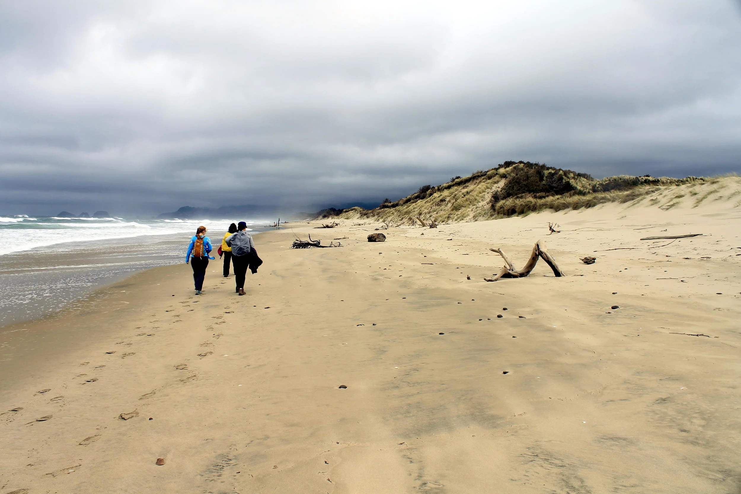
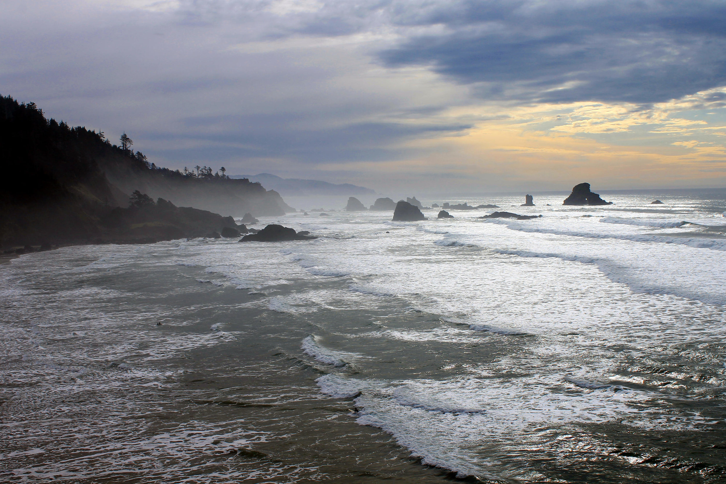
Hike 1. Table Rock

Distance: 7.4 miles out and back

Elevation Gain: 1,500 feet

Trailhead elevation: 3,382 feet

Trail high point: 4,890 feet

Season: June – October

Best: June – July

Map: Opal Creek Wilderness (Imus)

Directions:

  • From the junction of OR 213 and OR 211 on the western edge of Molalla, drive 2.1 miles through town to a junction with South Mathias Road. Veer right on South Mathias Road here.

  • Drive this road for 1 mile south to a junction with S Feyrer Park Road, and veer left.

  • Continue on this road for 1.6 miles until you cross the Molalla River and meet South Dickey Prairie Road.

  • Turn right on Dickey Prairie Road and drive 5.4 miles to a sign on your right marking the Molalla River Recreation area.

  • Turn right and cross the Molalla River. Here the road curves to the left immediately and becomes the Molalla River Road.

  • Continue on this road for 11 miles to a junction with the Horse Creek Road on your right.

  • Continue straight (ignoring the road veering downhill to the right) and drive another 1.7 miles to a junction with the road to Table Rock.

  • Turn left onto gravel Table Rock Road and drive 2.5 miles to a junction with a road up towards Table Rock.

  • Turn right and drive 4 miles to the end of the road.

Hike: By far the most popular hike in the small Table Rock Wilderness, the trail to the summit of the wilderness area’s eponymous peak is surprisingly well-graded and fairly easy. The views from the summit are magnificent and wide-ranging, and there are even a couple of campsites at the summit if you feel like camping overnight (bring water, though). If you time it correctly, you may even come home with a bag full of delicious huckleberries – a delightful treat indeed!

Begin by following the old road, now a wide trail east to where it washed out in 1996. At 0.3 mile, the trail cuts uphill to the right into a lovely forest of lichen-draped hemlocks to avoid the washout that closed the road. After a few tenths of a mile, the trail rejoins the road, which you follow for almost a mile to the old trailhead. Turn right here.

The trail passes a decaying signboard and begins a moderate ascent up the surprisingly gentle north face of Table Rock. After one mile of uphill, the trail switchbacks under the massive, fortress-like rock face and talus slopes below the summit. Here you will likely hear the meep! of the pika, a small, round-eared mammal that lives in rockslides. Wear boots on this hike – this stretch is quite rocky as the trail follows cairns through this maze of rockfall. The basalt formations on the huge walls of the mountain are among the most impressive in this part of the Cascades. Once past the rockslide, the trail climbs to meet an unsigned junction with the trail over to Rooster Rock (Hike 2). Turn left here and climb 0.6 mile, skirting along the huge basalt cliffs but never close enough for discomfort, to the wide summit. Here the view is incredible – you can see snowpeaks from Mount Rainier to the Three Sisters, as well as most of the Willamette Valley. What is less impressive, so to speak, is the tremendous number of clearcuts visible below – a testament to the small size of the Table Rock Wilderness as well as the huge amount of logging on BLM land. There are a few campsites if you feel like spending the night but make sure to bring your own water – there is none anywhere close to the summit.

Return the way you came, or head over to Rooster Rock to extend your hike. If you choose this second option, however, be warned that the stretch of trail over to Rooster Rock is far rougher and steeper as it rides the rollercoaster of Table Rock’s broad ridge 2 miles to Rooster and Chicken Rocks (see Hike 2 for more information).

Hike 2: Rooster Rock

 Distance: 10.8 miles out and back

Elevation Gain: 3,700 feet

Trailhead elevation: 1,261 feet

Trail high point: 4,559 feet

Season: May - November

Best: June - July

Map: Opal Creek Wilderness (Imus)

Directions:

  • From the junction of OR 213 and OR 211 on the western edge of Molalla, drive 2.1 miles through town to a junction with South Mathias Road. Veer right on South Mathias Road here.

  • Drive this road for 1 mile south to a junction with S Feyrer Park Road, and veer left.

  • Continue on this road for 1.6 miles until you cross the Molalla River and meet South Dickey Prairie Road.

  • Turn right on Dickey Prairie Road and drive 5.4 miles to a sign on your right marking the Molalla River Recreation area.

  • Turn right and cross the Molalla River. Here the road curves to the left immediately and becomes the Molalla River Road.

  • Continue on this road for 11 miles to a junction with the Horse Creek Road on your right.

  • Continue straight (ignoring the road veering downhill to the right) and drive another 1.7 miles to a junction with the road to Table Rock.

  • Ignore the fork to the left signed for Table Rock, and turn right on Rooster Rock Road.

  • Cross the Table Rock Fork of the Molalla River and immediately turn into the Old State Trailhead on the left.

This photo of a tiger lily on the High Ridge Trail was the first photo I took during my research on 101 Hikes.

Hike: It’s a long way up to Rooster Rock, but when you get there you won’t regret making the trek. The pinnacle stands above fields of wildflowers, while you have outstanding views out to Mount Jefferson and the rest of the central Cascades. Even on a hot day, a gentle breeze cools you off while you relax for lunch up on this scenic ridgetop. Though there are other, easier hikes in the Table Rock Wilderness, this one is the closest to Portland, the easiest to find and perhaps the least crowded.

Begin on the High Ridge Trail, a well-maintained path that climbs uphill above the Table Rock Fork of the Molalla River. Bright orange Tiger lilies and pink rhododendrons add color to this lower section of the trail in June and July. Continue uphill on a long series of switchbacks in second-growth forest until the trail opens up in a series of south-facing meadows with spectacular wildflower displays. The flower show here is fascinating, with an unusual mix of flowers that generally tend to grow in far drier climates. Look for little yellow sunflowers, blue-eyed Mary, red paintbrush and rosy plectritis, a pinkish poofball flower that grows in great profusion here. Re-enter the forest and soon reach a crossing of a wide trail that was once a road. Continue straight on the High Ridge Trail.

You will steeply switchback uphill from here until you reach the bottom of a long series of rock outcrops, which you parallel as the trail begins to level out. The High Ridge Trail then follows this ridgecrest through a forest of second-growth lodgepole pine. Along the way, you’ll pass a series of gigantic anthills – don’t rile the millions within! At a little less than 5 miles from the Old Bridge Trailhead, the trail emerges into the huge summit meadows below Rooster Rock. In June and July, these meadows feature one of the most impressive wildflower displays in this part of the Cascades. Look for masses of yellow sunflowers, red paintbrush, blue and purple larkspur, lupine, fuzzy cat’s ears, and in favorable years, huge white stalks of beargrass. The High Cascades spread out to the south, with views out to the peaks of the Bull of the Woods Wilderness and south to the Three Sisters.

Reach a junction with the Saddle Trail and turn left. Head up to the top of the ridge below Rooster Rock, where you reach another junction. Turn left and hike this short trail up to a rocky viewpoint known as Chicken Rock. Here the view is considerably better than the meadow below, with views north to Mounts Hood, Saint Helens, Adams and Rainier and views south to the Three Sisters. A better lunch spot would be hard to find in this area.

When you are done, return the way you came or arrange a car shuttle to one of the other trailheads in the area.

EXTENDING YOUR TRIP:

If you have the time and energy, consider extending your trip to check out historic Pechuck Lookout. The views aren’t as good as at Rooster Rock but it’s mostly level all the way to Pechuck. In winter people have been known to snowshoe to the lookout this way - even in winter, expect company (and mice) at the lookout. For more information, see Hike 3.


 Hike 13: Rho Creek and Big Bottom

Distance: 8.2 miles out and back

Elevation Gain: 2,400 feet

Trailhead elevation: 2,624 feet

Trail high point: 4,529 feet

Season: May - November

Best: June

Permit: none needed

On the traditional lands of: the Molalla people

Directions:

  • From Estacada, drive southeast on OR 224 for approximately 25 miles to the old guard station at Ripplebrook.

  • Just past Ripplebrook OR 224 becomes FR 46 at a junction with FR 57. Stay on the main road (ignore signs for Timothy Lake) and continue straight on FR 46 for 4.2 miles from Ripplebrook to a junction with FR 63.

  • Keep straight here, and drive another 12.3 miles south on FR 46.

  • At a junction with FR 4670, turn right and drive 0.3 miles to a bridge over the Clackamas River and then a fork.

  • Keep left on paved FR 4670 and drive 1.1 miles to a junction with FR 4671.

  • Fork to the left and drive exactly 1 mile of pavement to the trailhead on your right.

  • There is room for approximately 2 cars to park on the side of the road. Otherwise, continue another 0.2 mile to the road’s crossing of Rho Creek, where there are a few more spaces to park.

Lonely and wild, Rho Creek tumbles through a narrow canyon deep in Clackamas country.

Hike: This lovely and little-known hike traces a cascading stream through a mossy and magical forest just south of Big Bottom. The trail is at times very faint but it is well-marked, and generally easy to follow. Best of all, because this is a trail that is very much off the beaten trail, the chances are that you will have it all to yourself. Because of this, I do not recommend hiking it alone – this place is very, very remote – but also very, very beautiful.

First of all, a word of thanks should go to the fine folks at Trail Advocates who helped reopen the trail and now maintain it. We all owe them a huge debt of gratitude for resurrecting such a beautiful trail! While officially still abandoned, the trail is reasonably easy to follow for the most part, with only a few faint sections. If you are unsure of your ability to follow trails like this, either download my GPS track and map or turn around when you feel uncomfortable.

Begin at a signpost on the side of FR 4671. The trail climbs swiftly above the road and angles to the south, towards Rho Creek’s narrow canyon. The trail soon descends slightly to meet the creek, passing over a verdant carpet of moss. At about 0.7 mile from the trailhead, the Rho Creek Trail crosses Tumble Creek on a large fallen log (if you can’t see the crossing, look around – the trail bends to the left and crosses Tumble Creek on a log about ten feet above creek level), then bends uphill to follow Rho Creek. For a nice and easy hike, I recommend turning around at the crossing as it doesn’t get better than this.

From the crossing, the trail climbs uphill above Rho Creek and eventually enters a recovering clearcut. Here, the trail becomes faint and will test the navigational abilities of most hikers. Just keep straight and keep your eyes on the trail ahead – there is nowhere else for the trail to go but straight (the creek is downhill while uphill would lead you further into the old clearcut). Eventually, the trail becomes easier to follow for a little while, but becomes faint again when it reaches a boggy spot along Rho Creek just a little ways up the trail. Here, you curve to the left, cross the creek and climb a short ways to Fadeaway Spring on your left. A natural pool about three feet deep at the edge of a clearcut, this is a really neat spot!

From here, the trail switchbacks up to a crossing of FR 4672 at 2.9 miles from the trailhead. Look for flagging to help you find the trail on the way down, as the Rho Creek Trail is not obvious heading back the opposite direction. Across the road, the trail becomes very obvious as it has received recent maintenance. You will hike steeply uphill until the trail reaches the edge of Rhododendron Meadow, now mostly grown-in (there is a meadow, but finding it requires bushwhacking). From here, blowdown becomes an issue and the trail becomes somewhat faint. Pass a signpost marking a junction, but without destinations – no junction indeed – and continue to a faint junction just after a final crossing of Rho Creek. Left leads to the ruins of an old guard station, but you should turn right. The trail climbs up to a campsite just off FR 4670 known as “Bear Camp” at 4.1 miles from the trailhead. Just across FR 4670, the Rho Ridge Trail heads south towards Graham Pass and north towards Mount Lowe (Hike 14). The summit of Mount Lowe is 2.6 miles and 800 feet of elevation gain to your right - so if you choose to continue, your overall hike will be 13.4 miles out and back with approximately 3,000 feet of elevation gain. Either arrange a car shuttle or return the way you came.

Less experienced hikers should probably turn around at Fadeaway Spring, as the trail from this point, though flagged, is at times fainter than most hikers would prefer. There is a lot to explore up here, and combining this hike with Mount Lowe would make for a rewarding and challenging day hike; do not stray off-trail in this area, however, as massive amounts of downed trees and thick rhododendrons make off-trail travel a nightmare.

Big Bottom:

If you are in the area and have extra time and a willingness to explore, you should consider checking out Big Bottom’s tremendous grove of ancient trees. To find Big Bottom, drive back to the junction of FR 4671 and FR 4670 and continue north on FR 4670 for 1 mile to the junction with FR 4651 on the west bank of the Clackamas. Continue straight, now on FR 4651, for 1 mile to a pullout on your right at a junction with what was once FR 4651-120. The trail is the decommissioned road, cutting right through the heart of a recent clearcut.

Big Bottom in the fall.

One of western Oregon’s newest wilderness areas, Big Bottom features some of the Cascades’ finest old growth timber – and serves as a lesson of the perils of logging virgin forest.

Begin by hiking down decommissioned road FR4651-120. This old logging road descends gently amid land that seems to have been cut 30-40 years ago – a juxtaposition that will seem jarring as you leave the grove on the way out. At one point Big Bottom was a proposed timber sale but years of citizen activism eventually resulted in its inclusion in the Lewis & Clark Wilderness Act of 2009. Soon reach open fields of daisies that are slowly erasing this old road. After approximately a mile of alternating daisy fields and newer-growth forest, follow the old road past and over a few downed trees into the heart of Big Bottom.

When the road curves into deep forest, the old growth becomes increasingly impressive. Six to eight-foot thick Douglas Firs reign supreme over a lush understory complete with many massive downed giants. The old road becomes an avenue of giants, a sort of Fifth Avenue with treescrapers on each side of the road. After about 1.8 miles the trail disintegrates near the edge of a marshy creek. You can continue on the remains of the road but it’s best to stop at the creek with old-growth giants around you on all sides. This makes an excellent pit stop before turning back.

The fun of Big Bottom is exploring off the road. Off-trail travel reveals mossy meadows, enormous cedars and fantastic displays of color in the fall. Remember this though: off-trail travel is inherently tiring, and climbing over huge downed trees takes a toll. Furthermore, while it is very difficult to get truly lost in Big Bottom (being that it is located between a gravel road and the Clackamas River), it is very easy to get disoriented, as the woods here have a uniformly beautiful quality that makes routefinding difficult. It is very easy to get turned around here. Allow lots of time to find your way out if you decide to head off-trail.


 Hike 21: Opal Creek

Distance: 11.2 mile semi-loop

Elevation Gain: 700 feet

Trailhead elevation: 1,944 feet

Trail high point:

Season: April – November 

Best: July – October

Pass: NW Forest Pass

Map: Opal Creek Wilderness Area (USFS)


Directions:

  • From Salem, drive OR 22 east for 23 miles to the second flashing light in Mehama.

  • At a sign for the Little North Fork Recreation Area (and directly across from the Swiss Village restaurant), turn left.

  • Follow the paved two-lane road up the Little North Fork for 15 miles to the end of pavement at the entrance to the Willamette National Forest.

  • Continue another 1.5 miles of gravel road to a junction with FR 2207.

  • Following signs for Opal Creek, keep straight (left) on FR2209 and continue 4.2 miles to the trailhead at a large metal gate on the road. There is room for several dozen cars to park – and yet the trailhead will be full on many nice weekends.

Update Notes: The Opal Creek Trail was one of the most beautiful places anywhere. I grew up hiking here as a kid and returned many times as an adult. The Beachie Creek Fire in September 2020 burned through the Opal Creek and Little North Santiam River canyons, incinerating the forest and rendering them unrecognizable. The impact is not unlike the aftermath of the eruption of Mount Saint Helens in 1980. If you ever got to hike Opal Creek, you know how special this place was. It will take a very long time, but it will be so again.

Hike: With its ancient forests and emerald pools, Opal Creek is justifiably famous. In the 1980s, this was the site of one of Oregon’s fiercest battles over the fate of the area’s magnificent groves of old-growth timber. Years of citizen activism saved the grove, and today you can enjoy one of Oregon’s special places in peace and quiet. Though the hike is extremely popular, the area holds people well and feels solitary even when there are dozens of cars at the trailhead. 

The trail to Jawbone Flats is actually a road, one that only the handful of Jawbone Flats residents are permitted to drive. Pass the gate and set off on a slight downhill course. After 0.4 miles cross Gold Creek on a high and rustic bridge. Look down to your left at the waterfall on Gold Creek and the emerald-green pool below; it is the first of many such pools you will see on this hike. Continue to a junction with the Whetstone Mountain Trail and keep straight. The road skirts a cliff on a series of half-bridges at 1.2 miles and enters gorgeous cathedral forest of Douglas firs. This is one of the most photogenic groves of ancient forest you will ever see; mosses drape down off the understory while giants frame the old road on each side. At 2.1 miles pass the remnants of Mertin Mill and take a short side trail down to Sawmill Falls (also known as Cascadia de los Niños), a 20-foot plunge on the Little North Santiam River. Be careful around the rocks as they can be slippery and the pools are deep on each side of the rock.

After returning to the main trail, ignore the Kopetski Trail junction 0.2 mile later (this is your return route) and continue down the old road another 1.2 miles to the rustic village of Jawbone Flats. Built on the site of the Santiam Indians’ winter retreat, Jawbone Flats is a former mining town that has been converted into an educational retreat. You can rent restored cabins and bunkhouses and munch on delicious vegetarian cuisine at reasonable rates should you decide against roughing it on an overnight into the area. Be sure to reserve your room well in advance!

If you aren’t staying the night in Jawbone Flats, head straight through town and turn right, crossing Battle Axe Creek and following signs for Opal Pool. Please stay on the main road and respect the privacy of the residents and guests. After leaving town, the road becomes narrow and rocky and you come to a junction with the trail down to Opal Pool. Turn right and hike down a short switchback to a bridge over Opal Creek just above the pool. Cross the bridge and hike up to a junction with the Kopetski Trail. If you are tired you can turn back here and make it a nice 7.2 mile loop, but in truth the best scenery yet is upstream, so it’s better to keep on going.

If you plan on continuing upstream to Cedar Flats, return to the rocky road and continue another few hundred yards with the Kopetski Trail on your right. Turn right and switchback into the ancient forest above Opal Creek. Continuing upstream alongside magnificent Opal Creek, you will pass more giant trees while the creek tumbles over ledges into deep green pools, each more beautiful than the last. It is almost impossible to avoid stopping over and over again to take pictures. The Opal Creek trail winds uphill a bit and then descends quickly into Cedar Flats at 5.1 miles from the trailhead. A collection of 1,000-year-old cedars that lord over a campground beside Opal Creek, Cedar Flats is where most hikers and backpackers turn around – and this is where you should turn around. Though the trail does continue beyond the flats, it becomes rough, faint and difficult to follow as it navigates through ancient forest. It does not really go anywhere; don’t bother unless you love climbing around on huge fallen trees, clawing through rhododendrons and searching for elusive waterfalls hidden down in Opal Creek’s canyon.

On your return you can and should make a loop by turning left at the sign for Opal Pool just before you enter Jawbone Flats. You will descend a switchback to a bridge over Opal Pool, where you can follow user trails to the base of Opal Pool. Hiking downstream, you’ll pass through spectacular old-growth forest and stellar vistas of the Little North Santiam River to your right. At 1.5 miles from Opal Pool, the trail forks right to cross the bridge over the river. Across the river, turn left on the road to return to your car.

Other Hiking Options:

Just before the bridge you are presented with a fun side trip to Stony Creek. This trail turns left and climbs through a towering collection of Douglas firs for a half-mile until it drops steeply into Stony Creek’s narrow canyon.  If you have the time, this is a worthy detour. The trail once continued up onto the ridge towards Opal Lake but is now impossible to follow past Stony Creek.

Return the way you came.


As of the Summer 2024, the trailheads for this hike are still closed due to damage from the 2020 fires. This trail is open but must be accessed via Elk Lake and Beachie Saddle. Expect rough trail conditions. For more information, see this link and contact the Detroit Ranger Station.

 Hike 23: French Creek Ridge

Distance: 8.2 miles out and back to the summit of Mount Beachie

Elevation Gain: 1,800 feet

Trailhead elevation: 4,084 feet

Trail high point: 5,193 feet

Season: June - October

Best: June - July

Permit: none needed

On the traditional lands of: the Molalla people

GPS Track: Gaia, 11/03/2019

Directions:

  • From Salem, drive OR 22 east for 48 miles to the town of Detroit.

  • Immediately before you cross the Breitenbush River, turn left on the French Creek Road (FR 2223). Do not continue into Detroit!

  • Drive north on this paved road for 4 miles to a fork in the road, a junction with FR 2207.

  • Fork to the right onto FR 2207 and drive 3.6 miles of narrow and occasionally cliffy gravel road to a pass. Turn right here into a small parking lot, which is for both the trail to Phantom Bridge (Hike 22) and the French Creek Ridge Trail.

  • Warning: The last two miles of FR 2207 hug a huge cliff and can be frightening for people with a fear of heights. Exercise caution.

Rock towers line the French Creek Ridge Trail. This photo was taken on November 3, 2019, the year before the Beachie Creek Fire that burned over this area.

Hike: A continuation of the Elkhorn Ridge and Phantom Bridge Trails, the French Creek Ridge Trail is just like its two predecessors to the west: it climbs up and down on a scenic ridge amidst old-growth forest, features fantastic views, and suffers from a chronic lack of trail maintenance. Most should plan on a moderate hike to a series of rock formations on the ridge; adventurous hikers can continue on a much fainter, rougher trail to the summit of Mount Beachie.

The trail begins at the signboard on the east side of the trailhead. You’ll be hiking on an old roadbed at first, one that is overgrown with rhododendron and huckleberry. The trail seems overly brushy at first, but improves once you enter ancient forest at the base of rugged Marten Buttes. You’ll emerge at the foot of the rocky butte and its talus slopes at about 1 mile from the trailhead. Downhill in the canyon below is famed Opal Creek, with the peaks of the Bull of the Woods Wilderness on the horizon. Over the next 1.8 miles, you’ll have excellent views as the trail skirts the ridgetop. In general, this stretch of trail is in pretty good shape.

Marten Buttes, just above the French Creek Ridge Trail.

At 2.5 miles from the trailhead, the trail passes under a series of rock castles and shortly thereafter, descends to a saddle where you meet the Beachie Trail. The French Creek Trail actually turns right here, descending around Byars Peak to a very remote and hard-to-find trailhead in the cliffs above Detroit. The recommended hike ends at this trail junction, as both trails are seldom maintained and occasionally difficult to follow.

Should you wish to continue, turn left on the Beachie Trail and descend steeply for 0.3 mile until the trail levels out on the wide saddle between Boulder Peak and Mount Beachie. This stretch of trail is extremely brushy and sometimes difficult to follow. Continue another 0.3 mile to an open spot on the ridge - a quick scramble up the talus slope here reveals fantastic views and an excellent place to eat lunch. This viewpoint makes a good place to stop. If you choose to continue your hike, the French Creek Ridge Trail (now known as the Beachie Trail) continues a little under a mile to near the summit of Mount Beachie; before the trail begins to descend, you can turn right and bushwhack to the summit of Mount Beachie, just above Elk Lake. From here, the Beachie Trail curves around the far side of Mount Beachie and descends 2.5 rough and brushy miles to an old, abandoned trailhead at Beachie Saddle. Here, you can connect to the hikes to Battle Ax Creek (Hike 25) and Battle Ax (Hike 26), while Elk Lake is about 1 mile downhill from here.


 Hike 26: Battle Ax

Distance: 6 mile loop

Elevation Gain: 2,300 feet elevation gain

Trailhead elevation: 4,022 feet

Trail high point: 5,559 feet

Season: June - October

Best: July - October

Permits: None

On the traditional lands of: the Molalla people


Directions:

  • From Salem, drive OR 22 for 49 miles to Detroit.

  • Immediately after crossing the Breitenbush River, turn left at a sign for Breitenbush and Elk Lake on FR 46.

  • Drive 4.5 miles to a poorly-signed junction with FR 4696.

  • Turn left here and drive this paved road 0.8 mile to a junction with FR 4697.

  • Turn left again, pass a sign stating that this road is not maintained for passenger cars and begin climbing. The first 2.5 miles of this road are good gravel but the road eventually becomes rough and rocky.

  • After 4.5 miles, turn left at a signed junction to continue on FR 4697, which may show as FR 2209 on some maps (this was the old name of this road, which once connected Elk Lake to Opal Creek).

  • Drive 1.4 rough, rocky miles to a bridge over Elk Lake Creek at the east end of Elk Lake.

  • Continue another 0.6 mile of terrible road to a sign for Elk Lake’s campground. Just before you reach the campground, there is a small and unsigned parking area that can fit 3-4 vehicles. This is the best place to park for this hike.

  • Do not drive any further up the road beyond the campground, as it as it deteriorates past this point until it is soon impassable, and turning around is almost impossible.

  • Note: Be very aware of your car’s ability to handle these roads – a vehicle with low clearance and good tires can handle the drive if you drive very, very slowly. Vehicles with higher clearance will manage just fine.

Elk Lake and Mount Jefferson as seen from the summit of Battle Ax, July 2024.

Hike: No matter where you are in this part of the Cascades, Battle Ax’s rugged, sharp profile seems to be on the horizon. As you would expect, the view at the summit is impressive, encompassing pretty much everything from Mount Rainier to Diamond Peak. With such a great view and only a moderate hike to the summit, you would also expect this hike to be popular, but you may instead have the trails here to yourself as I did recently. Battle Ax and Elk Lake are in an island of unburned forest wedged between the damage from the 2020 fires, and this area feels as beautiful as ever; it may be even more beautiful when you consider how much devastation surrounds this area. The drive to the trailhead is unpleasant, but once you’re there, you won’t want to leave anytime soon. It’s a good thing there’s a campground right at the trailhead!

Cascade lilies (Lillium washingtonium) line the Battle Ax Trail in July.

Begin your hike at a parking spot near the campground spur. You’ll walk up the road for 0.3 mile to the Bagby Trailhead on your right. This is the start of your loop. Continue walking up the road as it rapidly deteriorates into a narrow, brushy trail with several large washouts. At 1 mile from the campground, reach Battle Ax’s former trailhead at Beachie Saddle. The saddle is in fact a 4-way trail junction: on your left is the seldom-used Beachie Trail (see Hike 26), while the equally quiet Battle Ax Creek Trail (actually an old mining road) continues downhill ahead of you, reaching Jawbone Flats after 6.5 rough miles (see Hike 24). For Battle Ax, turn right on the Battle Ax Trail.

As you ascend, views open up at every step. Look down to deep blue Elk Lake and out to Mount Jefferson. Paintbrush and beargrass line the way up. You will pass some strange, fluted rock formations that are fascinating to investigate. After 1.5 miles of gradual climbing, you will reach the 5,558 foot summit of Battle Ax. The view is fantastic. Look north to Mount Hood and the entirety of the Bull of the Woods Wilderness, most of which was burned to a crisp in three different fires between 2010 and 2021. East is hulking Mount Jefferson, and to the south, views stretch to the south all the way to Diamond Peak. The concrete blocks at the summit are the remnants of an erstwhile lookout building; three separate lookouts stood on the summit here, the last of which was removed in the late 1960s.

Before you continue on your loop, take a minute to hike down the southeast side of Battle Ax to a breathtaking viewpoint almost directly above Elk Lake – you are close enough to hear people conversing in the campground from this vantage point! Then hike back up to the summit and look behind and to the left of the summit block for the continuation of the trail. The next mile begins following the ridgeline of Battle Ax, offering more spectacular views, but eventually begins to steeply switchback down the back side of the mountain.

When you reach a junction with the Bagby Trail (544), turn right. From here the way is easy going as the trail traverses around a couple of talus slopes with excellent views towards the summit of Battle Ax and passes a few small ponds. After a mile or so, reach a series of springs that flow through a massive rockslide where wild rose and other brush crowds the trail. As of July 2024, this stretch of trail is so brushy that it can be very difficult to negotiate. Push through the brush the best you can until you leave the springs, at which point the trail is once again easy. Reach a viewpoint out to Elk Lake and Mount Jefferson before switchbacking down to the Bagby Trailhead on FR 4697. Turn left to hike 0.3 mile to your car.


 Hike 28: Hawk Mountain and Round Lake

Distance: 4.4 miles out & back

Elevation Gain: 900 feet

Trailhead Elevation: 4,559 feet

Trail High Point: 5,270 feet

Season: June - October

Best: July (wildflower season)

Map: Green Trails #525 (Breitenbush) Green Trails #525 (Breitenbush)

On the traditional lands of: The Molalla, Siletz, Grand Ronde, Cayuse, Umatilla, and Walla Walla peoples.


Directions:

  • From Salem, drive OR 22 east approximately 49 miles to Detroit.

  • Turn left at a sign for Breitenbush, Elk Lake and Olallie Lake onto FR 46.

  • Drive 16.6 miles on FR 46 to a pass where you enter the Mount Hood National Forest.

  • Continue another 0.6 mile to a junction with FR 6350, angling sharply away on your

  • left.

  • If you are coming from Portland, this junction is exactly 28.1 miles from the Ripplebrook Guard Station on US 224. Keep a very close eye for FR 6350 on your right, which is very difficult to see if coming from the north.

  • Fork to the left on the wide gravel road and drive 4.7 miles to a four-way junction with FR 6355.

  • Turn left on this road for 0.3 mile to another junction with FR 150.

  • The trailhead is on your right at this junction but the best parking is down the side road to the left.


The old cabin on the summit of Hawk Mountain, August 2023.

Hike: Hidden on a ridge top near Breitenbush Pass, Hawk Mountain features an outstanding view of Mount Jefferson to the south. A cabin remains where a lookout once stood, offering a fascinating look at the history of the area and a place to stay should you wish to spend the night. Wildflowers scent the mountaintop while butterflies light at your feet. In an area with many nice hikes, this is one of the nicest.

Begin by hiking through a meadow that is slowly becoming forested. This meadow is recovering from the 2021 fire but is still scenic. After only 100 yards look for a large clump of beautiful white-pink Cascade lilies in July; these showy flowers have a delightful perfume when fresh. The trail winds through this meadow for almost a half-mile, treating the hiker with more wildflowers and outstanding views of Mount Jefferson.

Here the trail is faint as beargrass is beginning to obscure the tread, but the way is never difficult. Switchback away from Mount Jefferson and climb slightly, entering forest 0.8 mile from the trailhead. Here descend into a lovely old-growth forest of mountain hemlock and silver fir and then begin climbing slightly again to make up what you just lost. Parts of this trail burned terribly during the fires, but you’re in fire damage for a short distance and then it’s back to unburned forest.

At 1.8 miles from the trailhead, reach a junction with the spur to the summit of Hawk Mountain at the edge of Round Meadow, a long, narrow meadow that serves as the headwaters to Round Lake two miles to the west. Turn right. On the spur, climb steadily through deep forest for 0.4 mile to the wide-open summit of Hawk Mountain, where you are greeted by its rustic lookout cabin, which survived the ravages of the two fires that burned through this area. The lookout tower that stood here was removed in 1967 but the recently-restored cabin remains. The staffers of the lookout stayed here and you may also stay in it if you wish to do so. As it is first-come, first-served, plan ahead and bring backpacking gear in case the cabin is occupied. In July the summit meadow is speckled with yellow arnica, red paintbrush, blue lupine and larkspur and white cat’s ears. Despite the fire damage, the view of Mount Jefferson to the southeast is even better than the flower display. This is a spectacular site! Return the way you came or arrange a car shuttle at the Graham Pass trailhead 5 miles to the north (see Other Hiking Options).

Mount Jefferson from the summit of Hawk Mountain, July 2010.

Other Hiking Options:

Round Lake: If you are in the area and wish to do a little more hiking, consider checking out Round Lake’s abandoned campground. While this suggestion may evoke thoughts of the Friday the 13th movie series, this is a nice place that sees very little use since the more direct approach to the lake washed out many years ago.

To find the lake, follow FR 150 for 0.8 mile from the Hawk Mountain (Rho Ridge) Trailhead. Fork to the right (downhill) on FR 220 for 2 miles to a T junction with FR 6370. Turn right on FR 6370 and drive 3.5 miles to the signed trailhead on the right side of the road. The trail departs from a signboard and climbs to the lake. As you would expect for a former campground, there are several excellent campsites here. After the trail crosses an inlet creek it becomes very rough; you can continue around the lake on a rough and very brushy trail to make a 1.2 mile loop but it is much easier to return the way you came. I haven’t been here since the fires but Round Lake is located in an area that escaped the 2021 Bull Complex Fire. It should look the same as it always has.

Round Lake, July 2014.

Hawk Mountain via Graham Pass: You may also hike to the summit of Hawk Mountain by way of the Rho Ridge Trail from Graham Pass. This approach is more than twice as long, has very few views and wanders through recovering clearcuts where the tread is frequently obscured by rhododendron and huckleberry. Though the tread is sometimes faint, yellow diamond-shaped signs that read “ULT 564” are posted on trees along the route to mark your way. You’ll also cross several decommissioned logging roads along the way, where in favorable years there are excellent displays of beargrass. You will reach the aforementioned junction with the Hawk Mountain spur trail at 4.8 miles from the trailhead, just after passing Round Meadow. Turn left here and hike uphill 0.4 mile to Hawk Mountain’s summit. This approach is 10.4 miles with 1,400 feet of elevation gain.

Directions to Graham Pass:

  • From Estacada, drive southeast on OR 224 for approximately 25 miles to the old guard station at Ripplebrook.

  • Just past Ripplebrook OR 224 becomes FR 46 at a junction with FR 57. Stay on the main road (ignore signs for Timothy Lake) and continue straight on FR 46 for 4.2 miles from Ripplebrook to a junction with FR 63, where you turn right, following signs for Bagby Hot Springs.

  • Drive 3.5 miles of pavement to a junction with FR 70, where you keep straight (ignore signs for Bagby Hot Springs).

  • Continue 5.1 miles on this road (it changes to gravel in 2.3 miles) to a junction with FR 6350 on your left.

  • Following a sign for Graham Pass, turn left onto paved FR 6350 and drive 5.6 miles of alternating gravel and pavement to a junction with FR 6355.

  • Fork to the left to stay on FR 6350 and continue 1 mile to Graham Pass.

  • Turn right into a large unsigned parking lot. This is the trailhead.

  • Note: There are two other ways to get here, both of which are fairly easy. The first involves driving FR 4670 from its junction on FR 46 for 14.3 miles to Graham Pass. The other involves driving FR 6350 from the Hawk Mountain Trailhead another 7.3 miles to Graham Pass. Either is a good way to get to Graham Pass, but the shortest route from Portland is the Collawash River approach described above.


 Hike 30: Coffin Mountain

Distance: 3.0 miles out and back

Elevation Gain: 1,000 feet

Trailhead elevation: 4,713 feet

Trail high point: 5,733 feet

Season: June - October

Best: late-June - end of July

Permit: none required

On the traditional lands of: the Molalla people

Directions:

  • From Salem, drive OR 22 east approximately 49 miles to Detroit.

  • Continue past Detroit on OR 22 for 19 miles to a junction with the Straight Creek Road (FR 11) on your right.

  • Turn right and drive this winding but paved road for 1.4 miles to a junction with FR 1168. Ignore this junction and continue on paved FR 11.

  • Continue another 2.6 miles to another junction with FR 1168, veering sharply off to the right.

  • Turn right and drive this gravel road 1.4 miles to a fork with FR 368.

  • Keep left on FR 1168 and continue another 2.4 winding miles to a junction with FR 450.

  • Turn left and drive 50 yards to the signed trailhead.

Every few years beargrass blankets the slopes of Coffin Mountain, seen here in 2019.

Hike: This is a wonderful hike up to the cliffy, flat-topped summit of Coffin Mountain that is short enough to do in just a few hours but exciting enough to make a day destination. The trail climbs up an open slope that is absolutely filled with wildflowers to a lookout tower with a panoramic view of the Cascade Range – it doesn’t get better than this!

Begin by charging uphill on a rocky trail, once a jeep road. Soon you will leave the forest and emerge on a steep, open slope that is carpeted with beargrass. The views out to the Cascades are stupendous, with Mount Jefferson dominating the view to the east while views to the south stretch out to the Three Sisters and all the way south to Diamond Peak.

Continue climbing on a winding trail up through the beargrass until you reach the summit plateau at 1.3 mile. Above you to the left is a radio tower on one end of the plateau. Continue on towards the lookout tower ahead of you, which you reach at 1.5 miles. The tower is staffed in the summer by an individual whose job it is to spot fires – do not enter the lookout unless you are invited to do so. The view, as you might imagine, is stupendous. In addition to the peaks to your east and south, Mount Hood and Mount Adams rise to the north. Below you to the immediate north is Detroit Lake. When you are done at the summit, return the way you came. For a bit of variety on the way back, follow a user trail near the summit off towards the radio tower on the other end of Coffin Mountain’s summit to the end of the ridge. The flowers on this end of the summit are outstanding, with lots of paintbrush, phlox and many other flowers. You can follow user trails back down to the main trail and back to the trailhead.

 Hike 31: Bachelor Mountain

Distance: 3.8 miles out and back

Elevation Gain: 1,100 feet

Trailhead elevation: 4,832 feet

Trail high point: 5,946 feet

Season: June - October

Best: July - October

Permit: none needed

On the traditional lands of: the Molalla people

Directions:

  • From Salem, drive OR 22 east approximately 49 miles to Detroit.

  • Continue past Detroit on OR 22 for 19 miles to a junction with the Straight Creek Road (FR 11) on your right.

  • Turn right and drive this winding but paved road for 1.4 miles to a junction with FR 1168. Ignore this junction and continue on paved FR 11.

  • Continue another 2.6 miles to another junction with FR 1168, veering sharply off to the right.

  • Turn right and drive this gravel road 1.4 miles to a fork with FR 368.

  • Keep left and continue another 2.4 winding miles to a junction with FR 450, down which you’ll find the Coffin Mountain Trailhead.

  • From the junction of FR 1168 and FR 450 (50 yards from the Coffin Mountain trailhead), continue another 0.7 mile on FR 1168 to a junction with FR 1168-430, angling away to the left.

  • Turn left here and drive 0.5 mile of narrow, rocky gravel to road’s end at the Bachelor Mountain trailhead on your right. Above you is an exceptional view of Coffin Mountain to your left.

Wildflowers line the Bachelor Mountain Trail all summer.

Hike: Just one mile east of Coffin Mountain, the trail up Bachelor Mountain is longer, more forested and in many ways very different from its neighbor to the west. Like Coffin Mountain, the trail up Bachelor Mountain passes through spectacular wildflower meadows with outstanding views out to the high Cascades off to the south and east.

The trail begins by climbing uphill through an impressive forest on the northwest side of Bachelor Mountain. You will soon emerge onto an open, wildflower-spangled ridge. The sheer quantity and variety of wildflowers here boggles the mind – on my first trip here I counted over thirty different varieties, and with some time you could easily identify twice that number. The most common species you will find on this hike are red, trumpet-shaped scarlet gilia (also known as skyrocket), large, fragrant Cascade lilies, yellow arnica and white beargrass.

Look ahead to the many false summits of Bachelor Mountain – there are many, so keep moving straight ahead. Leave the ridgecrest and arrive at a basin with phenomenal views ahead to Mount Jefferson, just ten miles to the east. You are hiking through the Buck Mountain burn, which torched this area in the 1970s. Soon you will leave the burn area and enter a classic alpine forest, which in July of some years is completely carpeted with white beargrass blooms. At 1.3 miles from the trailhead, arrive at a junction with the Bruno Meadows Trail. Turn left on the Bachelor Mountain Trail and begin climbing up through forest and then open meadows for 0.7 mile to the summit of Bachelor Mountain. Though Coffin Mountain has a lookout tower and has for many years, you may be surprised to discover that Bachelor Mountain had a lookout tower as well. All that remains of the tower, which was built in 1934 and destroyed in 1967, is some glass and metal rods. The view remains outstanding, though, with a panorama north to Mount Adams and all the way south to at least the Three Sisters. Mount Jefferson dominates the skyline to the east. When you are finished, return the way you came.

Other things to do:

Along the way to or from the Coffin Mountain and Bachelor Mountain trailheads, be sure to stop near the trailhead at a stupendous viewpoint of the Cascades right off the road. The view is perhaps as impressive as anything on either the Coffin Mountain or Bachelor Mountain Trails, but with no effort required. Like I needed to tell you to stop – you’ll know the viewpoint when you reach it!

Hike 32: Bachelor Mountain via Bruno Meadows

Distance: 7 miles out and back

Elevation Gain: 1,700 feet

Trailhead elevation: 4,331 feet

Trail high Point: 5,941 feet

Season: June – October

Best: June – July  

Pass: none needed

On the traditional lands of:


Directions:

  • From Salem, drive OR 22 east approximately 49 miles to Detroit.

  • From Detroit, drive south 16 miles to Marion Forks.

  • Continue past Marion Forks another 1.5 miles to a junction with FR 2234 on your right. There isn’t really a sign so you’ll have to watch closely.

  • Turn right here and immediately cross the North Santiam River on a concrete bridge.

  • Continue uphill about 2.5 miles to a confusing junction with several side roads on your left at a curve. There are two side roads here, one of which has a gate.

  • Stay on the main road (FR 2234) here and drive another 0.5 mile to a junction with another side road on your left. This is the trailhead for the Bugaboo Ridge Trailhead.

  • Continue driving 2.9 miles on FR 2234 to the Bruno Meadows Trailhead on the left side of the road.

  • Drivetime from Salem: 2 hours


Mount Jefferson appears surprisingly close from the slopes of Bachelor Mountain.

Hike: Bachelor Mountain is the highest point in the Old Cascades, and perhaps the best hike. There are three ways to approach the scenic summit, and all of them are worthwhile. My favorite is the long-forgotten Bruno Meadows Trail. This path climbs through ancient forest and passes a spectacular hanging meadow to a junction with the Bugaboo Ridge Trail, and then on to the rocky summit of Bachelor Mountain. As with all forgotten trails, expect a fare share of blowdown and brush. I assure you; it is worth it!

The trail begins on an old road. Before long, you’ll reach the signed Bruno Meadows Trail. Turn right here and follow this narrow path along the edge of an old clearcut. Rhododendrons bloom profusely here in June and early July. The trail skirts the old clearcut here and there, passing through a grove of magnificent ancient Douglas fir that appears to have been narrowly saved. You will begin climbing along the northwest slopes of Bachelor Mountain in dense forest. At a little under a mile from the trailhead, you will reach a junction with a spur trail that heads left. Mount Jefferson is visible through the trees. Follow this short spur to a most wonderful viewpoint! Here, at the edge of a rocky and dry cliff, you will find great profusions of July wildflowers and spectacular views east to Mount Jefferson and points south. The meadowy mountain in front of Mount Jefferson is Minto Mountain if you’re keeping track. Watch your step here, as it’s a long way down from the edge of this viewpoint. Back on the main trail, continue some 0.3 mile through spectacular wildflower meadows to a junction with the Bugaboo Ridge Trail in a meadow of chest-high bracken ferns at 1.7 miles from the trailhead. Turn right here to stay on the Bruno Meadows Trail.

The trail then climbs above this meadow amid fabulous June and July displays of larkspur and mariposa lilies to a spectacular ridge end, where views stretch south to the Three Sisters (and behind you, Mount Jefferson). Continue on this trail, passing in and out of meadows, to a junction with the Bachelor Mountain Trail in deep woods at 2.9 miles from the trailhead. Looking behind you, note the old Bruno Meadows Trail sign high up on the tree! Turn right here and climb 0.6 mile through the woods to the rocky summit of Bachelor Mountain at 5,943 feet. The view here is magnificent, covering the entirety of the Old Cascades and much of the high Cascades from Mount Hood to the Three Sisters and beyond. A lookout once stood here, as evidenced by the bent metal and broken glass strewn about the summit. Although this is a popular destination, you should be able to find an isolated corner to spread out for lunch.

Return the way you came, stopping for many photos and merriment along the way.

 Hike 34: Bachelor Mountain via Bugaboo Ridge

Distance: 8 miles out and back

Elevation Gain: 1,844 feet

Trailhead elevation: 4,160 feet

Trail high point: 5,946 feet

Season: June - October

Best: July

Permit: none needed

On the traditional lands of: the Molalla people

GPS Track: Gaia

Directions:

  • From Salem, drive OR 22 east approximately 49 miles to Detroit.

  • From Detroit, drive south 16 miles to Marion Forks.

  • Continue past Marion Forks another 1.5 miles to a junction with FR 2234 on your right. There isn’t really a sign so you’ll have to watch closely.

  • Turn right here and immediately cross the North Santiam River on a concrete bridge.

  • Continue uphill about 2.5 miles to a confusing junction with several side roads on your left at a curve. There are two side roads here, one of which has a gate.

  • Stay on the main road (FR 2234) here and drive another 0.5 mile to a junction with another side road on your left.

  • The trailhead is 100 yards down this road on your right but the best place to park is right at the junction.

Mount Jefferson and the Bugaboo Ridge Trail, June 2023.

Hike: Little-known and seldom-traveled, the Bugaboo Ridge Trail is for the adventurous. This is not to say that it’s extremely difficult, or hard to follow, or anything like that –it’s just that the Bugaboo Ridge Trail feels wild in a way that the shorter, more popular Bachelor Mountain Trail does not. You are unlikely to meet anybody on this trail until you near the summit, and the views and wildflower meadows are superior to that of the more well-known approach to Bachelor Mountain. But you have to earn it, as the way is steep and brushy.

Begin your hike in a lush old-growth forest as the trail climbs gradually at first. You will soon leave the forest, instead trading woods for an open, bushy ridge that is a remnant of the 1970 Buck Mountain fire. After a little under a mile, the trail crosses a gravel road and then returns to the forest as the climbing continues. Soon the trail becomes brushy as you enter a meadow that is completely overgrown, as bracken fern and several species of wildflowers overhang the trail. It is here that you will meet the Bruno Meadows Trail, yet another approach to Bachelor Mountain. Keep straight here and climb out of this meadow into a series of exceptional flower gardens as the trail skirts through an open forest. Here you have excellent views out to Mount Jefferson, looming across the canyon to the east.

The best part comes next, as the Bugaboo Ridge Trail curves around an open ridge end, amidst hanging gardens and absolutely spectacular views that stretch all the way south to the Three Sisters and points further south. Beyond this point, brush encroaches on the trail but this section is mercifully short. Just a little bit later, you’ll meet the well-maintained Bachelor Mountain Trail, at which point you turn right and hike 0.7 mile to the summit. The views here are incredible, but especially great is the view to Mount Jefferson, just seven miles to the east. Return the way you came or arrange a shuttle with the other Bachelor Mountain Trail, described in Hike 33.


 Hike 41: Rooster Rock and the Menagerie Wilderness

Distance: 6.8 miles out and back

Elevation Gain: 2,400 feet

Trailhead elevation: 1,242 feet

Trail high point: 3,568 feet

Season: April - November

Best: April - May

Permit: NW Forest Pass

On the traditional lands of: the Molalla people

Directions:

  • Drive east of the Quartzville Road junction at the eastern edge of Sweet Home on US 20 for 15.6 miles to the poorly-marked Trout Creek Trailhead. The trailhead is located on your left not far past milepost 49.

  • The trailhead is just after Trout Creek Campground on the right side of the highway.

A misty day on the Rooster Rock Trail.

Hike: The hike up to Rooster Rock in the Menagerie Wilderness is short on highlights. It’s a shame that the builders of this trail did not see fit to extend the trail to anywhere more interesting; for that, you have to take matters into your own hands. This may be the least interesting hike in the Old Cascades; and in spite of that, it is a useful trail for its easy access, and is good for a spring conditioner. Just make sure to continue further into the Menagerie for the good stuff.

First of all, about the Menagerie: The Menagerie Wilderness is a collection of fascinating rock pinnacles with colorful, animal-themed names, among them Turkey Monster, Rabbit Ears, and of course, Rooster Rock. The trick is to find the way to see all of them, and that isn’t easy. Get started on the Trout Creek Trail. The trail charges uphill at an almost constant grade - never too steep, but rarely level. The forest has clearly been logged before, and has a fairly uniform quality. Keep an eye out for poison oak on both sides of the trail all the way to the summit; though a rarity elsewhere in this book, it’s everywhere here. A few madrone trees spice things up as you ascend - look for the peeling bark of this beautiful tree, which is far more common further south.

At 2.9 miles, reach a junction with the shorter, steeper Rooster Rock Trail. Continue straight as the trail steepens considerably, making its final ascent towards Rooster Rock. Reach the rock just before the end of the trail. The trail passes the rock, offering chances for climbers equipped to handle the route to the top of Rooster Rock. Unless you are climbing, switchback to the left and reach the former lookout site at a ridge end at 3.4 miles. The view is underwhelming, to put it lightly: the only thing you can see is the ridge on the far side of Keith Creek’s canyon.

To see and truly understand the Menagerie, you need to follow a rough climbers trail out to Panorama Point. Walk back 100 steps from the summit to a junction with the climbers trail. The climber’s trail leads deeper into the wilderness, into the domain of the adventure climber. What you find depends on what you are looking for - and I’ll leave the adventure up to you. The rough trail that follows the ridge is closed from January 15 to July 31 to protect nesting raptors.

Walton Ranch: Before you leave the area, be sure to check out the short trail to Walton Ranch. It departs from the Trout Creek Trailhead and proceeds to cross Trout Creek immediately on a nice bridge. You will climb a bit to an overlook directly above the highway of a prairie across the river. Each winter, a herd of elk winters at this prairie and if you visit from November to April, you may just see them. Even when the elk aren’t there, this is a worthy detour just for the crossing of Trout Creek alone - after all, the Trout Creek Trail never once approaches Trout Creek.

Rooster Rock via the Rooster Rock Trailhead: You can also reach the summit of Rooster Rock via the shorter, more direct Rooster Rock Trail. This trail gains 1,300 feet in about 1.5 miles, so it’s far steeper than the Trout Creek Trail. The advantage to this approach is that it is more direct, and some will appreciate its brevity. To find the Rooster Rock Trailhead, continue east beyond the Trout Creek Trailhead on US 20 another 2.7 miles to the signed trailhead on the left. There is a small trailhead loop and room for plenty of cars.


 Hike 44: Iron Mountain

Distance: 6.6 mile loop

Elevation Gain: 2,100 feet

Trailhead elevation: 4,234 feet

Trail high point: 5,382 feet

Season: June - October

Best: July

Permit: NW Forest Pass

On the traditional lands of: the Molalla people

Directions:

  • From Sweet Home drive east on US 20 for 35 miles to Tombstone Pass.

  • Turn right into a large lot with a bathroom.

  • If you are coming from the east, the trailhead is 11.1 miles west of the split with OR 22.

Cone Peak and flower meadows, June 2018.

Hike: The Iron Mountain Loop is the most popular hike in the Old Cascades, and with good reason. The flower displays rival any in the entire Cascade Range, the views are outstanding and the hike easy enough for anybody in reasonable hiking shape. For the best experience, come in late June or early July, check online to see how the flowers are doing, and show up early. If you can come on a weekday, all the better.

Begin at Tombstone Pass and hike downhill slightly through the forest paralleling US 20. At about a half-mile from the trailhead, you will cross US 20. Look both ways and carefully cross the highway. From here, the trail climbs gradually up through the forest until you reach Cone Peak’s meadows at a little over 2 miles. In flower season, the next mile of trail is among the finest in the Cascades: acres of wildflowers carpet the meadows, while Iron Mountain looms across the valley to the west. Look for countless blue and purple larkspur, red paintbrush, yellow Oregon Sunshine, a small daisy-like flower. Photographers will want to spend a long time here (see the photo above).

Beyond Cone Peak’s meadows, the trail dips into the forest a bit as it traverses around Iron Mountain’s forested north face. At 3.6 miles, meet the Iron Mountain Spur Trail on your left. Turn left here and hike 0.7 mile of uphill to the summit, where you will find a huge observation deck with benches. The view is exceptional, stretching from Mount Adams to Diamond Peak and pretty much everything in between. US 20 stretches out like a river below you as it heads east towards Central Oregon. A lookout tower stood on the summit until 2008 and an observation deck now stands in its place. You will likely need to share the summit with many other admirers, but that’s fine - everybody here is as happy to be there are you are.

Return to the junction and turn left to continue your loop. In just a bit, you’ll pass a junction with the Iron Mountain trail on your right. Most of the people who hike to the summit of Iron Mountain do so from this trailhead, but they miss out on Cone Peak’s flower meadows. Continue downhill until you reach another crossing of US 20. Carefully cross the highway and descend into the forest below Tombstone Pass. You have to regain a bit of elevation over the next 0.6 mile, but once you top out, you’re back at the trailhead.

Other hiking options:

Iron Mountain the short way: Many people who hike to the summit of Iron Mountain do so from this shorter trailhead. Going this way avoids Cone Peak’s wildflower meadows but delivers you to the top of Iron Mountain in less than a mile. To find this alternate trailhead, drive up US 20 towards Santiam Pass a total of 29 miles from the Quartzville Junction at the edge of Sweet Home. At a junction with FR 035 on your left, turn left and drive 2.6 miles to the end of this road at the large Iron Mountain Trailhead.

Hike 45: West Browder Ridge

Distance: 11.6 miles out and back

Elevation Gain: 2,200 feet

Trailhead Elevation: 4,085 feet

Trail High Point: 5,751 feet

Season: June - October

Best: June - July

Permit: None needed

On the traditional lands of: the Molalla people

Directions:

  • From the junction of US 20 and Quartzville Road east of Sweet Home, drive approximately 30 miles on US 20 up the South Santiam River to a junction with FR 15.

  • If you are coming from the east, this junction is on your left 11.7 miles after the OR 22 / US 20 split, and 0.6 mile beyond Tombstone Pass.

  • Turn right here onto FR 15 and drive 2.5 paved miles to the trailhead, a small parking lot with a “P” sign on the right. The trailhead is located at the junction of FR 15 and FR 080.

  • The trail departs from the left side of the road at a signboard.

The Three Sisters from the summit of Browder Ridge, June 2023.

Hike: The western approach to Browder Ridge’s wildflower meadows is all but forgotten. While you can expect brush and blowdown on occasion, the access is easier than the more popular eastern approach to Browder Ridge and the scenery just as good. The only difference is that the trail is in worse shape, and marginally more difficult. This hike is so great I doubt you’ll care all that much.

Begin at the Browder Ridge Trailhead on FR 15. The trail begins with a mostly-level stretch through a cool forest. At a little under a mile from the trailhead, reach a seemingly endless meadow of bracken ferns, stretching all the way to the top of the ridge. Getting to the top looks daunting, but the trail switchbacks all the way to the top without ever feeling steep. Occasional forays into the forest keep hikers from overheating. When you reach the top at about 2 miles from the trailhead, you are almost done with your elevation gain for a good long while.

Scarlet gilia (also known as skyrocket) on the Browder Ridge Trail.

The next 2.5 miles are pure pleasure. Sure, you’ll have to deal with occasional stretches of faint and brushy trail, but there is so much to see! The trail follows Browder Ridge just below its crest, passing through meadow after meadow with views south to the Three Sisters. The wildflower displays here in June and July are among the best in the Cascades: look for lots of blue and purple larkspur, red paintbrush, yellow Oregon sunshine, pink owl’s clover, blue and purple lupine and so many more. At 3 miles or so from the trailhead, the trail enters a small piece of fire-damaged forest and becomes vague - cut straight through the forest to locate the trail on the far side. Stay straight and you cannot get lost. Over the next 1.5 miles the trail becomes quite brushy and narrow in some spots, but remains very beautiful.

At 4.5 miles, the Browder Ridge Trail meets the Gate Creek Trail coming from the east (see Hike 48). Turn left here and start up the Heart Lake Trail. You will begin climbing again through the forest for about 0.5 mile until the trail emerges under Browder Ridge’s summit cliffs. The views, flowers and cliffs make for a sublime setting. At 0.9 mile from the trail junction, the Heart Lake Trail reaches a saddle. The trail continues downhill to Heart Lake (a noble adventure that is not for the faint of heart), but first you should turn left on a faint social trail that departs from the saddle. The trail leads you left (right goes to Heart Lake), first through the trees and then steeply up to the summit of Browder Ridge. Watch your step in a few places as the ridge is narrow here. You don’t need to hike all the way to the true summit of the ridge for the fantastic views, but you do need to hike above treeline. At the top you’ll see far to the south, with the Three Sisters appearing surprisingly close. To the north and west, Mount Jefferson rises above the true summit of Browder Ridge while Mount Hood looms on the far horizon. Bachelor Mountain (Hikes 31-33) and Coffin Mountain (Hike 30) are immediately to the left of Mount Hood. Most hikers will want to turn around here.

To visit Heart Lake, continue downhill on the narrow, rough and steep Heart Lake Trail. You’ll lose nearly 700 feet in just 0.7 mile on the way to the scenic lake - a steep price to pay after the long hike to Browder Ridge from the west. For more information about the detour down to Heart Lake, see Hike 48. Return the way you came.

Oh, and one more special message to go: this would be an easy car shuttle if you have the means to set one up. For directions to the eastern Browder Ridge Trailhead (known as the Gate Creek Trailhead) and more information on the trail down to Heart Lake, see Hike 48.


Hike 47: Crescent Mountain

Distance: 9.6 miles out and back

Elevation Gain: 2,500 feet

Trailhead elevation: 3,724 feet

Trail high point: 5,740 feet

Season: June - October

Best: July

Map: Green Trails #588 (Echo Mtn)

On the traditional lands of: The Molalla, Siletz, Grand Ronde, Cayuse, Umatilla, and Walla Walla peoples.


Directions:

  • From the junction of US 20 and Quartzville Road east of Sweet Home, drive 37.7 miles east on US 20 to a junction with Lava Lake Road, FR 2067.

  • This junction is about 0.5 mile west of the junction of US 20 and OR 126 and about 3.5 miles west of the junction of OR 22 and US 20.

  • If you are driving here from Salem, drive to Santiam Junction and turn right on US 20 for 3.5 miles to the turnoff for the Lava Lake Road on the right, 3.5 miles past Santiam Junction and 0.5 mile past the junction of US 20 and OR 126.

  • If you’re coming from Bend, drive to Santiam Junction and continue west on US 20 for 3.5 miles to the turnoff for the Lava Lake Road on the right, 3.5 miles past Santiam Junction and 0.5 mile past the junction of US 20 and OR 126.

  • Turn left (or right if driving west on US 20) and drive 0.9 mile north on this paved road.

  • Turn left at a hiker sign on to FR 580.

  • Drive 0.7 mile to a large parking lot at road’s end.

  • Drivetimes: 1 hour from Sweet Home, 1 hour and 45 minutes from Salem, 1 hour and 10 minutes from Bend


Hike: This excellent hike is ideal in any season but no more so than in late June and early July, when its sunny slopes are carpeted with one of the more spectacular wildflower displays in the Cascades. Every few years the display of beargrass on this hike is absolutely mind-boggling – try and time this hike for one of those years if possible.

The trail begins with a gentle descent along placid Maude Creek. The forest here is beautiful, with huge hemlock trees and a variety of woodland flowers. Look for yellow violets, pink bleeding hearts and early in the season, lots of trillium. The trail crosses Maude Creek on a bridge at about 1.1 miles and begins a well-graded but steady uphill through a dark forest. Note the copious amounts of yellow lichen on the sides of the trees here – the height of the lichen on the trees indicates the depth of the winter snowpack, showing that this area is typically covered with six to eight feet of snow in the winter.

At about 2.5 miles into your hike, the trail exits the forest and enters the hanging meadows for which this area is famous. Look for lots of larkspur, bleeding hearts, paintbrush and wallflowers. Equally impressive are the views; Three-Fingered Jack seems close enough to touch as it looms just across the valley to the east. The trail switchbacks up the hanging meadows for almost a mile until it re-enters the forest, at which point you are nearing the summit. At 4.6 miles from the trailhead, reach a junction with the unmarked but very obvious spur to the summit of Crescent Mountain. Turn right and climb 0.1 mile to the summit. The remains of the erstwhile lookout tower, abandoned to the elements in the 1950s, dot the summit. As you would expect, the view is outstanding, stretching from Mount Hood to the Three Sisters in an excellent 180 degree panorama. Look down to remote Crescent Lake, situated at the base of Crescent Mountain’s cliffs.

Return the way you came, or arrange a shuttle to the northern trailhead for Crescent Mountain at the beginning of the Old Cascades Loop. Please note that I did not hike this northern section of trail and it is purported to be rough in spots. If you visit and have something to add, please send me a note!


 Hike 54: Olallie Butte

Distance: 7.4 miles out and back

Elevation Gain: 2,600 feet

Trailhead elevation: 4,648 feet

Trail high point: 7,207 feet

Season: July - October

Best: July - October

Permit: None needed

On the traditional and current lands of: the Confederated Tribes of the Warm Springs


Directions from Portland:

  • From Estacada, drive southeast on OR 224 approximately 25 miles to the Ripplebrook Guard Station.

  • A short distance after Ripplebrook, OR 224 becomes FR 46 at a junction with FR 57. Continue straight (right) on FR 46.

  • Drive another 22.3 miles on FR 46 to a junction with the Olallie Lake Road (FR 4690) – you will notice that “Olallie” is painted on the road with an arrow to mark the direction.

  • Turn left here onto FR 4690 and drive 6.1 miles of narrow pavement and another 1.9 miles of rocky gravel to a junction with the Skyline Road, FR 4220.

  • Turn right here and drive 2.6 gravel miles to a clearing under some high-tension wires.

  • Park on either side of the road here. The trailhead is on the left side of the road, at a paper sign.

Directions from Salem:

  • From Salem, drive OR 22 east approximately 49 miles to Detroit.

  • Turn left at a sign for Breitenbush, Elk Lake and Olallie Lake onto FR 46.

  • Drive 16.6 miles on FR 46 to a pass where you enter the Mount Hood National Forest.

  • Continue another 6.6 miles (for a total of 23.2 miles from Detroit) to a junction with FR 4690 on your right, signed for Olallie Lake.

  • Turn right onto FR 4690 and drive 6.1 miles of narrow pavement and another 1.9 miles of rocky gravel to a junction with the Skyline Road, FR 4220.

  • Turn right here and drive 2.6 gravel miles to a clearing under some high-tension wires.

  • Park on either side of the road here. The trailhead is on the left side of the road, at a paper sign.

Disclaimer: This information is intended for public use; as this hike passes into the Warm Springs Reservation, access to this area can be revoked at any time. As of this writing it is unclear if hiking is allowed on the Olallie Butte Trail, but this seems to be a gray area that is tolerated as the trailhead is on Forest Service land. Please follow all tribal rules and regulations, and should this trail be closed, please respect the closure. If the Warm Springs wishes that I remove this description and hike, please contact me and I will be happy to remove it.

Hike: The view from the summit of Olallie Butte, the highest point between Mount Hood and Mount Jefferson, is among the best in the state – on a clear day you can see the entirety of northwest Oregon, with the star attraction being a face-to-face view of Mount Jefferson. The trail to the summit is a breeze despite its large elevation gain, and is never steep at any point as it switchbacks gradually up through ancient forest on its way to the summit crater. There is, however a monumental catch: at 1.5 miles the trail enters the Warm Springs Reservation, and it is unclear whether or not you are allowed to continue.

The view from the summit of Olallie Butte seems to stretch on forever.

Indeed, a sign at the trailhead reads “Warm Springs Reservation Ahead – Hike at Your Own Risk!” The trail is well-maintained as it climbs up the gradual slopes of Olallie Butte. After a short distance, cross the Pacific Crest Trail at an unsigned junction and continue hiking uphill. You will have occasional glimpses north to Mount Hood, but otherwise the trail stays in the forest almost the entire way to the summit. The 2020 fires passed over Olallie Butte, burning parts of this trail and leaving others as peaceful and beautiful as ever. At 1.5 miles, the trail enters the Warm Springs Reservation. As mentioned, it is not clear whether this trail is open to non-tribal members. In general, the Warm Springs do not allow access to their land anywhere other than a handful of lakes. That being said, the Warm Springs are usually very clear about not allowing access to places – if they do not want non-tribal members to go somewhere, they will put up yellow “No Trespassing” signs. I did not see any such sign and thus continued my hike; if you see a no-trespassing sign, turn around at the boundary and go somewhere else.

The remains of the old lookout tower on Olallie Butte’s summit.

From the reservation boundary, the trail continues its gradual uphill. The forest here is beautiful and the trail mostly very well-maintained even after the fires. At about 3 miles from the trailhead, at an elevation of about 6,500 feet of elevation, the trail begins to break out of the forest and the views become increasingly fantastic. Reach the summit at 3.7 miles and rejoice – the view is simply incredible! Mount Jefferson towers above the fire-scarred and lake-dotted Olallie plateau. This is the best place to see and take in the true extent of the devastation from the 2020 fires (and previous fires), as a once green landscape stretching out below is now mostly a sea of snags. The view is still stunning, though. To the left of Mount Jefferson are the Three Sisters and Broken Top. To the east is central Oregon, stretching out as far as the eyes can see. Keen eyes can even pick out Smith Rock if you know where to look. To the north is Mount Hood and Washington’s volcanoes. To the west lies the rumpled quilt of the Old Cascades, from Table Rock to Iron Mountain. This is, without a doubt, the most wide-reaching view found in this book.

Take some time to explore the summit. On the northern end of the summit is the collapsed remains of Olallie Butte’s lookout tower, abandoned in 1967. The summit is huge and offers a number of different perspectives, not just of the mountains but also the butte itself. Please remember though – you are on Warm Springs land. Do not start a fire, do not camp, and do not venture far off-trail. This trail can be closed at any time, for any reason the Warm Springs see fit. Return the way you came.


 60. Breitenbush Cascades

Distance: 0.3 miles out and back

Elevation Gain: 150 feet

Trailhead elevation: 4,663 feet

Trail high point: 4,663 feet

Season: June - October

Best: June - October

Map: None needed.

Directions from Portland:

  • From Estacada, drive southeast on OR 224 approximately 25 miles to the Ripplebrook Guard Station.

  • A short distance after Ripplebrook, OR 224 becomes FR 46 at a junction with FR 57. Continue straight (right) on FR 46.

  • Drive another 22.3 miles on FR 46 to a junction with the Olallie Lake Road (FR 4690) – you will notice that “Olallie” is painted on the road with an arrow to mark the direction.

  • Continue past this junction 6.6 miles to a junction with the Skyline Road (FR 4220) on your left at Breitenbush Pass.

  • Turn left here and drive 1 mile of gravel road to a large gate.

  • Continue past the gate, where the road abruptly worsens into a rocky, narrow and severely rutted track that will test the patience of any passenger car driver to his or her breaking point.

  • Drive another 2.5 excruciatingly slow miles to the unsigned but obvious trailhead on your right.

  • If you cross the North Fork of the North Fork Breitenbush River, you’ve gone too far.

Directions from Salem:

  • From Salem, drive OR 22 east approximately 49 miles to Detroit.

  • Turn left at a sign for Breitenbush, Elk Lake and Olallie Lake onto FR 46.

  • Drive 16.6 miles on FR 46 to a pass where you enter the Mount Hood National Forest.

  • Turn right here on the Skyline Road (FR 4220) and drive 1 mile of gravel road to a large gate.

  • Continue past the gate, where the road abruptly worsens into a rocky, narrow and severely rutted track that will test the patience of any passenger car driver to his or her breaking point.

  • Drive another 2.5 excruciatingly slow miles to the unsigned but obvious trailhead on your right.

  • If you cross the North Fork of the North Fork Breitenbush River, you’ve gone too far.

The second tier of Breitenbush Cascades, July 2023.

Hike: I’m going to tell you a secret: Breitenbush Cascades is one of Oregon’s tallest and best waterfalls. You probably haven’t heard of it, but standing next to this behemoth proves its greatness - you can stand at the precipice and look down and the many cascades below. There’s only one catch – it is virtually impossible to see the whole thing from any vantage point, so you’ll just have to use your imagination (or satellite imagery). Whether or not you believe me, this is a fantastic little hike that is worth a visit on your way to Breitenbush Lake, Ruddy Hill, Pyramid Butte or Park Ridge (Hikes 61, 62 and 63). This trail burned during the 2020 fires and is currently in rough shape, but still easy enough to follow. Exercise caution around the falls though, as it’s a long way down.

After navigating the Skyline Road, the Breitenbush Cascades will be a welcome relief. Descend three quick switchbacks, each passing the brink of a tier of the waterfall. On your way down look through the trees to a glimpse of Mount Jefferson, just six miles to the south. The first switchback is located at the very brink of the falls. At the second turn left for fifteen feet to a spot face-to-face with the highest tier of the falls, a twenty-foot veil of water. While this spot is nice, the next tier is even better.

You will switchback first to the right and back left towards the base of the second tier. When you reach the falls, use your hands and feet to carefully step over a large boulder at the edge of the narrow promontory inside the base of the second tier. Set in a mossy boulder garden, you’ll find yourself snapping pictures by the dozen. Be careful, however! The mossy rocks can be slippery and it is prudent to stay away from the lip of this tier of the falls as much as you possibly can. This is a very precarious spot and it must be respected.

Looking down the lip of Breitenbush Cascades, August 2020. This area would burn some three weeks later.

DO NOT attempt to continue downstream. Breitenbush Cascades drops approximately 1,200 feet over many tiers on its way to meet the South Fork of the North Fork Breitenbush River. The terrain here is extremely rocky, rough, steep, cliffy and treacherous. Once upon a time I tried to bushwhack down the side of the falls and nearly paid for the effort with my life. After getting cliffed out on a loose shale slope just above a cliff edge, I decided it was perhaps best to let Breitenbush Cascades remain the mystery it deserves to be. Do believe me when I say that this is an adventure best left to the birds. From the end of the trail, the best plan is to return the way you came.


 Hike 63: Park Ridge and Jefferson Park

Distance: 6.8 miles out and back to Park Ridge, 12 miles out and back to Jefferson Park

Elevation Gain: 1,400 feet to Park Ridge, 2,500 feet to Jefferson Park

Trailhead elevation: 5,506 feet

Trail high point: 6,886 feet

Season: July - October

Best: August - September

Permit: Central Cascades Wilderness Permit, for day and overnight use

On the traditional lands of: The Molalla and Warm Springs peoples

Directions from Portland:

  • From Estacada, drive southeast on OR 224 approximately 25 miles to the Ripplebrook Guard Station.

  • A short distance after Ripplebrook, OR 224 becomes FR 46 at a junction with FR 57. Continue straight (right) on FR 46.

  • Drive another 22.3 miles on FR 46 to a junction with the Olallie Lake Road (FR 4690) – you will notice that “Olallie” is painted on the road with an arrow to mark the direction.

  • Continue past this junction 6.6 miles to a junction with the Skyline Road (FR 4220) on your left at Breitenbush Pass.

  • Turn left here and drive 1 mile of gravel road to a large gate.

  • Continue past the gate, where the road abruptly worsens into a rocky, narrow and severely rutted track that will test the patience of any passenger car driver to his or her breaking point.

  • Drive another 5.8 excruciatingly slow miles to the signed trailhead on your right, at a large parking lot made of bright red cinders. As of July 2024 this road is in absolutely awful condition and should not be attempted by any vehicle smaller than a Subaru Outback with strong tires and all-wheel drive. Expect the last 5.8 miles to take 30-45 minutes to drive in any vehicle.

  • Note: Do not attempt to drive here from Olallie Lake. The Skyline Road between Horseshoe and Breitenbush Lakes is truly horrendous and is better described as a rubble field than a road. My Subaru Outback did just fine but the drive is extremely unpleasant and is not worth attempting for any reason.

Directions from Salem:

  • From Salem, drive OR 22 east approximately 49 miles to Detroit.

  • Turn left at a sign for Breitenbush, Elk Lake and Olallie Lake onto FR 46.

  • Drive 16.6 miles on FR 46 to a pass where you enter the Mount Hood National Forest.

  • Turn right here on the Skyline Road (FR 4220) and drive 1 mile of gravel road to a large gate.

  • Continue past the gate, where the road abruptly worsens into a rocky, narrow and severely rutted track that will test the patience of any passenger car driver to his or her breaking point.

  • Drive another 5.8 excruciatingly slow miles to the signed trailhead on your right, at a large parking lot made of bright red cinders. As of July 2024 this road is in absolutely awful condition and should not be attempted by any vehicle smaller than a Subaru Outback with strong tires and all-wheel drive. Expect the last 5.8 miles to take 30-45 minutes to drive in any vehicle.

  • Note: Do not attempt to drive here from Olallie Lake. The Skyline Road between Horseshoe and Breitenbush Lakes is truly horrendous and is better described as a rubble field than a road. My Subaru Outback did just fine but the drive is extremely unpleasant and is not worth attempting for any reason.

Mount Jefferson towers over Jefferson Park and Park Ridge, July 2024.

Hike: After driving into the trailhead on the Skyline Road, you could be forgiven for wondering if this hike is worth the trouble it took getting there. It most definitely is. The view from the summit of Park Ridge is impossibly great: Mount Jefferson reigns supreme over the parklands and lakes of Jefferson Park. A more scenic destination is difficult to imagine. Once you’ve seen Jefferson Park from above, it is almost impossible to resist the temptation to continue on down to Jefferson Park, where Mount Jefferson fills the sky above an alpine wonderland of gorgeous lakes and meadows filled with wildflowers. Unlike many places, even the hyperbole cannot prepare you for Jefferson Park. Parts of this hike burned severely during the 2020 fires but much of it remains absolutely gorgeous. It’s just too bad that the road to the trailhead is so awful.

Pick up the PCT at a signboard at the trailhead. Hike a hundred yards to a junction where you meet up with the main trail. Turn left and hike through alpine forest with small meadows as you ascend gently out of the basin that holds Breitenbush Lake. Pass by a couple of talus slopes where pikas meep! as you pass and enter forest burned in the Pyramid Butte Fire in 2010. Look out to your right to rocky Pyramid Butte (Hike 62), badly scorched in the fire bearing its name. Once you leave the fire zone behind you will begin a moderate ascent through unburned forest until you reach a crest at about 6,100 feet. Descend for a bit before beginning another moderate climb; soon the trail levels out and passes through a series of rocky meadows that are covered in snow until late in July most years. The tip of Mount Jefferson peeks out behind Park Ridge, reminding you of your destination ahead. The Lionshead Fire passed over this area, burning some of the forest up on the ridge and absolutely eviscerating the basin below the trail. Keen eyes can pick out Babe Lake and Pyramid Lake in small basins west of the trail.

At approximately 2.5 miles from the trailhead, leave the forest behind and enter a moonscape of rockslides, snow patches and scattered ponds fed only by snowmelt. The trail braids here in many places as it passes by ponds and through scattered clumps of weather-beaten trees. Follow cairns across this stark, rocky basin until you reach Park Ridge’s snowy, boulder-strewn headwall. Soon you will arrive at a permanent snowfield; follow footsteps here up to the summit of Park Ridge, where the view will knock your socks off. Mount Jefferson towers over the meadows and lakes that make up Jefferson Park. A more amazing view is hard to imagine.

Paintbrush and Mount Jefferson at Park Ridge.

Many hikers will want to make this their final destination. Though wildly beautiful, Jefferson Park is 2.6 miles and 1,100 feet of elevation below the summit of Park Ridge, miles and elevation you will need to regain on the way back to your car. If you choose not to hike down to Jefferson Park but have a bit more energy and a willingness to explore more of the rugged landscape up on Park Ridge, you have several options. Exploring either east or west along the ridge crest is highly recommended; every step east or west opens up new views to Mount Jefferson and hidden basins on both sides of the crest. Remember that the boundary with the Warm Springs Reservation is less than a mile east of the Park Ridge viewpoint, and continuing east from there is prohibited. If you are continuing to Jefferson Park, it’s 2.6 miles downhill through hidden basins and meadows to a junction with the South Breitenbush Trail just west of Russell Lake. Before the 2020 fires this section of trail was perhaps the most scenic in all of Oregon; sadly, the south slopes of Park Butte burned extremely hot, and the PCT was re-routed away from the fragile basin below Sprague Lake. The hike is now longer and less beautiful than it was before the fire. Once you arrive in Jefferson Park however, all is still well. From here, the possibilities are seemingly endless. Return the way you came. For more information about Jefferson Park and points south see Hikes 70, 73 and 74.

Backpacking in Jefferson Park:

Jefferson Park is among the most beautiful backcountry destinations in Oregon. If you wish to camp, you’ll need to get an overnight permit on recreation.gov, designated on the website as PCT Breitenbush / Breitenbush Lake.

Once you’ve arrived in Jefferson Park, be sure to camp in designated campsites (marked by a post) or at least 250 feet away from any body of water on bare, non-vegetated surface. If you visit in July or August, mosquitos are a major nuisance. This is also peak flower season, and the park can be very crowded. September brings cool weather and less crowds, and best of all, the mosquitos are gone. October brings cold nights and frequent snow showers. The vast huckleberry fields here turn a vivid shade of red, you are more likely to spot wildlife and the solitude is tremendous. You can’t beat it if you don’t mind the cold.


 Hike 101: Metolius River - Into the Horn

Distance: 11.2 miles out & back to Metolius Camp, 20.2 miles out & back to Shut-In Trail

Elevation Gain: 300 feet / 500 feet

Trailhead Elevation: 2,728 feet

High Point: 2,728 feet

Season: all year

Best: April - June, October April - June, October

Permit: none needed

On the traditional lands of:

Directions from Salem / Albany:

  • From Salem, drive east on OR 22 for 82 miles (or exactly 31.7 miles past the Breitenbush turnoff in Detroit) until OR 22 ends when it merges onto US 20.

  • If coming from Albany, drive US 20 to Santiam Junction.

  • Continue straight on US 20 for 5.4 miles to Santiam Pass.

  • Continue on US 20 approximately 11 miles to a junction with FR 14, signed for the Metolius River. Turn left here.

  • Drive north on FR 14 for 2.6 miles to a split in the road. While left takes you to the town of Camp Sherman, you keep right here, following the pointer for area campgrounds.

  • From this point, drive north on FR 14 another 10.5 miles to Lower Bridge Campground, located on the east bank of the Metolius River where FR 14 crosses the river.

  • Park on the opposite side of the campground access at a small parking area, next to a signboard on the east bank of the river.

  • The trail departs from the far end of the campground.

Directions from Sisters:

  • Drive US 20 for 9 miles northwest to a turnoff on your right for FR 14, signed for Camp Sherman and the Metolius River.

  • Drive north on FR 14 for 2.6 miles to a split in the road. While left takes you to the town of Camp Sherman, you keep right here, following the pointer for area campgrounds.

  • From this point, drive north on FR 14 another 10.5 miles to Lower Bridge Campground, located on the east bank of the Metolius River where FR 14 crosses the river.

  • Park on the opposite side of the campground access at a small parking area, next to a signboard on the east bank of the river.

  • The trail departs from the far end of the campground.

Walking along the lower Metolius River, into the Horn. This wild place is a wonderful escape at almost any time.

Hike: With its incense cedars, ponderosa pines and yes, rattlesnakes, it may seem like the lower canyon of the Metolius River is a world removed from Mount Jefferson. You might be surprised to discover that this remote canyon is in fact less than ten miles from the great volcano. This canyon, tucked into the mountain’s rain shadow, is the true eastern edge of Mount Jefferson country; this is where the Cascades unfurl to the east into central Oregon’s high desert. It is a trek that is short on difficulty and long on rewards. Best of all, it is open almost year-round, offering backpackers (at least those with a high tolerance for cold nights) the chance to go deep into the backcountry at times when other locations are snowbound. More than anything it is a special place, one that soothes the soul even on the coldest and rainiest of days. The only thing about this place that isn’t soothing is the presence of ticks throughout the year - this is one of only a few places in the Majestic Mount Jefferson region where they are common, and you should check your clothes and skin from time to time to keep them out of your business.

Begin at Lower Bridge’s car campground. While most of your trek will be on the Lower Metolius Road, now closed to vehicle traffic, you should start by hiking on an unofficial trail that parallels the east bank of the Metolius. Look for this trail departing from the far (northern) end of Lower Bridge Campground. A sign on an incense cedar reads: “Hiker Trail”. You will follow the trail as it meanders along the river, passing a series of outstanding campsites. The trail seems to end at a debris flow at about 1.6 miles, opposite Candle Creek’s campground on the other side of the river. Turn right here and ramble a bit away from the river where you will very quickly intersect the Lower Metolius River Road. Turn left here and continue downstream.

The Lower Metolius River Road parallels the river for nearly its entire length, spending much of the time in the woods out of sight of the river. At 3.1 miles, reach a fork in the road. Keep left and begin one of the best stretches of this trek, where the road passes directly above the river at times. At 5.5 miles, the road passes another series of excellent campsites next to the river. If you are dayhiking, you should turn around here - while the road downstream is beautiful, remember: it’s all beautiful. The uniform beauty of this area is one of its charms. If you’re backpacking, there are lots of great sites - if this spot is occupied to capacity, keep going downstream until you find one to your liking. Downstream of the campsites, the road enters a large flat beside the river. Believe it or not, you may encounter rattlesnakes here in warmer conditions, and ticks are a nuisance in the spring. Occasional views open up of crags on Green Ridge above. The trail passes directly under one of these crags at 6.5 miles and continues closely following the river to the edge of the Horn, located at about 8.7 miles from Lower Bridge. Here the river bends to the east and begins its end run towards Lake Billy Chinook. Soon after the Lower Metolius River Road passes through a small section of private property; here you are required to stay on the road. At a little under 10 miles, you’ll pass another excellent campsite with river access; this is the last campsite before the temporary end of the road, and you should probably turn around here if you haven’t already. Keen eyes can spot Gothic Rock, also known as Five-Fingered Sentinel, on the ridge above.

At 10.1 miles, the Lower Metolius River Road ends abruptly at the remote trailhead for the Shut-In Trail. This trail, which more closely resembles a brushy fisherman’s path, follows the Metolius River 1.5 miles until the road reemerges. This stretch of trail receives little maintenance and you may need to duck under some deadfall and rock hop in a few places. The nice thing about the Shut-In Trail is that it follows the Metolius quite closely. Once you are back on the road, you can continue approximately 6 miles further downstream to trail’s end near Monty Campground, near Lake Billy Chinook. Most hikers won’t want to hike this far without first establishing a car shuttle, a time-consuming endeavor that involves driving an endless series of gravel roads across Green Ridge. Unless you can pull this off, return the way you came from wherever you ended up stopping.