The Hardest Cuts: Crescent Mountain
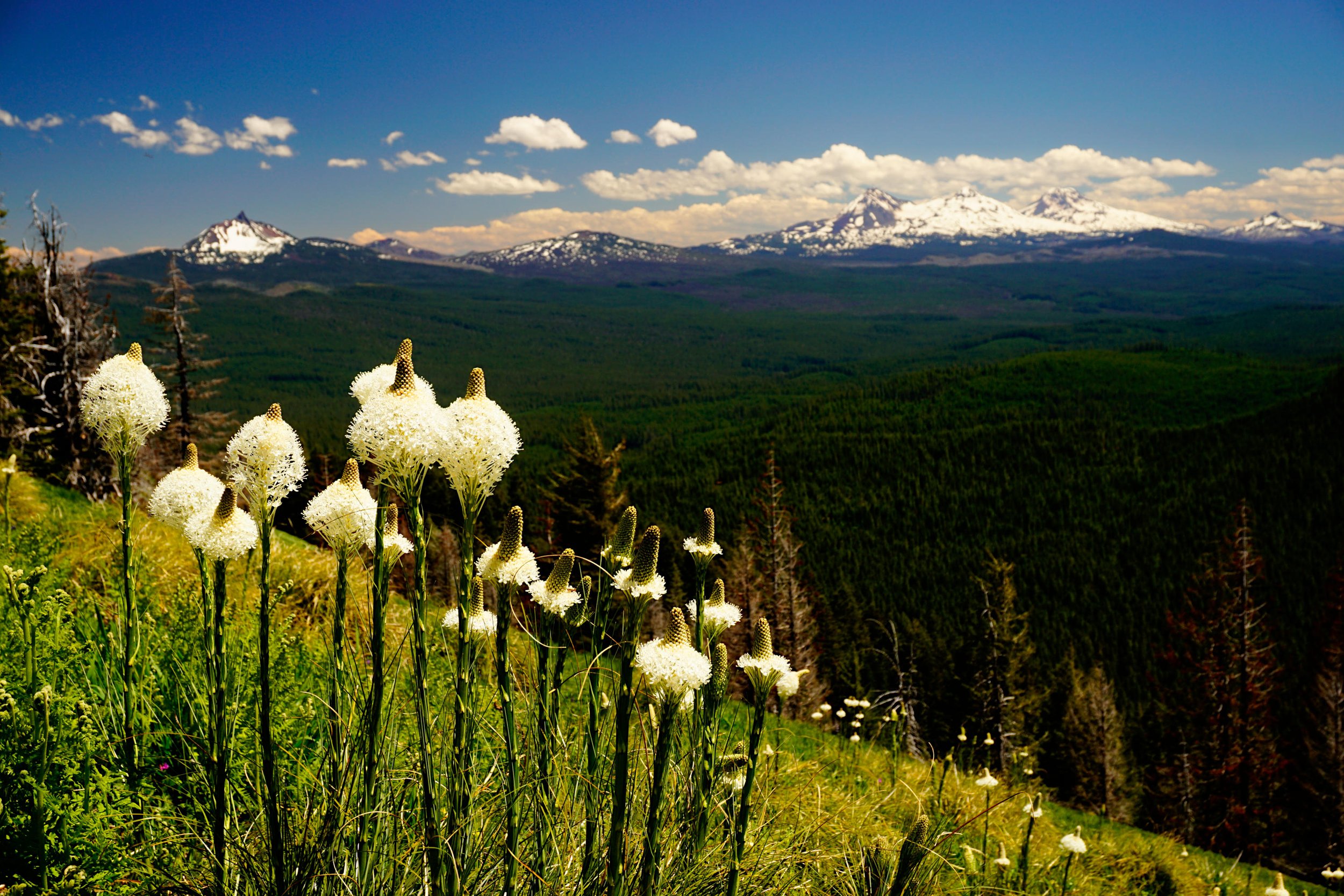
Beargrass and views of the Three Sisters are highlights of the Crescent Mountain Trail.
Why this hike just missed the cut: As much as I would have loved to include every hike in the Central Oregon Cascades that I could, this one is slightly less exciting than both Iron Mountain and Browder Ridge, the two hikes in this area that made the final cut of Extraordinary Oregon. That being said, this is a gorgeous hike and one I highly recommend if you’re in the area. We did this hike again in the summer of 2022, and my description from 101 Hikes in the Majestic Mount Jefferson Region is still on point. Presented here is the writeup from that book.
Distance: 9.6 miles out and back
Elevation Gain: 2,500 feet
Trailhead elevation: 3,724 feet
Trail high point: 5,740 feet
Season: June - October
Best: July
Map: Green Trails #588 (Echo Mtn)
On the traditional lands of: The Molalla, Siletz, Grand Ronde, Cayuse, Umatilla, and Walla Walla peoples.
Directions:
From the junction of US 20 and Quartzville Road east of Sweet Home, drive 37.7 miles east on US 20 to a junction with Lava Lake Road, FR 2067.
This junction is about 0.5 mile west of the junction of US 20 and OR 126 and about 3.5 miles west of the junction of OR 22 and US 20.
If you are driving here from Salem, drive to Santiam Junction and turn right on US 20 for 3.5 miles to the turnoff for the Lava Lake Road on the right, 3.5 miles past Santiam Junction and 0.5 mile past the junction of US 20 and OR 126.
If you’re coming from Bend, drive to Santiam Junction and continue west on US 20 for 3.5 miles to the turnoff for the Lava Lake Road on the right, 3.5 miles past Santiam Junction and 0.5 mile past the junction of US 20 and OR 126.
Turn left (or right if driving west on US 20) and drive 0.9 mile north on this paved road.
Turn left at a hiker sign on to FR 580.
Drive 0.7 mile to a large parking lot at road’s end.
Drivetimes: 1 hour from Sweet Home, 1 hour and 45 minutes from Salem, 1 hour and 10 minutes from Bend
Hike: This excellent hike is ideal in any season but no more so than in late June and early July, when its sunny slopes are carpeted with one of the more spectacular wildflower displays in the Cascades. Every few years the display of beargrass on this hike is absolutely mind-boggling – try and time this hike for one of those years if possible.
The trail begins with a gentle descent along placid Maude Creek. The forest here is beautiful, with huge hemlock trees and a variety of woodland flowers. Look for yellow violets, pink bleeding hearts and early in the season, lots of trillium. The trail crosses Maude Creek on a bridge at about 1.1 miles and begins a well-graded but steady uphill through a dark forest. Note the copious amounts of yellow lichen on the sides of the trees here – the height of the lichen on the trees indicates the depth of the winter snowpack, showing that this area is typically covered with six to eight feet of snow in the winter.
At about 2.5 miles into your hike, the trail exits the forest and enters the hanging meadows for which this area is famous. Look for lots of larkspur, bleeding hearts, paintbrush and wallflowers. Equally impressive are the views; Three-Fingered Jack seems close enough to touch as it looms just across the valley to the east. The trail switchbacks up the hanging meadows for almost a mile until it re-enters the forest, at which point you are nearing the summit. At 4.6 miles from the trailhead, reach a junction with the unmarked but very obvious spur to the summit of Crescent Mountain. Turn right and climb 0.1 mile to the summit. The remains of the erstwhile lookout tower, abandoned to the elements in the 1950s, dot the summit. As you would expect, the view is outstanding, stretching from Mount Hood to the Three Sisters in an excellent 180 degree panorama. Look down to remote Crescent Lake, situated at the base of Crescent Mountain’s cliffs.
Return the way you came, or arrange a shuttle to the northern trailhead for Crescent Mountain at the beginning of the Old Cascades Loop. Please note that I did not hike this northern section of trail and it is purported to be rough in spots. If you visit and have something to add, please send me a note!

Map of the Crescent Mountain Hike.