
Hidden Falls is tucked away in a small canyon just outside a subdivision in Happy Valley.
It hasn’t been easy.
I cherish ritual, and I need open spaces to feel at peace with the world. For me, hiking is something akin to meditation. I am not a religious person - I am in fact, an atheist - but being out in nature is as close as I get to going to church, to meditation.
When the full scope of COVID-19 became apparent, I knew we wouldn’t be able to hike as much, or as far away as expected. Let me be clear in saying also that I supported, and support all of these closures. I know that many of you will disagree with me, but I believe that we need to all do what we can to stop a disease that is ravaging communities across the globe. Let me also state that this is as serious a situation as any of us have faced in our lifetimes; I understand why so many people need to seek out nature to find some peace. This is our Great Depression and World War 2 moment…it is almost impossible to truly grasp.
With that in mind, we’ve been able to get out and hike sporadically, but always local. Sometimes it has worked, and sometimes it hasn’t. Sometimes it’s been great, and sometimes it hasn’t, and sometimes we haven’t even been able to leave the house. For me personally, my workload has effectively doubled, and I reach the end of every week in a fugue state of complete exhaustion. Even for me, hiking has not always been the refuge I expected it would be when this started. But we have gotten out here and there, and I’m going to write about a few of these experiences below.
March 26 - North Oxbow

It took me awhile to find this hike, but when I finally did in January I was immediately smitten. This is a wilder side of Oxbow, away from the boat ramps and group shelters. We decided that this was as far away as we felt we could go while still abiding by the state’s Stay at Home order. As it turned out, we only saw a few other people. The trail is wide enough for the most part that you can keep a reasonable distance from people.
Now, the negative: The narrow gravel road into the trailhead does not allow much room to pass cars going in the opposite direction, and there are several houses along the road. Please be VERY considerate of the folks who live on this road when you visit. Moreover, there is only room at the trailhead for 8 cars at most, so if you’re going to hike this trail, choose a time early in the day or on a weekday to avoid overwhelming this secluded corner of Oxbow.
Here are some photos from the hike:


The hike ended up being about 3.2 miles round-trip. The trail reaches a crossing of a side channel of the Sandy River at 1.6 miles that is flooded over in winter and spring; I’m sure you could go further now. This is a lovely area, if you can find it. There’s no access to the popular parts of Oxbow across the river, so it’s just you and the few other folks who know about this neat little corner of the park.
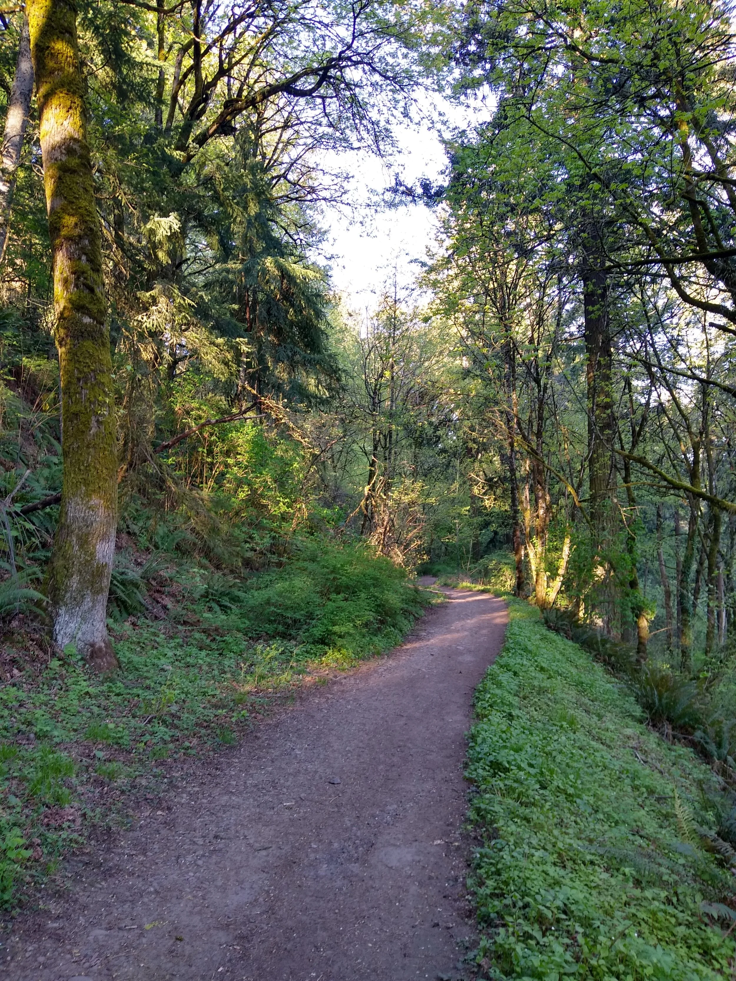
April 3 - Hidden Falls Nature Park

See the photo above? See how gorgeous Hidden Falls is? This was a consolation prize if there ever was.
We had grand ideas of connecting two parks in Happy Valley into a full day of hiking. One of these was the brand-new Hidden Falls Nature Park; the other I have already forgotten, because we never made it there. By this point I was already pretty worn out from two weeks of remote work, and I was looking for something pretty easy.
There isn’t really a trailhead for Hidden Falls, just a few spots to park along a quiet suburban street. Once we found a parking spot, we realized that it was cold. Very cold. As in, 37 degrees cold - and it was starting to rain.
It doesn’t take very long to reach the falls. The wide trail drops down into a secluded and verdant canyon, where you soon reach a huge wooden bridge over the creek:

This is one of the nicest bridges I’ve ever seen on a hike. Happy Valley put a lot of time and work into this park, and it shows. The falls is just upstream of the bridge, and the best place to photograph it is from the bridge:

Hidden Falls
The trail winds uphill, very quickly reaching a second trailhead. There is a parking lot here, but it was closed off and gated. There was a lot of lupine along the trail, looking beautiful with water beading on the many leaves:

The Hidden Falls hike, if you can call it that, was about 1 mile round-trip. We got back in the car and drove through Happy Valley to another park, which we found closed. As in, completely closed, and gated. Unsure of what to do, and lamenting the bad weather, we decided to just drive home and work in our garden. It turned out to be a good day, but not a very satisfying day of hiking.
April 17 - Powell Butte

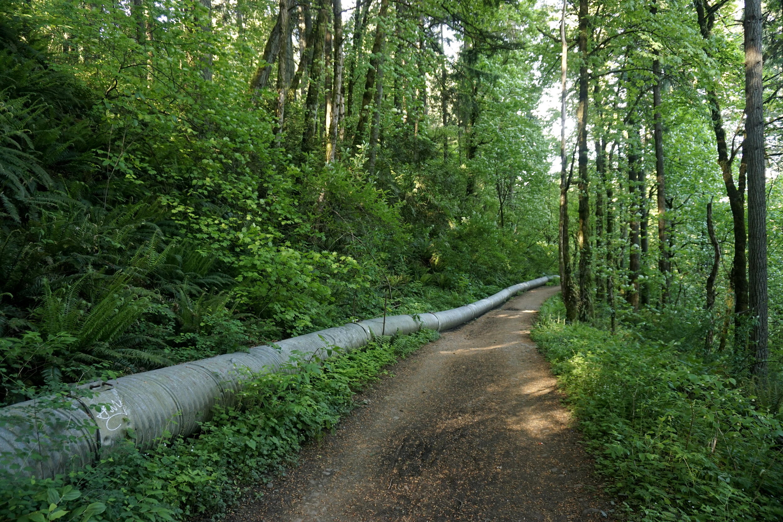
We live so close to Powell Butte that it takes less time for us to drive there than it did to write this paragraph. This means that we often take it for granted. I come here on the rare occasion it snows to get outside in the snow without needing to get in my car. This proximity also means that there isn’t anything to see at Powell Butte that I haven’t seen many times before. For this hike I decided to leave my camera at home, something I almost never willingly do. I still took some photos, and Powell Butte is still quite beautiful, but this was very much an urban hiking experience. It was also the longest hike we’ve done over the past two months.
We started at the Old Holgate Trailhead, the closest to our house. This is a nice, wide, gradual trail that allowed us to ease into our hike.
Once we reached the summit meadows, we hiked around the edge of the meadow, eventually reaching the summit. The view east to Mount Hood was too bright to photograph but I was elated to see my old friend Majestic Mount Jefferson:

See if you can spot Mount Jefferson in this photo. It’s out there somewhere!
We then hiked down into the woods, where we began to encounter more hikers. Wendy and I are both early risers and by this point, it was after 9AM. But the forest was peaceful, and past the junction with the junction with the Springwater Trail, we didn’t see too many people.

There were lots of trillium around:

The trails on the west side of Powell Butte eventually meet those at the western edge of the summit meadows. By this point we began to see lots of people, but it was still nice to get a few moments in the sun:

From there, it was back down into the woods and back to our car. We made it back to the trailhead by 10AM, a record for doing a full (5.6 miles) hike. Here’s a map of our excursion:

April 24: Canemah Bluff
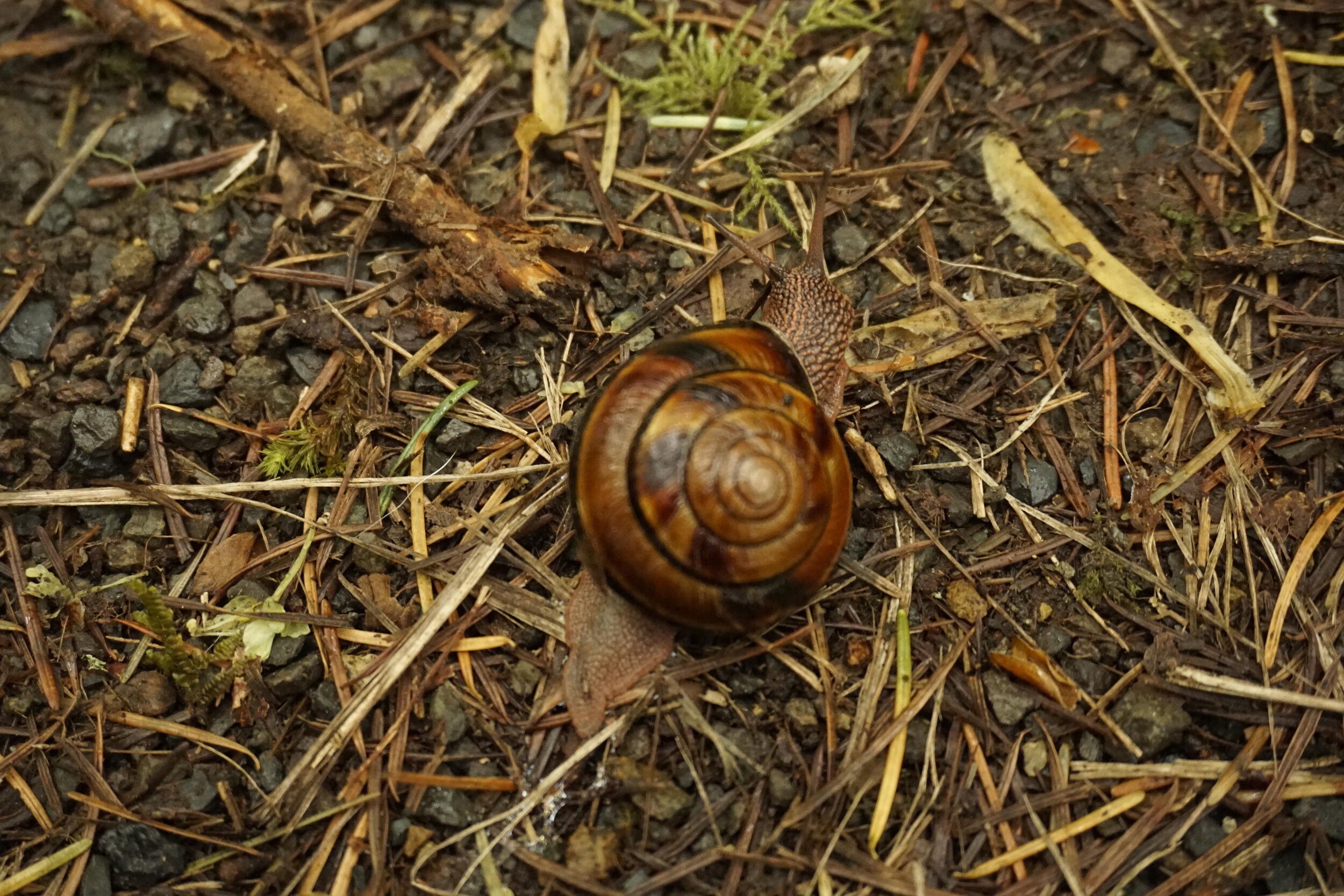
The following Friday, we made plans to hike the Canemah Bluff loop in Oregon City to see the peak camas bloom. This is one of the best spots in the Portland Metro area to see wildflowers, and with Camassia across the river closed, this was all we would be able to do. We figured we would go very early and do the loop through Canemah, then go hike at Mount Talbert afterwards.
I woke up that Friday morning more exhausted than I had been in a very, very long time. I was so exhausted that the day quickly took on the quality of a vivid dream. At times I wasn’t sure if I was awake and hiking or still asleep. The camas bloom was really nice:


As you can see, it was a little rainy and gray, as it seemed to be on a lot of our hiking days. The trail passes a nice view down to what was a very placid Willamette River:

Even the slight amount of elevation gain felt like a lot, given how tired I was. But the woods here were very peaceful, and we didn’t see almost anybody. But we did see a snail!

It started raining a bit towards the end of our hike, but it only added to the gloom and dark beauty of the morning:
We look forward to wildflower season every spring, and this hike fit the bill even though it was short. Sometimes you don’t need a long hike for it to be satisfying. We saw our first wild irises of the year as we neared the trailhead at the end of our loop:

When we reached the car, we had only hiked 1.7 miles, but I was done. I’m still in pretty good hiking shape, but I was so exhausted going into that day that I didn’t have any more hiking left in me. Sometimes the physical challenge just isn’t enough for me. Lately I’ve found myself needing rest more than anything.
Saturday, May 9: Powell Butte (again)
The last hike we did before the shutdown was Swale Canyon, on the Washington side of the Gorge. Over the course of the day we realized that it wasn’t really possible to socially distance in a lot of places, and that we would have to stay close to home and hunker down for the time being. The Swale Canyon hike was wonderful, and it was everything we needed that day. It was 11.8 miles round-trip.
Since that day (and until this morning), we’ve hiked 11.8 miles total.
Now, it’s not like I’ve been stuck at home all of this time. We’ve been going through walks in our neighborhood, even though it’s not the easiest place to walk. There aren’t many through streets, and most of the streets don’t have sidewalks. But it’s been nice to see more of our neighborhood than we ever have before.
I’ve also been going on bike rides along the Springwater Corridor, and on neighborhood streets. This was how I discovered that there’s a wetland close to my house. I’ve been going there a couple of times a week to listen to the birds in the morning, and it is bringing me joy. So I recorded them so others could share in my joy:
So in that vein, this morning we decided that we would hike up to the summit of Powell Butte from our house. It’s an absolute pleasure to forego the long drives to some of my favorite trailheads and start our hike directly from our house. Within a few minutes we were on the Springwater Corridor, where views of Mount Hood opened up ahead of us:

I swear, I swear, Mount Hood is out there. It isn’t really possible to get a good photo of Mount Hood from the west in the morning, looking straight into the sun.
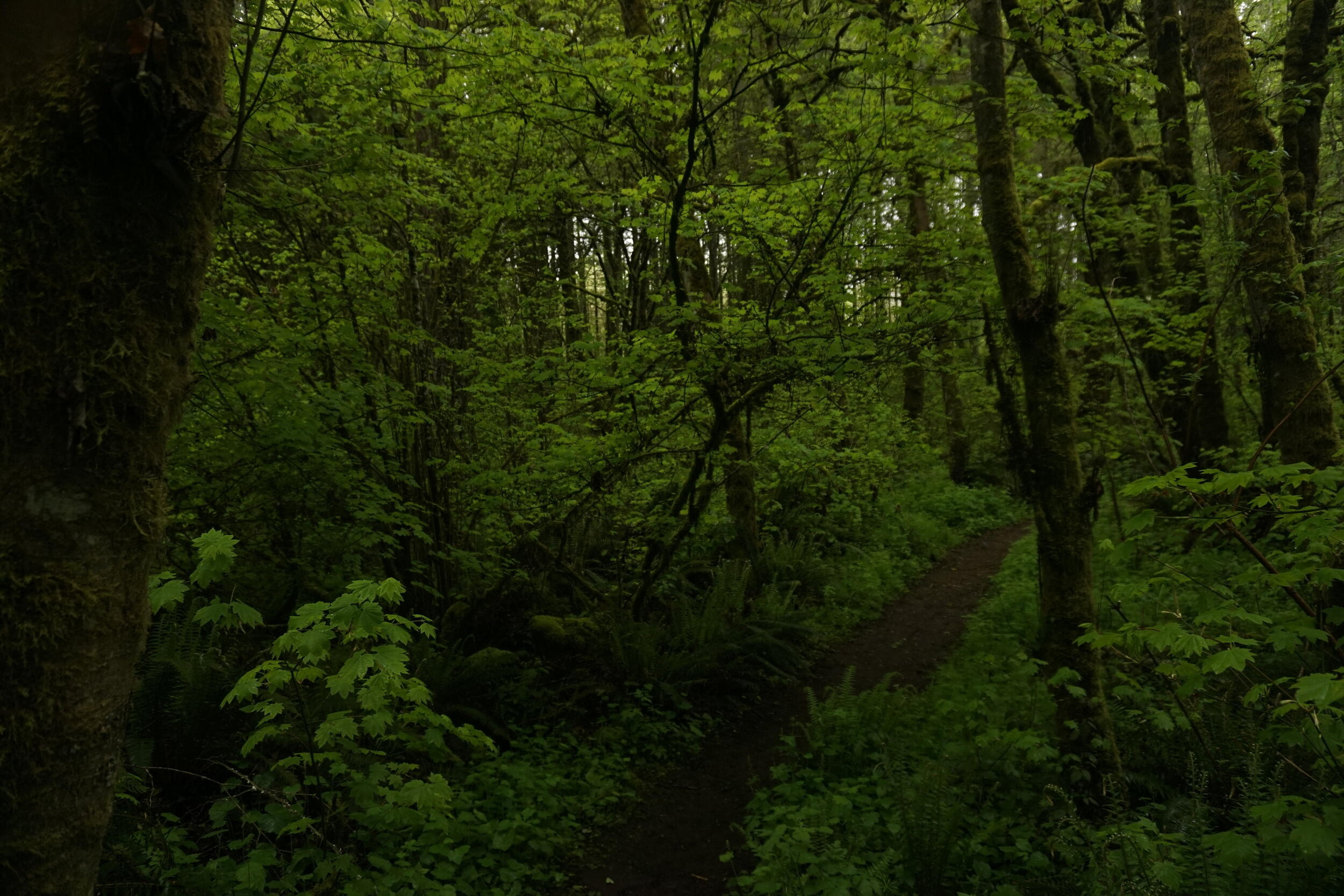
We walked along the Springwater until we reached the Powell Butte entrance on the backside of the park. Here we finally entered the woods to the sound of more birdsong. The woods were peaceful, as always:

The woods felt dark and cool, and like a sanctuary. It was here we started to see more runners and hikers as well. It felt good to get a little uphill in, seeing as how we’ve gotten almost no elevation gain since the pandemic started. Before long though, we were in the summit meadows of Powell Butte. Usually by this time of year we’re off exploring the Gorge and the eastern side of Mount Hood, and neither of us had ever been to Powell Butte in May. The flower show in the summit meadows was really nice!


In addition to lots of camas and lupine, there were also lots of columbine and iris, but they were both far enough off the trail that we couldn’t photograph them without trampling on other vegetation. As we hiked around the summit meadows we passed a number of hikers and runners but it never felt all that crowded. Of course, by this point it was still only 8:30 in the morning, so I’m guessing it’s a lot more crowded later in the day. Mount Saint Helens was looking spectacular in the morning light!

From there, it was back down to Old Holgate and out of the park:
After navigating the mean streets of outer southeast Portland, we arrived home at 9:30AM, shattering my previous record of the earliest time I’ve ever gotten home from a hike…set the last time we went to Powell Butte. In the time that we had been out hiking, our irises decided to open up. How cool!

Between the Springwater Corridor, Powell Butte and city streets we cobbled together a 6.4 mile hike, right from our doorstep. I made a map just to keep up the habit…look closely and you can figure out where I live!

I got to say it was a good day.
So with all that in mind, I do have some parting thoughts:
After two months of being effectively quarantined, I feel the call to get outside and explore the mountains and prairies and coastline that I so dearly love. I see so many of you out there, and my heart longs to join you and go back to doing the thing I love the most.
But I’m not going to, not until it’s safe for everyone. I’ve listened to and followed everything being said back and forth right now across the world about the subject of reopening the world, about returning back to normal. These discussions are lacking a crucial component: this IS normal now. This is the most severe public health crisis any of us have faced in our lifetimes. Consider this: 80,000 Americans, citizens like you and I, have died due to COVID-19 over the past two months or so. That’s just the confirmed death count; the real number is likely upwards of 100,000 Americans, and possibly as high as 120,000 Americans.
And this is after two months of aggressive lockdowns and social distancing. At the beginning of this pandemic, public health authorities told us we would be able to know if the lockdowns worked if it seemed like nothing happened. For many of you out there, nothing did happen. And still - we’ve lost something like 100,000 Americans to a disease that we’d never heard of even six months ago. The most dangerous thing to do now is to act like this is over, to act like we can go back to the way things were. We won’t be able to, not until we have a vaccine. We have no idea when that will be.
So does this mean that you shouldn’t go hiking? Of course not. You should still feel free to hike, so long as you’re not traveling too far from home (how far is too far is your decision), so long as you’re prepared to wear masks and clean up after yourself as much as is necessary, and provided that you understand that this is a different world now. Make sure you get gas before you leave town, avoid any stops unless they are absolutely necessary, and try to avoid popular hiking areas. And more than anything else, you should be hiking only with people from your household - so your partner, your roommates, or your family. Or you can just hike by yourself, which is immensely rewarding in its own right.
I have been pleased to rediscover how much I love urban hiking. While I’ve spent much of the past dozen years or so exploring the wonders of the Pacific Northwest, there have been many times in my life where I was not able to travel very far from home. During these times I took the time to explore the areas close to home, and no matter where I lived, I always found somewhere peaceful to explore. Even when I lived in central Illinois I found peaceful spots in the midst of an ocean of cornfields:

It’s up to all of us now to do our best to maintain the health and safety of our fellow citizens. That’s all that matters now.
Thanks for reading.