After mostly taking a few years off from the Mount Jefferson area after the publication of 101 Hikes in the Majestic Mount Jefferson Region in 2016, I decided to go back and begin exploring the area again in 2019. I will be writing about some of these experiences here.
Olallie Lake in the morning, just before we started our hike.
There’s just something about Olallie Lake that feels like home for me. I’ve been coming here since I was a kid, and every time I go back, I am overcome with wonder at the beauty to be seen everywhere. I suppose it helps that Olallie Lake is not close to anywhere, and is never the easiest place to access. I have always felt that if it were easier to access, it would be as popular as Lost Lake.
My buddy Gene loves Olallie Lake as much as I do, perhaps even more. So whenever he suggests we go to Olallie Lake, I am almost always inclined to go. He had never been to Ruddy Hill or Breitenbush Lake, and I had some trails I wanted to hike again; with that in mind, we decided to make a long loop from Olallie Lake to Breitenbush Lake, up and over the Gibson Lake Trail, down the Horseshoe Lake Trail, down to Monon Lake and back via the traditional Monon-Olallie Lake Loop. It is the grand tour of Olallie country, and it was a hell of a lot of fun.

Fall color along the trails.
We began by walking along the road to the Red Lake Trail, about 1/3 of a mile from the Olallie Lake Resort. From there, we found the Red Lake Trail and hiked it to Top Lake, and then up to the Pacific Crest Trail. Normally I would just start on the PCT and hike it to this same junction, but Gene had a point: the Red Lake Trail is more scenic. And it was on this day too, as the huckleberry along the trail was showing off its wonderfully red fall color display.
We reached Lower Lake soon after, and it was looking beautiful this morning!
Lower Lake on a cold fall morning.
Gene had never been past Top Lake so the next few miles were all new to him. We followed the Pacific Crest Trail for a few miles into the woods, occasionally coming across patches of snow. Not too far past Lower Lake is a large meadow with an excellent view of Mount Jefferson:

When we reached the Ruddy Hill junction, we decided to skip the summit. The photo lighting was terrible and we had many more miles to go. So on we went.
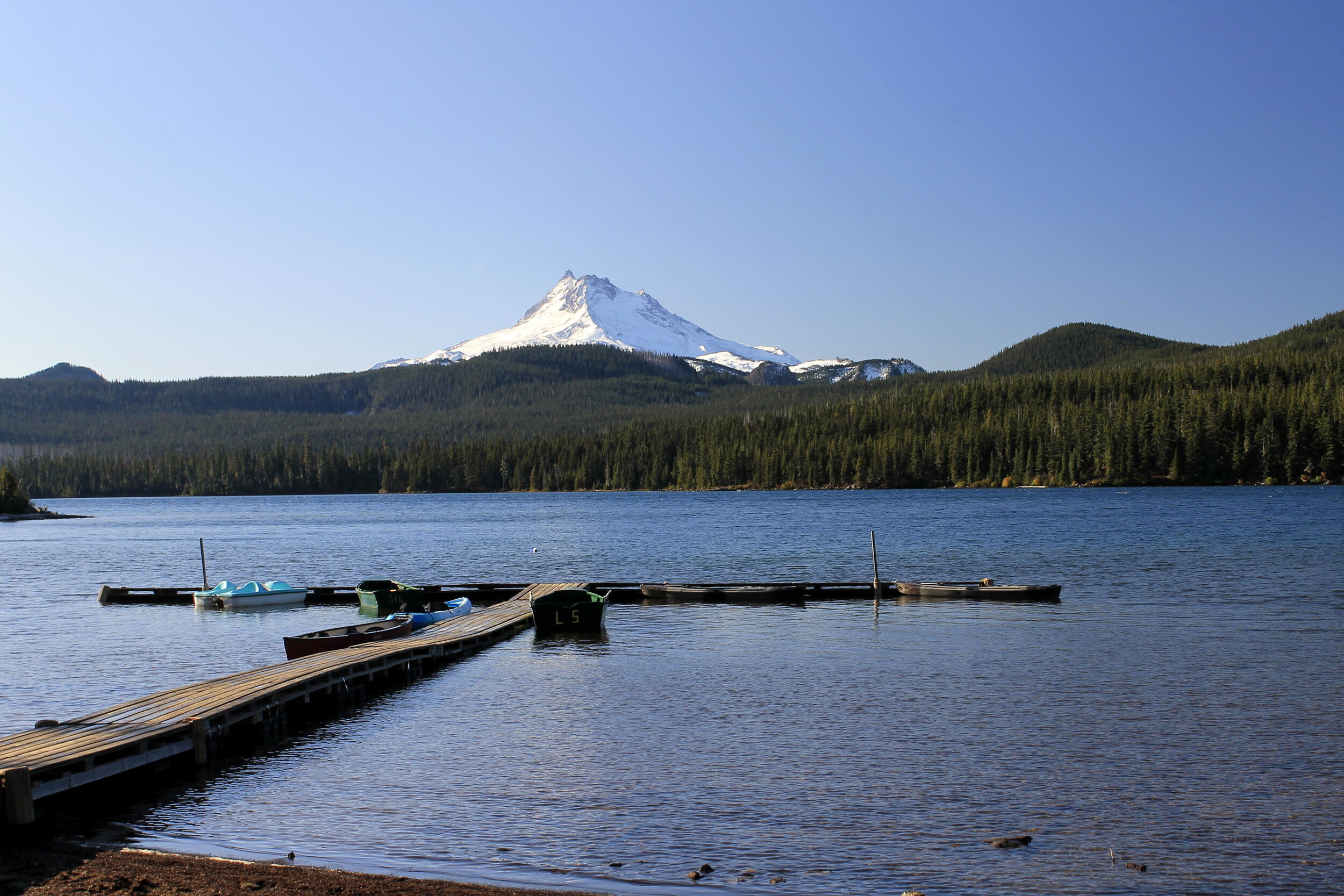
After around 6 miles from Olallie Lake, we reached the PCT trailhead at Breitenbush Lake. I had just passed through the area a few weeks earlier on a long trip to Park Ridge, but I’m always exciting to make it to this trailhead. All road access is terrible, and I don’t make it here very often. Gene had never been to Breitenbush Lake either, so it was all new to him. We followed the Skyline Road a few hundred yards east to the campground at Breitenbush Lake, where we stopped for lunch.

The view of Breitenbush Lake from the campsite where we had lunch.
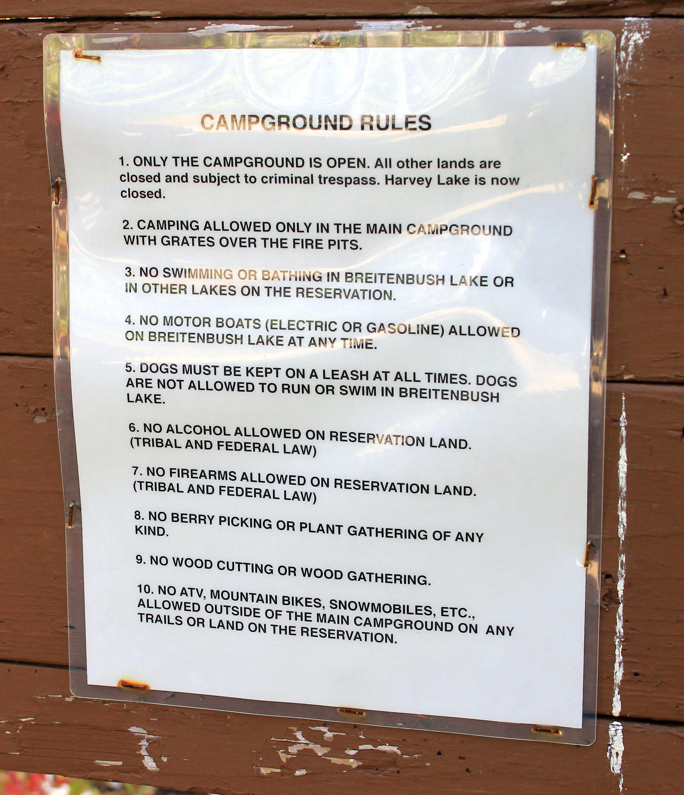
Breitenbush Lake is just inside the Warm Springs Reservation, and is mostly closed to non-tribal members. You can camp at the campground but you must follow the rules. Here are the rules:
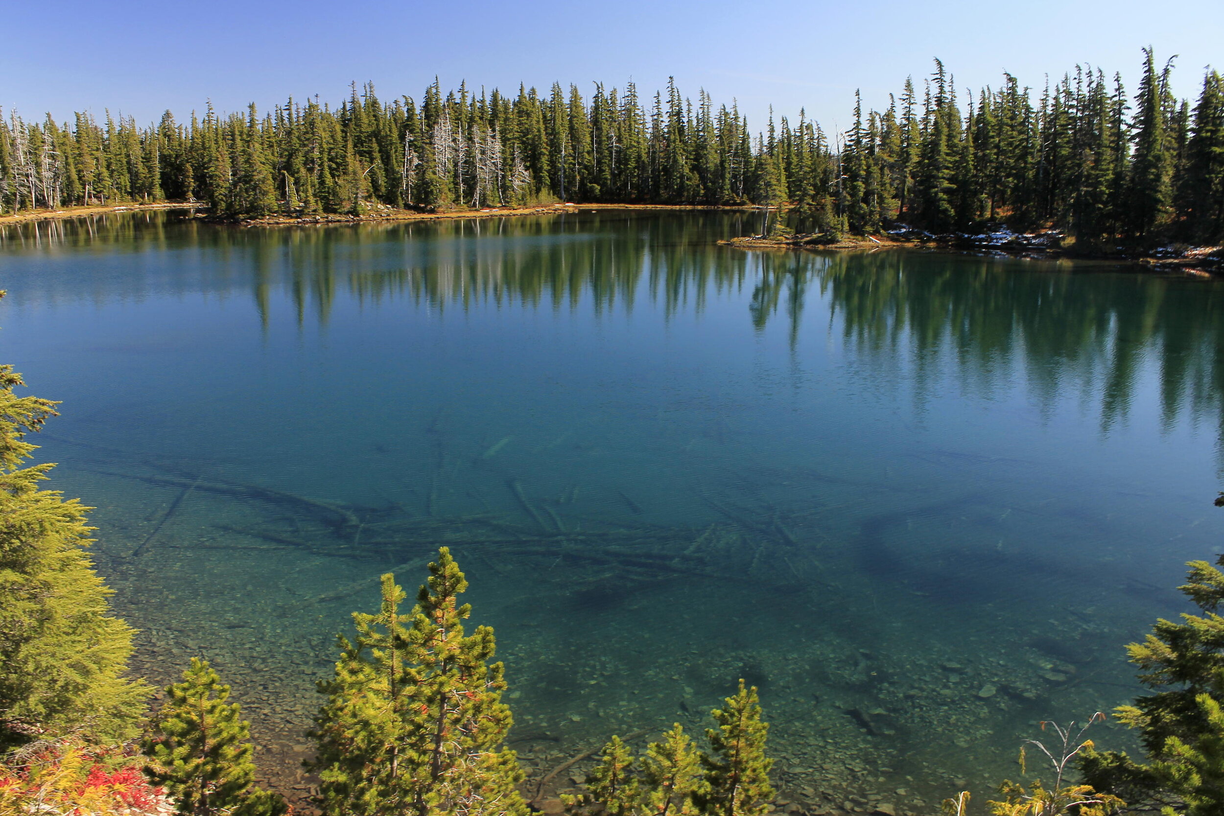
After lunch, we walked the Skyline Road east to the Gibson Lake Trail, which is an old part of the Skyline Trail. The trail departs from near the eastern end of Breitenbush Lake and traverses the bluffs above Horseshoe Lake before meeting the Pacific Crest Trail only a few hundred yards from the junction with both the Ruddy Hill Trail and Horseshoe Saddle Trail. It had been eight years since I had hiked the Gibson Lake Trail, so I was happy to be back. The trail does pass through the reservation, but hiking is allowed provided you do not camp, fish, hunt or collect berries.
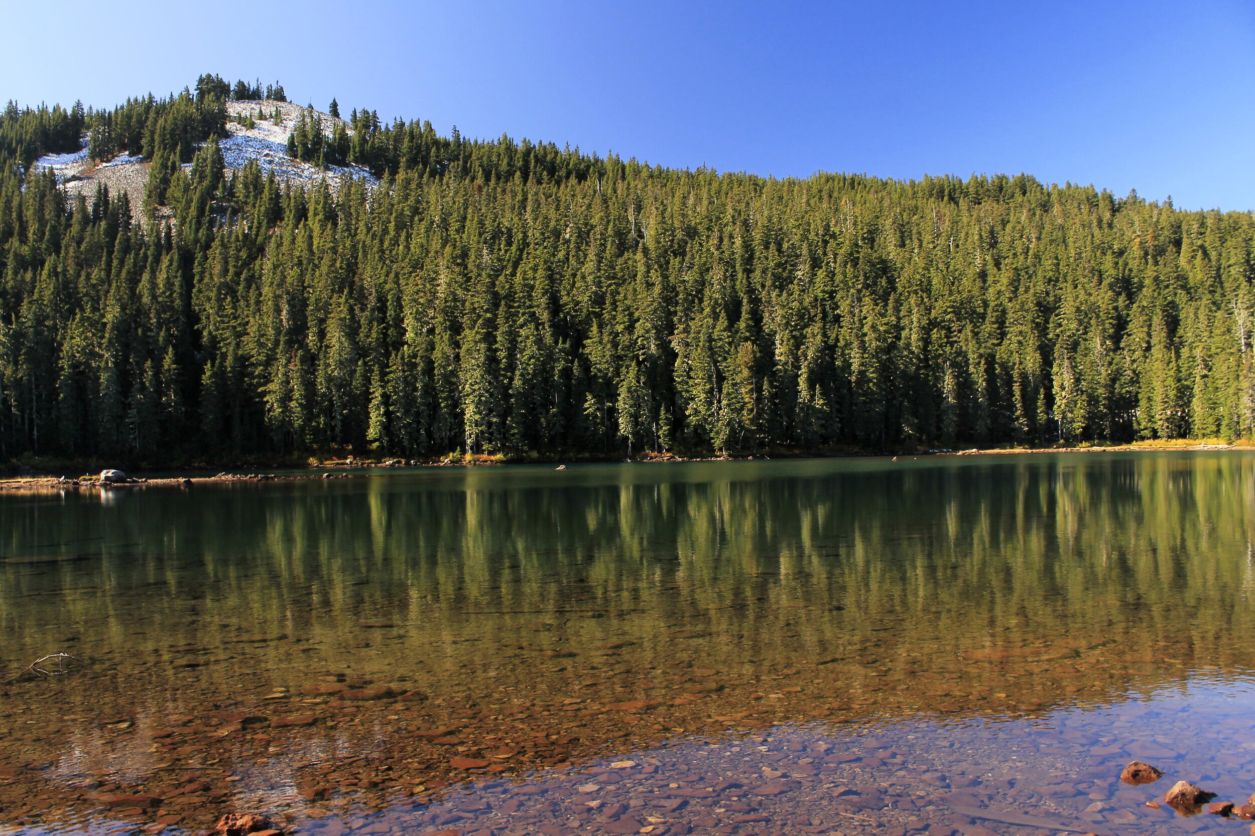
Gibson Lake is absolutely gorgeous:
After lingering a little while at Gibson Lake, we continued on the Gibson Lake Trail. The trail passes one of the finest views of Olallie Lake’s basin, a view few people ever get:

All lined up: Horseshoe Lake, Monon Lake, Olallie Lake, Olallie Butte and Mount Hood.
The trail got a little snowy near the junction with the PCT but the way was never in doubt. Once on the PCT, we hiked the short distance north to the Horseshoe Saddle Trail. This is a really nice trail that descends gently for a mile to Horseshoe Lake. Once at Horseshoe Lake, we turned left and walked the Skyline Road downhill for a mile to Monon Lake, where we regained trail. From here, it was back to the car on the Olallie-Monon Lake loop that both Gene and I have hiked so many times.

Monon Lake and Olallie Butte in the afternoon light.
The last few miles went pretty fast, even though our legs began to get a little tired. The weather was absolutely perfect: warm in the sun and a little chilly in the shade, with a light breeze. We were almost alone up there, aside from a few people on kayaks out on Olallie Lake. As always, we stopped for photos of Olallie Lake with its classic view of Mount Jefferson:

All in all, it was a fantastic day! Well, mostly fantastic: when we got to the Olallie Lake Resort, I was able to listen to the last inning of the Cardinals playoff game, and they ended up losing. Boo! So it was mostly a great day. As we drove out the bumpy road (bumpier this year than in the previous few years) and back to Portland, we were grateful to for a full day of exploration in Olallie Country, one of our favorite places.

A map of our adventure. What a day it was!