After mostly taking a few years off from the Mount Jefferson area after the publication of 101 Hikes in the Majestic Mount Jefferson Region in 2016, I decided to go back and begin exploring the area again in 2019. I will be writing about some of these experiences here.

Lower Opal Creek Falls.
We used to go to Opal Creek a lot when I was a kid. At some point around this time I first heard a rumor of a huge waterfall on Opal Creek near its source, near Opal Lake. Details were scarce, other than it was somewhere around 200 feet tall, and difficult to access. In the summer of 1993, we hiked the steep, rough trail down to Opal Lake, which we found to be beautiful. We never made it back to Opal Lake.
I moved back to Illinois in 1997, and it would be eight years before I got to visit Opal Creek again. When I moved back to Oregon in 2005, I visited Opal Creek as soon as I possibly could. It didn’t take me too long before I started to fantasize about finally visiting Opal Creek Falls. Around this time a number of explorers online began posting about their adventures exploring off-trail waterfalls, and I joined a number of these trips. The idea of making a trip to Opal Creek Falls began to look more and more plausible, especially once I finished grad school and found myself with a lot more time.
In the summer of 2007 I organized a trip to attempt to reach Opal Creek Falls from below, from Opal Creek. I had heard anecdotally that it was a lot easier to reach the falls from above, but I decided it would be a lot of fun and extremely rewarding to reach the falls from below, bushwhacking up Opal Creek. It ended up being an exhausting day, but also an exhilarating one. We never reached the falls, but we made it fairly close. Here are some photos from that day:


Life got in the way for a few years after this; I went to France for a year, the economy crashed, I had trouble finding a job, and so on. It wasn’t until late in 2015 that I made it back to Opal Lake, while I was putting the finishing touches on 101 Hikes in the Majestic Mount Jefferson Region.
We made it down to Opal Lake on a nasty, cold, rainy day. It was just as beautiful as I remembered:
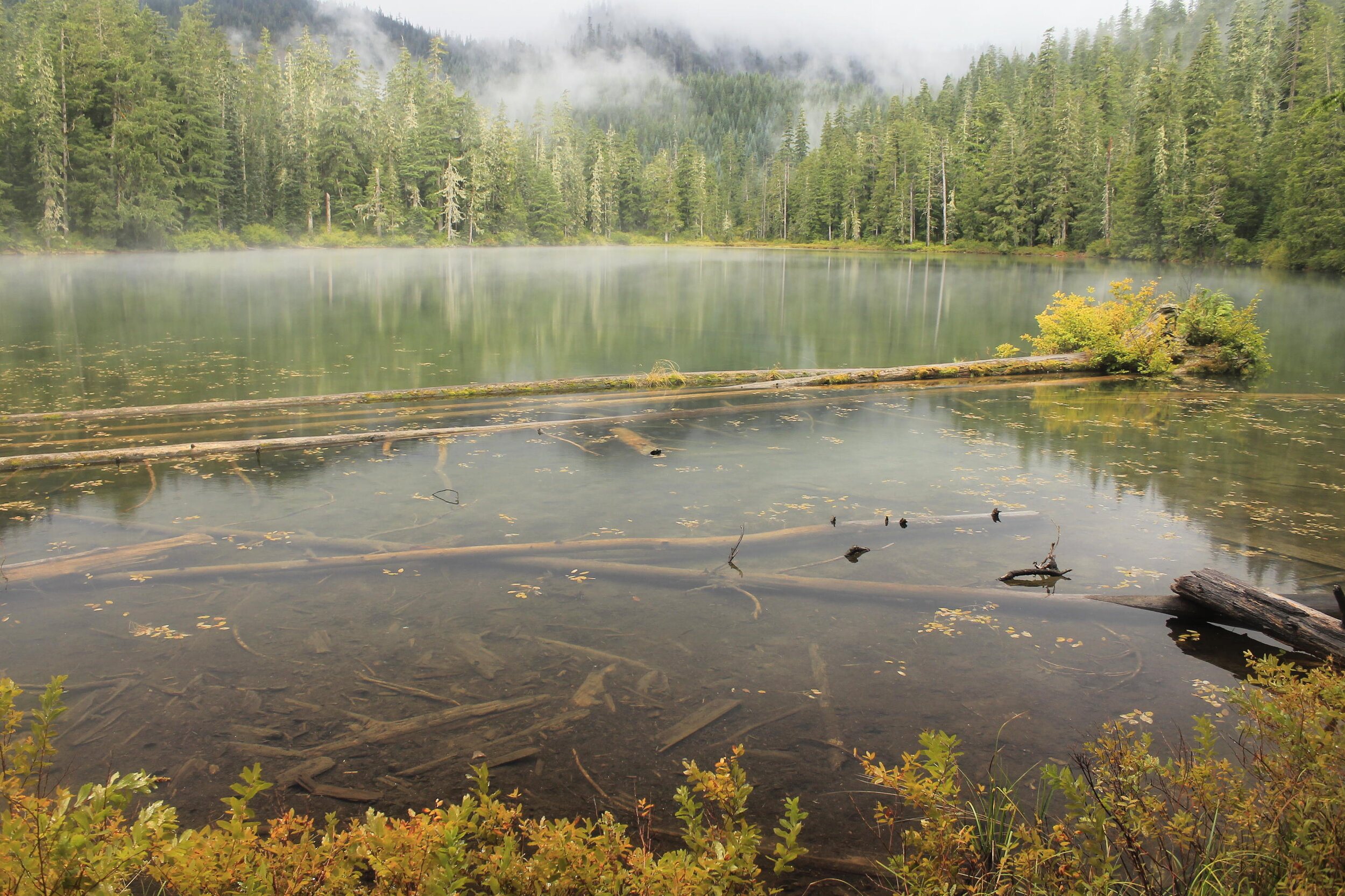
Opal Lake, September 2015
Actually, it looked a lot more like this:

Look closely and you can see the raindrops!
Over the past few years, I’ve organized adventurous bushwhacks with friends for my birthday. In 2019, I decided we needed to make an attempt at Opal Creek Falls. I had information from one of my fellow off-trail hikers on how to reach the falls, so I figured it was finally time.
Much to my surprise, I discovered that there was a well-developed, brand-new trail down to Opal Lake in place of the old scramble trail down. When I was working on 101 Hikes, I noticed this new trail alignment on the map, but I figured it was an error made by the Forest Service. It turns out that they were building a new trail, and had removed the old trail alignment from the map.
The new trail is really nice! It is well-graded, passes through some tremendous ancient forest, and completely skips the marsh and tangled brush on the west side of Opal Lake. We made it down to the lake in no time, where I was able to recreate the photo from above, taken on that nasty day in 2015. Here’s the photo from last year:

Compare this to the photo from 2015 above!
From there, we followed a brushy trail along the outlet of Opal Creek, here a mere trickle. Eventually we came to a rocky outcrop near the band of cliffs at the edge of the narrow basin that holds Opal Lake. This was a neat spot. Were it not for the falls below, I could have just sat here at the top of the cliffs for hours.
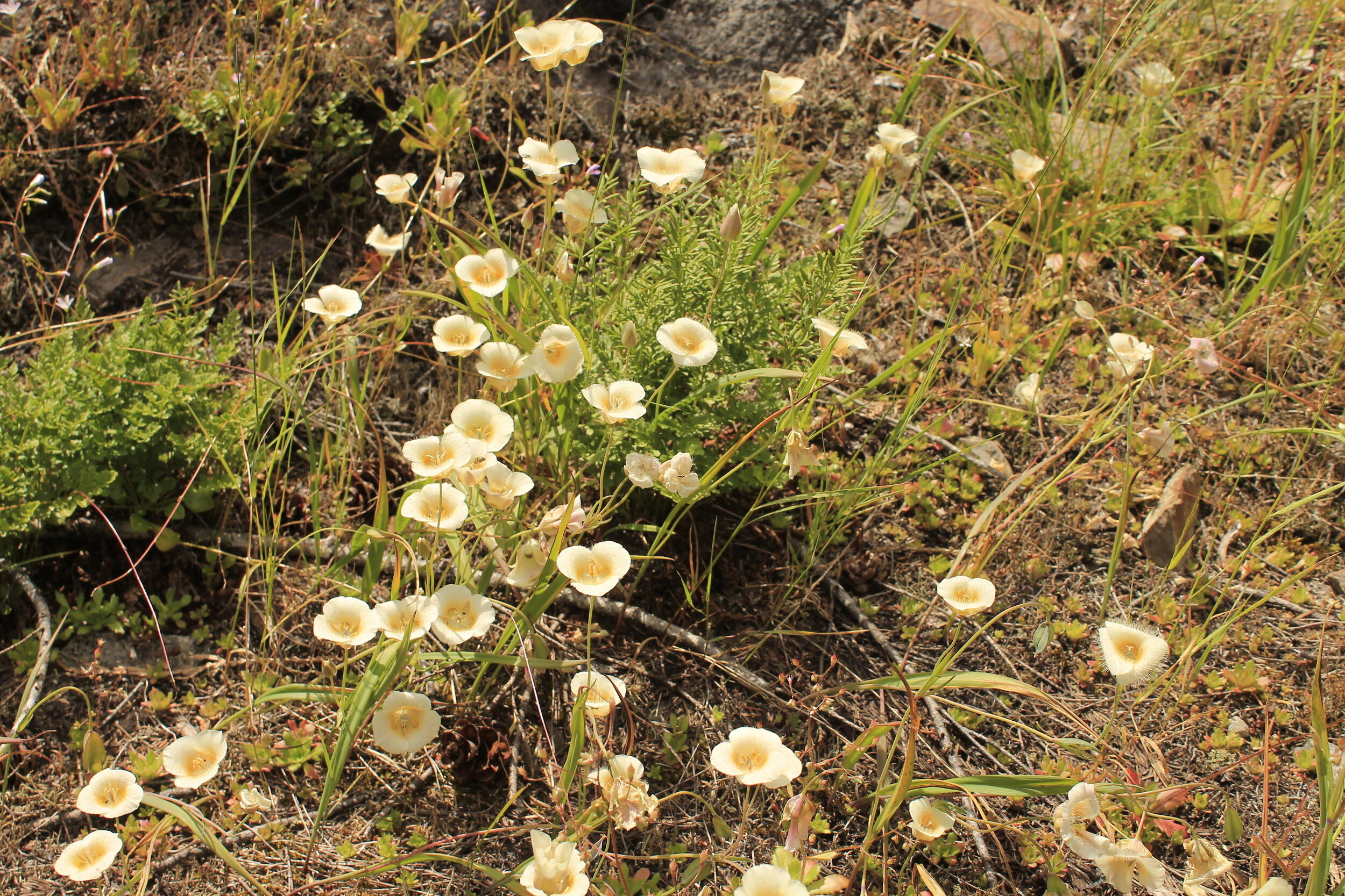
Cat’s Ears (Mariposa Lilies) near Opal Creek Falls.
From here, we made our way over to Opal Creek, where we found a beautiful little spot not far from the top of Opal Creek Falls. Just as with the spot near the cliff edge, I could have sat here for hours:

Once across Opal Creek, we made our way down an incredibly loose, steep and somewhat dangerous slope. I’m not going to describe our route in more detail because truth be told, it wasn’t exactly safe. I cannot recommend this to anyone not trained in using ropes and scrambling down slopes so steep it was hard to keep upright. In other words: don’t go down this way unless you happen to love a challenge and are sufficiently equipped for one.
On our way down we passed the top tier of Opal Creek Falls. It was stunning!
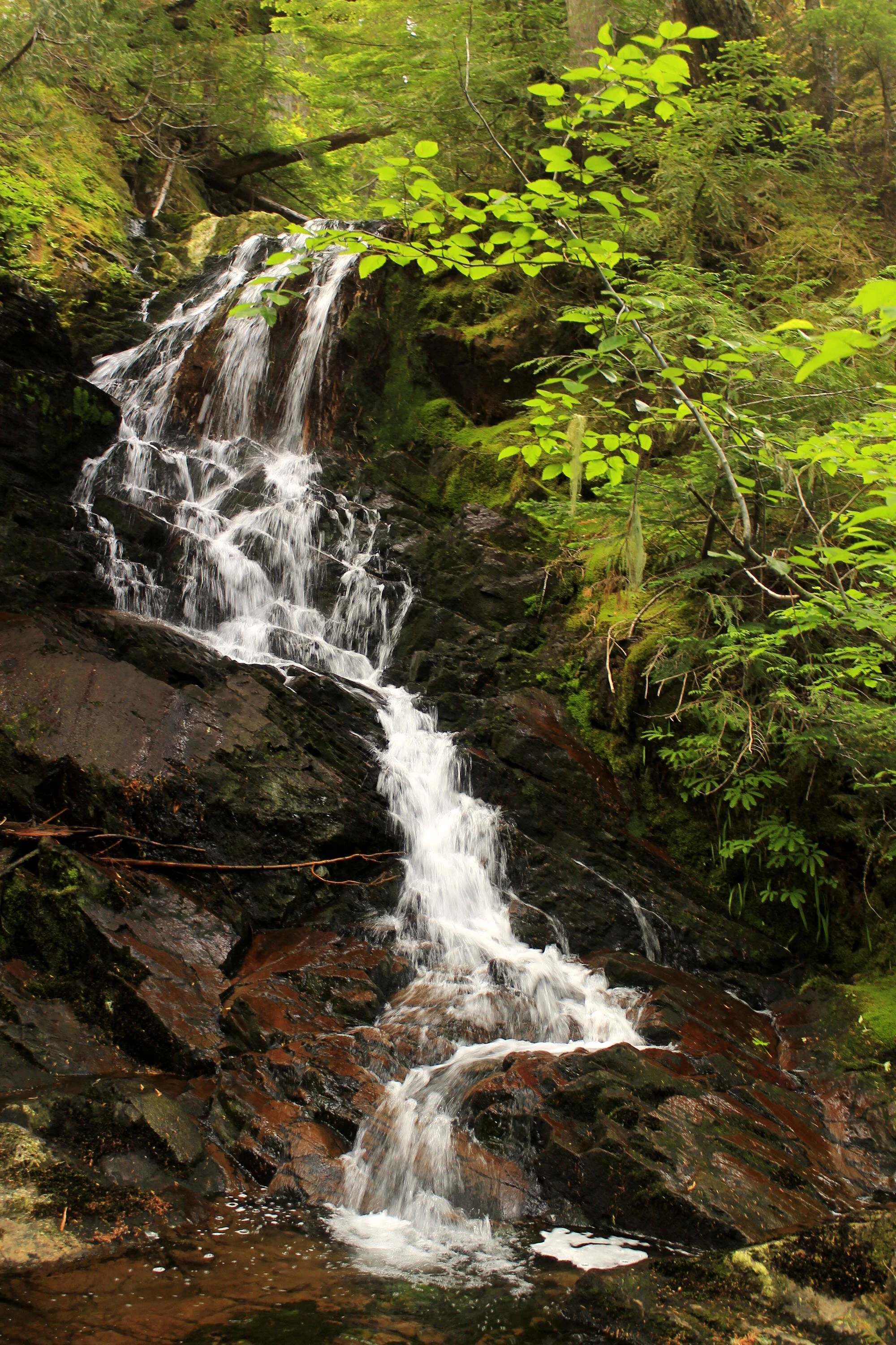
The top of Opal Creek Falls, or Upper Opal Creek Falls; take your pick.
One thing we noticed right away was that the flow of the creek was pretty low, much lower than I expected. Another thing we noticed was that there weren’t any deep green pools here, such as are found downstream. Still, it was an absolutely beautiful scene.
After crashing our way down an absurdly deep slope, we finally arrived, still intact, at the bottom of the canyon and at the base of Opal Creek Falls. What we found was astonishingly beautiful:

After taking some time at the lower falls, it was time to make our way back out of the canyon. We decided not to go back the way we had come, as it was far too steep and treacherous. Instead, we opted to climb out the opposite side of the creek, which, looking at our topo map, seemed like it might be a little less steep. It turned out to be less steep, but very brushy. On our way up, we passed by some absolutely huge trees. Opal Creek has a reputation for its old growth, but the trees in this canyon and near Opal Lake were some of the largest I’ve ever seen in this part of the Cascades.

We scrambled uphill, away from the lower falls. Over the past few hours of exploring, I had been wondering if we would ever come across a view of the main part of the falls. On our way down we passed the upper tier of the falls, and we arrived at the base of the lowest tier. The middle tier is the tallest of the three, and we were forced to traverse away from it to avoid the cliff bands near the falls. I had seen a photo of the middle tier years ago and it looked spectacular, so I was feeling somewhat unsatisfied as we made our way up.
After some scrambling, Neil called out that he had found a view of the middle tier at last. So up and over we went, finally arriving at the long-promised view of the main tier of Opal Creek Falls. It was breathtaking:

The middle tier of Opal Creek Falls.
It was the waterfall I had always dreamed it would be, even in spite of the low flow. We were all amazed. Keith in particular found it awesome; as per his custom, he had to swim in the pool at the base of the falls:

Keith loves exploring, so he scrambled halfway up the falls to get a better look at the upper ramparts of Opal Creek Falls…

…only to scramble back down:

As I sat there hoping he wouldn’t trip and fall on his way down, I also felt fortunate to be in such a rugged, wild place almost devoid of human influence. People do on occasion make their way down from Opal Lake to Opal Creek, but not many see Opal Creek Falls due to how steep and narrow the canyon walls are near the falls. In the years that I had been dreaming of this adventure, I had only ever seen a small handful of photos of Opal Creek Falls before I finally was able to see it in person. I feel very fortunate and grateful to be one of those rare adventurers who have seen it, and I feel even more fortunate and grateful to have some great friends with me on the adventure.
After the falls, we still had to negotiate our way out of the canyon and back up to Opal Lake. We knew the way up would be steep and tangled in brush, but we hoped it would be easier than the ordeal it was making it to the bottom of the canyon. While the way up was steep and brushy, it was not as bad as our way down. After 45 minutes of steep climbing, negotiating downed trees and climbing over narrow ribs of rock, we finally made our way out of the canyon and back into Opal Lake’s basin. Hooray! From there, we passed over some enormous downed trees as we headed in the direction of the Opal Lake Trail, which we reached after another 20 minutes of bashing through the brush. Feeling victorious, we hiked uphill and out the new Opal Lake Trail with smiles on our faces. As with any outdoor adventure, the sense of accomplishment one feels usually goes hand in hand with how hard you had to work to accomplish the feat - and with how long you’ve been dreaming of the accomplishment. I had been dreaming of seeing Opal Creek Falls since I was a kid, and for me it was a dream come true even though it was much, much more difficult than I imagined it would be.

Heading out of Opal Lake’s valley after our bushwhack.
Once we were back at the trailhead, it was time to make our way back to Portland. On our drive back along the French Creek Road, we passed the most spectacular Cascade Lily I’ve ever seen:

A Cascade Lily (Lilium washingtonianum) along the French Creek Road, July 2019. The Cascade Lily is also known as the Santiam Lily, the Mount Hood Lily, and the Washington Lily (this last being the official name).
This fortuitous sighting of my favorite wildflower felt like a fitting end to such a wonderful, fulfilling day. I’m not sure when, or even if I’ll ever bushwhack to Opal Creek Falls again, but I am so grateful that we made it happen. I couldn’t have done it without Keith, Neil, Sarah and Sarah. Thanks friends! You made it the best birthday present possible!
One more special message to go: here’s a map of our adventure, with the main tiers of Opal Creek Falls marked on the map. The new trail down from the 2019 adventure is marked in purple while the old scramble trail down is marked in orange. I decided not to mark the route we took to the falls, in the interest of leaving no trace but also in interest of public safety. If you’re planning on visiting Opal Creek Falls, I would recommend ropes or webbing, and a lot of time. It took us all day to cover 3.8 miles. This is a serious adventure and I cannot recommend it to anyone who isn’t prepared for it.
Thanks for reading!
