Extraordinary Oregon! by Matt Reeder

Well, it’s been awhile. During the height of the pandemic I wrote in this blog regularly, but of course as the pandemic receded I became very busy again. What have I been up to over the past three years? Working on a new guidebook, of course!

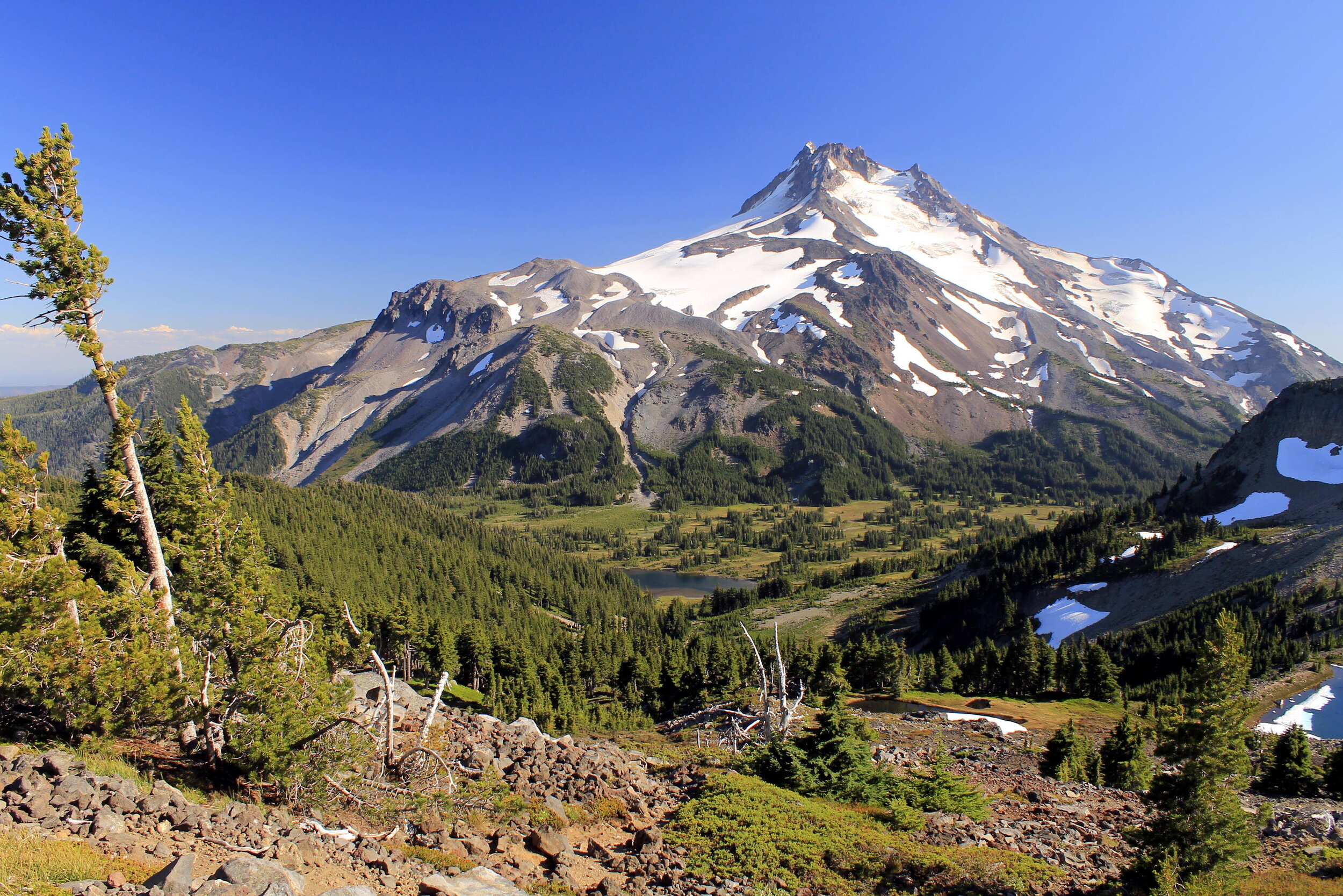
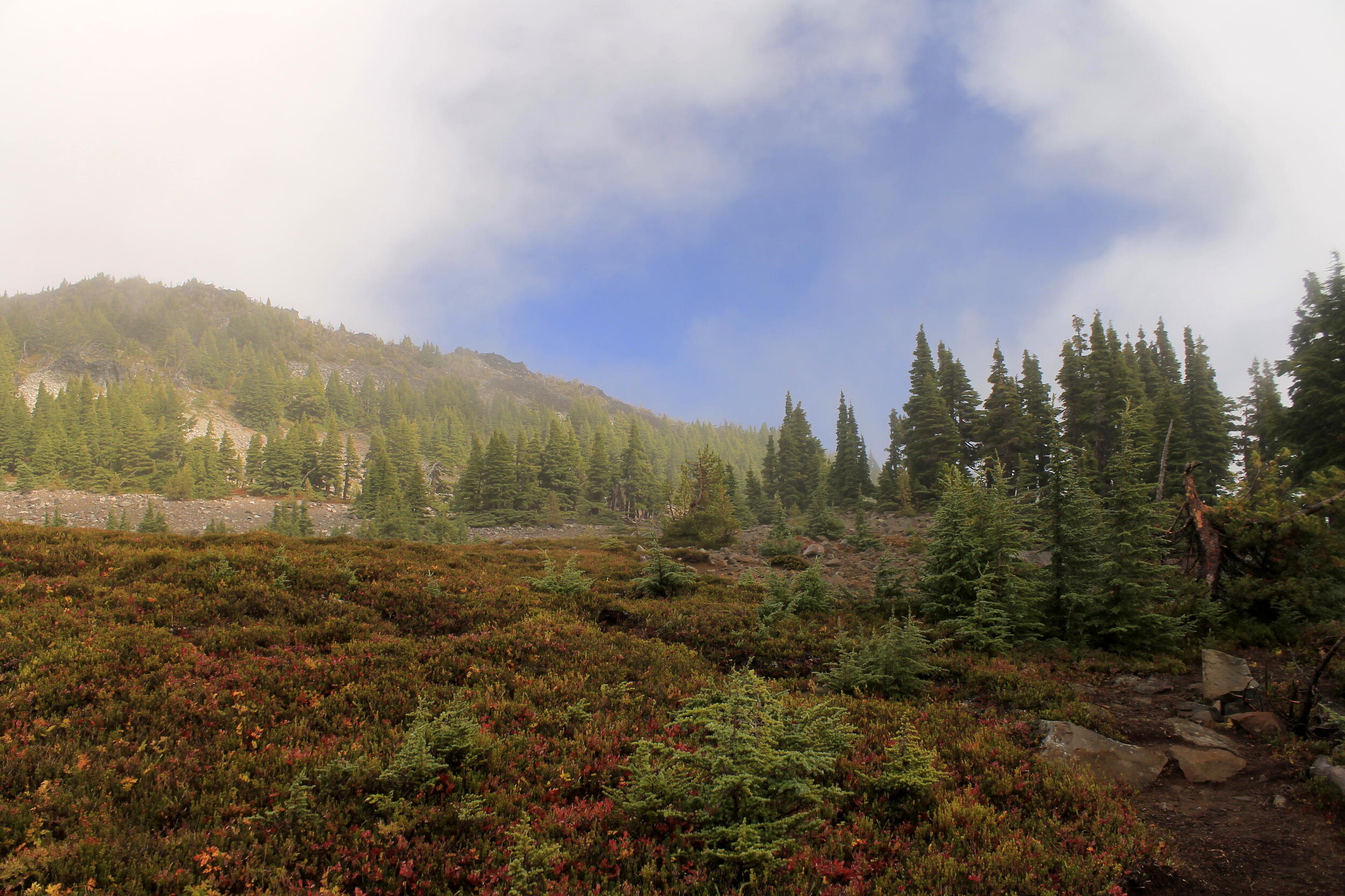
I published PDX Hiking 365 in 2018 and an updated edition of my first book Off the Beaten Trail in 2019, and then I took the rest of 2019 off. When the pandemic began here in Oregon in March 2020 I was beginning work on a new guidebook, which at the time I was calling The Oregon 100. I decided to put this project on hold during the height of the pandemic but by late summer 2020, I was itching to get back to this project. I made a trip to Central Oregon at the end of August 2020 to kickstart the project. Here’s a photo from my hike along Tam McArthur Rim to No Name Lake:

Broken Top in the Three Sisters Wilderness, Oregon.

Over the course of the winter months of 2020 into 2021, the project began to take shape. I decided that the Oregon 100 sounded too much like a list of influential people, and I decided to rename this project Extraordinary Oregon! When spring rolled around and I had a week off from my day job, work began on this project in earnest. More than just a book project, this was an excuse to visit places I had always dreamed about. During this trip in March 2021 I was finally able to visit Crack In The Ground:

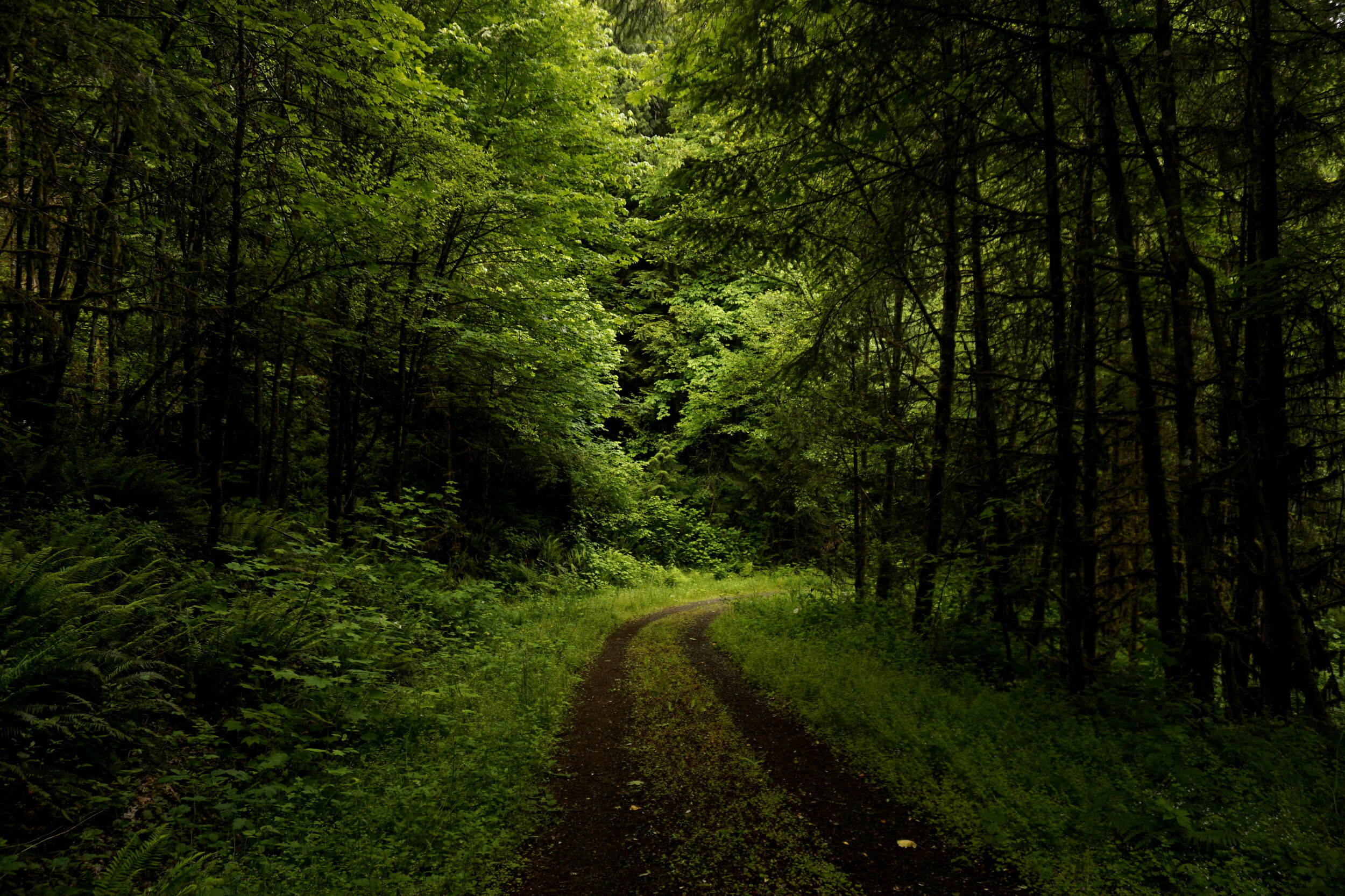
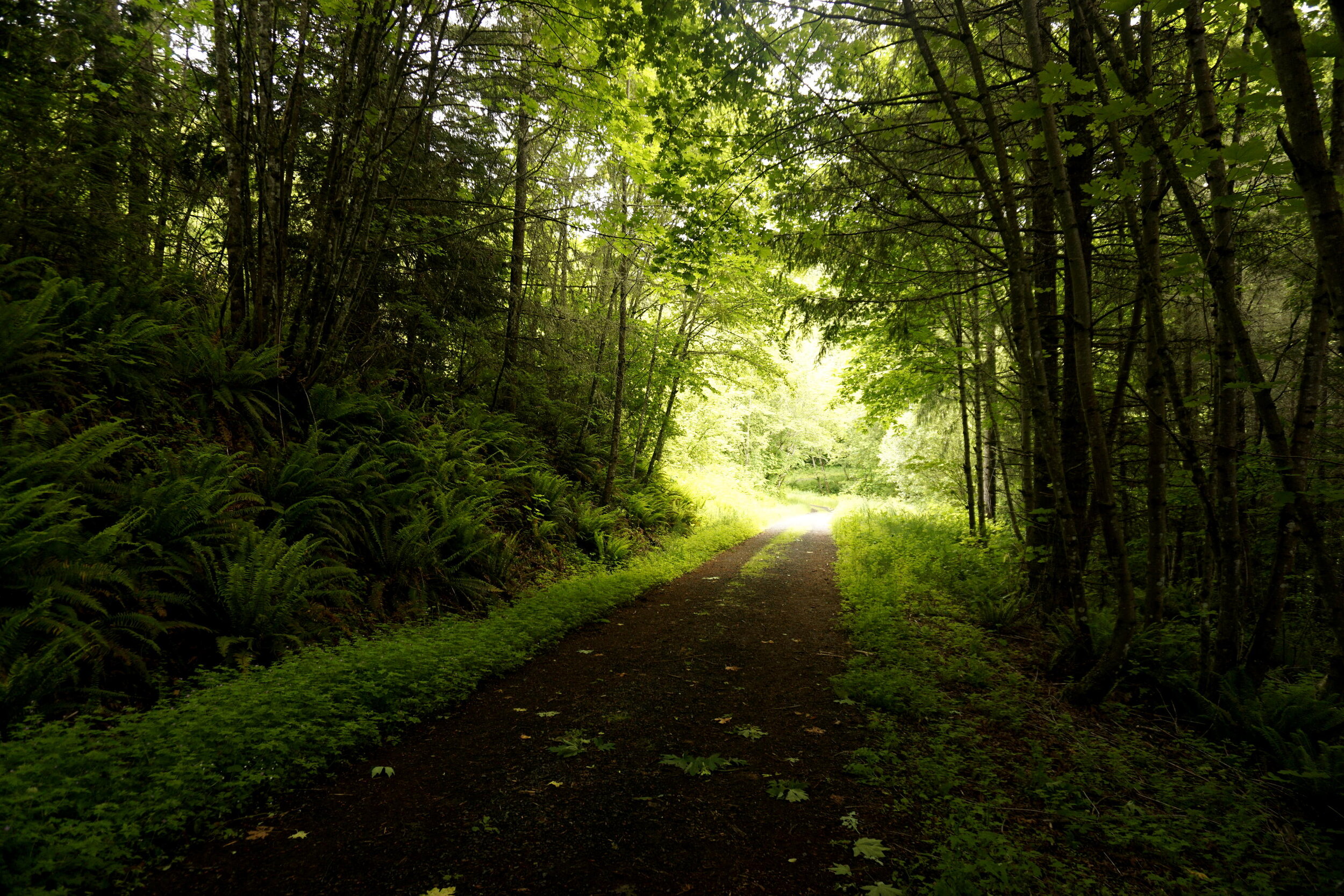
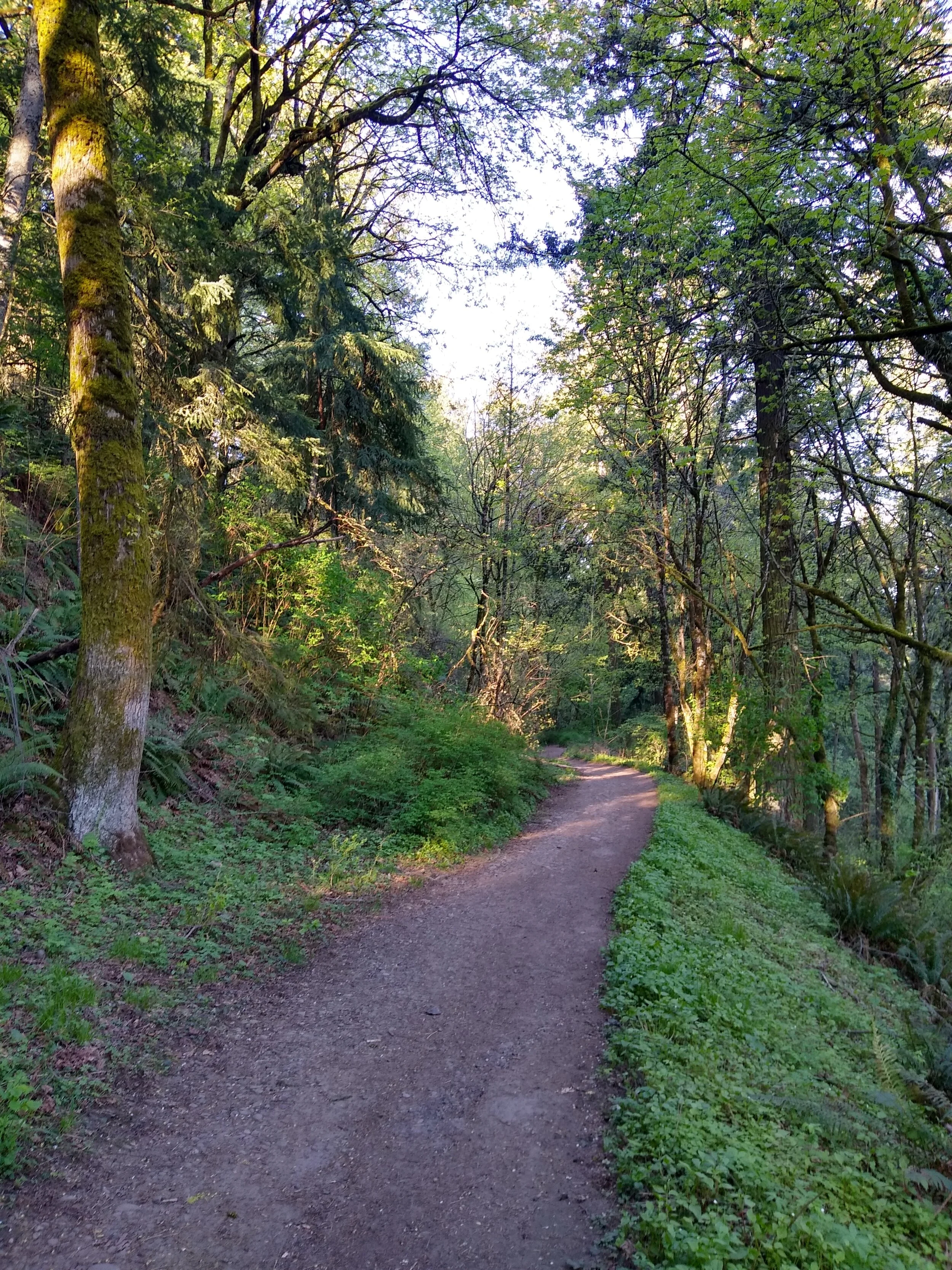
Not long after this I was also finally able to visit Kentucky Falls, deep in the Oregon Coast Range. Finding this place tested my nerves and my route finding ability, but it was even more spectacular than I had ever dreamed it would be:

North Fork Falls and Kentucky Falls in the Siuslaw National Forest, Oregon.

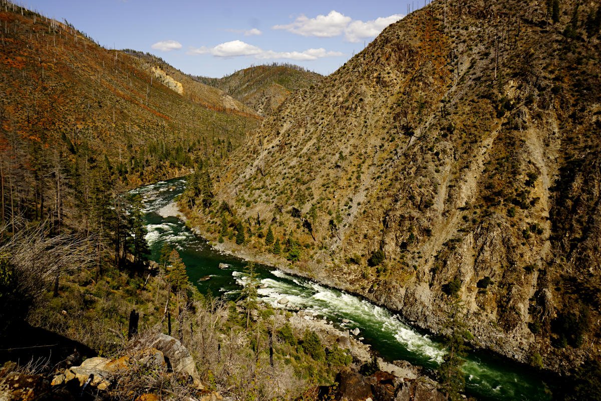
From this point I worked on Extraordinary Oregon! for the last 2 years almost without stopping. When I wasn’t out hiking and researching, I was writing, editing photos, making maps, and researching the history of every hike in this book. I visited many extraordinary places, some of which I had wanted to visit since I first began hiking as a child growing up in Salem. One place that meant a lot to me in particular was the Illinois River in southern Oregon, a river that shares a name with the river near which my family has lived in Illinois for more than 200 years. Here’s what Oregon’s Illinois River looks like:

The Illinois River flows through the Kalmiopsis Wilderness in southwest Oregon.

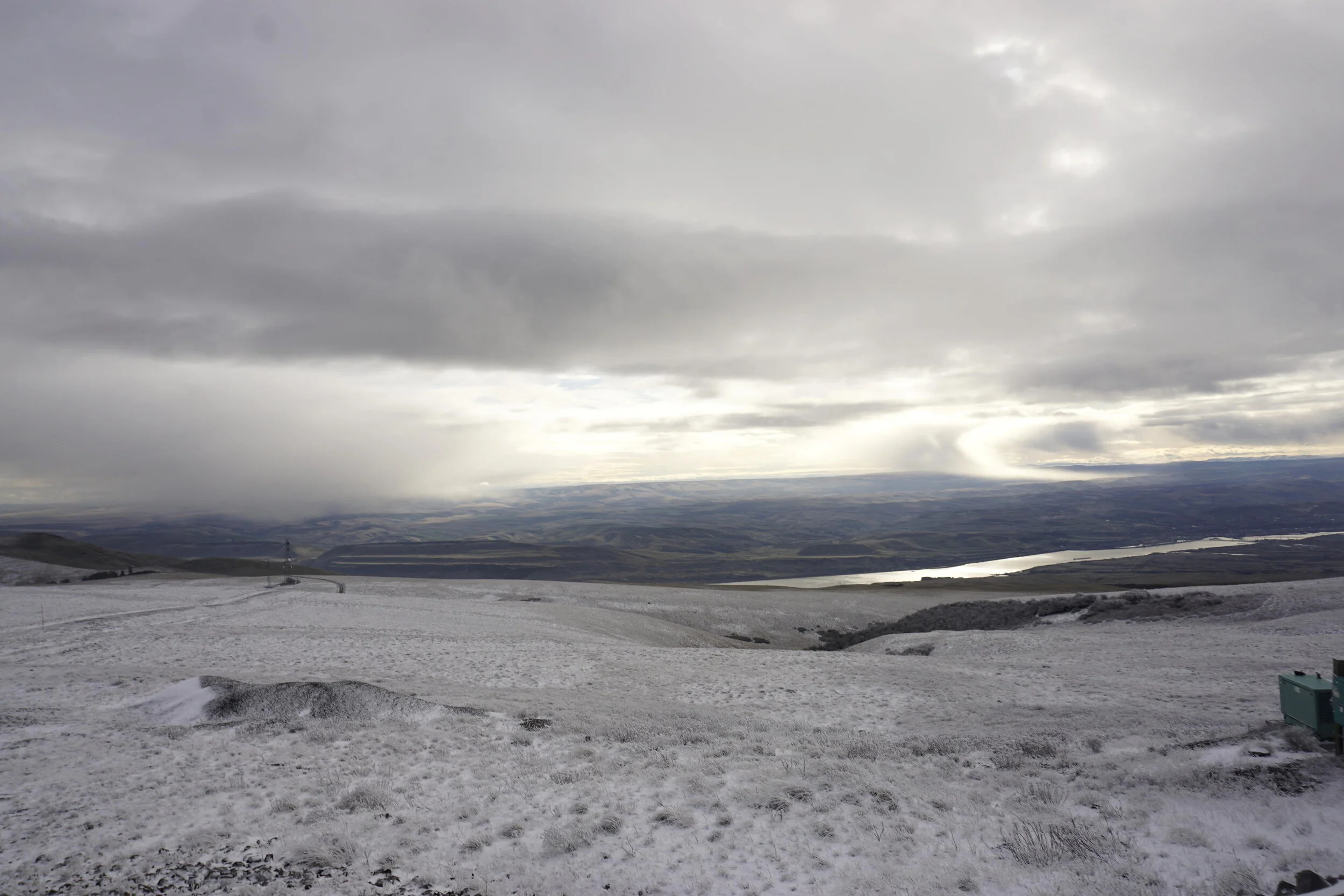
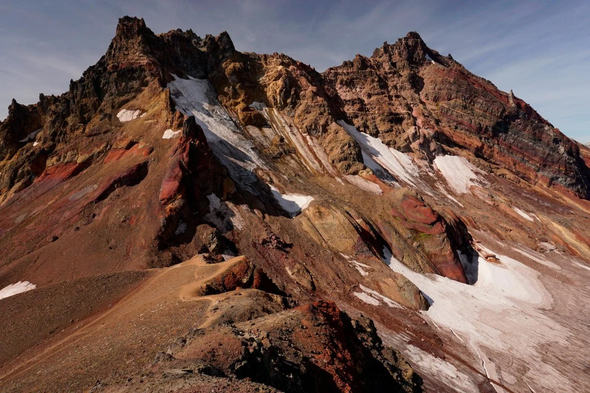
I was also finally able to visit the Owyhee Canyonlands at long last. While a lot of bad weather prevented me from exploring this area to the extent I had hoped, I was still able to visit the famed Leslie Gulch, which exceeded even my wildest expectations:

Over the course of the past three years since I began working on Extraordinary Oregon!, I hiked about 2,000 miles and drove nearly 15,000 miles in Oregon alone. Most of these trips were done solo, completely by myself. Over the past three years, I’ve had a lot of time to think about the meaning of this project as I drove all over every corner of Oregon again and again and again.

This book is dedicated to my favorite place, the place I call home: Extraordinary Oregon. I am please to share this project with you. I can’t wait for all of you out there to experience this extraordinary place as I did.

Thank you for reading, and thank you for your support.

Matt

Stacker Butte in Columbia Hills State Park - January 9, 2020 by Matt Reeder

Stacker Butte 073 web.JPG

Sometimes I just need to be alone. I am a social person by nature, but as I’ve gotten older I need more time to myself to recharge, to refresh, and to push myself. Maybe some of you will understand.

As 2020 began, I set ambitious goals for myself. The plan was to hike 750 miles, with 150,000 feet of elevation gain for the year. If that seems like a lot, I did about 600 miles in 2019 with about 120,000 feet of elevation gain. I figured with 2020, I needed to up my game at least 20%.

On the first Thursday I had free in January, I set out to hike the Crawford Oaks Loop in Columbia Hills State Park, on the Washington side of the Gorge. This is a hike that is featured in PDX Hiking 365, albeit in April for the height of wildflower season. This is what it looks like in April:

Dalles Mtn Ranch 113 web.JPG

It’s absolutely wonderful during wildflower season, albeit more crowded every single year. It’s hard to keep people away from such a beautiful place!

I’ve also hiked here in the winter before, and found it far less crowded. The blue skies and far-reaching vistas soothe my soul during the dead of winter, and that was what I was looking for on this day.

I left home early and drove through the Gorge in the dark. After 90 minutes on the road, I made it to the Columbia Hills Trailhead around 9AM. Starting my hike under full blue sky was just what I needed. Mount Hood was looking gorgeous in the morning light:

Stacker Butte 001 web.JPG

The trail up into Columbia Hills is an old road. Eventually the road becomes a trail, and soon the trail opens up into the wide-reaching vistas I so love about Columbia Hills. Speaking of hills, they looked inviting:

Stacker Butte 020 web.JPG

As I made my way uphill, I settled into a rhythm. I felt absolutely fantastic. The view of Mount Hood across the open prairie helped me along:

Stacker Butte 032 web.JPG

By the time I reached the ranch, I made the decision to continue all the way to the summit of Stacker Butte, the high point here. I knew it would probably be cold up there, but I felt fantastic and I wanted to keep pushing myself. I knew it would make for a longer day, but I really wanted it. I wanted it bad. So I kept going.

I’ve hiked the gravel road to the summit of Stacker Butte many times, but it had been a while. The last time, the time before this, was on an extremely cold day with my friend Anna. It was similarly clear that day.

As I hiked up the gravel road, the clouds began to move on. I looked up at the summit with some trepidation, knowing at the least that my views would be limited. The clouds moved in fast…or I moved into the clouds. When I reached the false summit, it began to snow. Welp.

Stacker Butte 053 web.JPG

The last half-mile to the summit was incredibly cold. I was prepared with my thick coat and gloves, but even so the cold wind forced me to hunker down, pull my collar up and face the cold, on my own. Of course, I had to ask myself: is it really worth it? Am I really hard-headed (read: stupid) enough to hike into a snowstorm just to bag a summit I’ve already bagged several times? Well, I had come this far, and the summit was just a few minutes away. So up I went.

To wit: it was really, really, really cold. See, here’s the thing about Stacker Butte: even though it’s only 3,200 feet above sea level, it’s the highest point around for many miles (which of course is why the view on top is so fantastic). It is always windy up there, and in the winter it’s not uncommon to encounter 30-40mph winds up there (or more). The last time I hiked to the top of Stacker Butte in January 2015, the winds were so intense and the temperature so cold on top that Anna and I had to leave after just a couple minutes, as we both felt our hands going numb. On this day in January 2020, it wasn’t quite so bad. But it was still very, very cold. I topped out on the summit as snow swirled around me, and I stopped to take a few photos. This is looking out to the western summit:

Stacker Butte 058 web.JPG

I didn’t want to push my luck continuing that way. If I’ve learned one thing about solo hiking, it is this: do not push your luck. Take what the mountains give you, and show gratitude.

This is looking north, towards Mount Adams, which was hidden in the clouds:

Stacker Butte 065 web.JPG

The canyon below is Swale Canyon, which is a wonderful hike in its own right.

Here’s a photo of the FAA installation on the summit, a fitting monument to the coldest place in the Columbia River Gorge:

Stacker Butte 066 web.JPG

I had to take a summit selfie, too. I almost never do this, but I felt elated to be standing on the summit, alone and accomplished.

Stacker Butte 067 web.JPG

Last but not least, here’s a look back at the route of my hike…and at the sunshine and pleasant weather still prevalent at river level:

Stacker Butte 057 web.JPG

This, to me, is what makes Stacker Butte such an interesting and rewarding destination in the winter. The hike gives you the feeling of climbing a real mountain, while offering easy access and a convenient escape if the weather is too threatening. The other reward of climbing to the summit is the view, which was limited on this day. Here’s a photo from the summit north to Mount Adams, taken on that wickedly cold day in 2015:

Mount Adams as seen from the summit of Stacker Butte on January 2, 2015. It looks pleasant, eh? It wasn’t. I estimated the wind chill up there at somewhere around 10 degrees. It felt colder than that.

Mount Adams as seen from the summit of Stacker Butte on January 2, 2015. It looks pleasant, eh? It wasn’t. I estimated the wind chill up there at somewhere around 10 degrees. It felt colder than that.

After a few minutes of taking photos and snacking, it was time to turn around. As I descended, it began to warm up almost immediately. This is evident in a shot I took of the false summit from just below the true summit:

Stacker Butte 076 web.JPG

Look closely and you can see that the snow line is at the level of the false summit, and only on the slopes where the wind sweeps across the summit. If you look really closely, you can even see a few sunspots.

By the time I was back to the gate at the upper trailhead, I actually started to feel warm. Such a feeling seemed unthinkable not even an hour before.

When I reached the ranch on my way down, I decided to go ahead and hike the rest of the Crawford Oaks Loop. It would add almost 2 more miles of hiking to my day’s total, but given my goals for the year and given that I still felt good, it felt necessary. The sun came out again as I wandered the open slopes above the Columbia. I embraced the warmth of the sun, and the shimmering reflection on the river:

Stacker Butte 099 web.JPG

Sometime around 3PM, I stumbled into the trailhead, tired and happy. My hike ended up being around 15 miles, with about 3,200 feet of elevation gain: a fitting beginning to 2020. More than that, I felt accomplished and ready to take on an exciting year ahead!

It is ironic to type these words now, quarantined at home, knowing that this is how I felt at the beginning of the year. In the midst of a pandemic, my fitness goals feel far less important. Who knows what the rest of the year will bring! I am sure that I will return to summiting mountains and pushing myself beyond 15 miles at some point this year; it just won’t be as soon, or as regular, as I imagined at the start of the year. And that’s okay! It’s been an absolute pleasure to write about past adventures, as I have had so many that I’ve never shared with people. I plan to continue writing throughout this, and I hope you’ll keep reading. So as always, thanks for reading!

Here’s a map of the hike if you want to see my route:

Burlington and McCarthy Creeks - May 23, 2020 by Matt Reeder

Burlington Creek 040 web.JPG

We’ve been seeking out obscure hikes in the metro area over the past few months of being quarantined. This week marked ten weeks for me of being home, ten weeks of not leaving the metro area, ten weeks of extremely hard work at my day job. Most weekends I’ve been too tired to do much more than go hiking for a half-day and then go home and relax. Once a week I go for a nice bike ride along the Springwater Corridor, or in my neighborhood. Other than that, it’s been work, cooking, drinking wine and a lot of reading.

I wrote about some of our adventures in pandemic hiking in a recent blog post. We are fortunate to have so many beautiful parks close to home. But after weeks of exploring many of the same areas, we were both eager to go somewhere new.

I had seen reference to some Metro lands north of Forest Park in James D. Thayer’s 2008 hiking guidebook Portland Forest Hikes: 20 Close-In Wilderness Walks. These hikes tend to be short, and as far as we could get from the metro area while still being close to home. I figured we could cobble together a few short hikes and make at least a half-day of quiet hiking. It ended up being so, at least until I got a pretty intense headache, and we decided to go home and just have lunch.

We started out looking for a hike known as the Beaver Ponds Loop. Wendy and I did this hike sometime a very long time ago, and I remember being decent, but not super exciting. We arrived at the trailhead only to find a large group of cyclists getting ready for some adventure, and we decided to go somewhere else. So we drove back south on US 30 until we reached NW McNamee Road, which we followed until we reached the unofficial Burlington Creek Trailhead. Much to our surprise, there were a few cars parked already, and another that arrived about 30 seconds after us.

It felt good to get back out on the trail, even if that trail happened to be an abandoned logging road. Lupine grows profusely along the road in open areas:

Burlington Creek 012 web.JPG

The road passes through some lovely second-growth forest. Everything was incredibly green! Along with the abundant wildflowers, spring’s green forests is my favorite thing about spring. Most of the hike looked like this:

Through the dark, verdant forests north of Forest Park.

Through the dark, verdant forests north of Forest Park.

We didn’t come into this hike expecting to see much in the way of wildflowers, so we were pleasantly surprised to encounter a few favorites:

Burlington Creek 051 web.JPG
Burlington Creek 018 web.JPG
Burlington Creek 036 web.JPG

The road winds around through the green forest, offering occasional breaks out with views across the Willamette River to north Portland and Vancouver. I suppose there might even be views of the Cascades here, but the promised sunshine and blue skies never materialized. Mostly we just walked along through the forest, and it was lovely. Here’s one more photo:

Burlington Creek 057 web.JPG

This full loop ended up being only 3.3 miles round-trip, so not nearly as long as we would have liked. At some point we’ll have to get out for a longer hike, but that will be further away, and perhaps when I’m less exhausted. Here’s a map of our hike:

We were looking for another short hike so we drove south to Newberry Road, and then followed directions to another short hike in the Thayer Guide. As we drove up Newberry Road, we counted more than 25 cars parked along the side of the road at the northern end of the Wildwood Trail (a hike featured in PDX Hiking 365). As we drove by, a few more cars were attempting to park along the road. I think this was the moment we decided that we need to leave the city soon. It has become almost impossible to find a hike that’s quiet enough for our standards.
Anyway: we arrived at the McCarthy Creek Trailhead, which is located along Skyline Boulevard just after you turn off Newberry Road. This is what the trailhead looks like:

Burlington Creek 069 web.JPG

Don’t block the gate, obviously.

The hike passes along the edges of McCarthy Creek’s basin. This tract of land was acquired by Metro maybe ten years ago, and is labeled on some maps as part of Forest Park. The trail is a gravel road which loops through a forest, passing the occasional view north towards the Tualatin Mountains. While there were not any other cars at the trailhead, we did pass a runner and his dog, as well as a family on our hike; I would guess this is a place that people who live along Skyline Boulevard come to go for a walk. The forest was pretty mundane, but it was nice to be out just the same:

Burlington Creek 066 web.JPG

About halfway through the McCarthy Creek loop, my head began to ache. I’m not sure if it was fatigue, too much coffee, or if it was just a headache for no reason whatsoever. By the time we neared the trailhead at the end of our loop, it was as bad a headache as I’ve had in a long time. When we got back to the car I took a couple of aspirin and we started the drive home. Needless to say, I don’t think I need to hike the McCarthy Creek Loop again.

Now, don’t get me wrong: this was a nice little loop on a wide gravel road. I just wasn’t feeling it. The loop ended up being only 1.3 miles round-trip. There were a couple of junctions where it looked like you could extend the hike, but nothing here was interesting enough to make me want to go explore. Or it could have just been the headache.

Anyway, here’s a map of the hike:

It’s been ten weeks since we last left the metro area. We have enjoyed our time at home as best we can, and have made the most of it. Our garden looks amazing, we have finished almost all of our projects around the house, and we’ve been cooking some absolutely delicious food (follow me on Instagram if you want to see a lot of pictures of food and cats…and hikes, when I’m able to do them). But I think we’re ready to get out and do a little exploring.

In the meantime, I’ll continue writing about some of my favorite adventures here. And maybe, just maybe…something more will come from this writing. We shall see.

Jefferson Park and Park Ridge - September 24, 2019 by Matt Reeder

After mostly taking a few years off from the Mount Jefferson area after the publication of 101 Hikes in the Majestic Mount Jefferson Region in 2016, I decided to go back and begin exploring the area again in 2019. I will be writing about some of these experiences here.

Jefferson Park 117 web.JPG

I’ve been coming to Jefferson Park for a long, long time. At some point, I lost track of how many times I’ve been but it’s at least ten. My first visit was in 1993, via the Whitewater Trail. I was 12. Here are my notes from my hiking journal that I kept:

Jefferson Park - October 26, 1993

10 miles

1,800 feet elevation gain

Note: View of Mount Jefferson was awesome!

I added the emphasis there, because I know my 12 year-old self would have done that. Growing up in Salem, we could see Mount Jefferson from the kitchen window of our tiny little house in south Salem, and it didn’t take too long for my stepdad and I to go exploring the area.

We went back two years later, in 1995, to hike into Jefferson Park via the South Breitenbush Trail. Again, here are my notes:

South Breitenbush to Jefferson Park - October 1995

11 miles

2,400 feet elevation gain

Notes: Snow, snow, snow. Got lost near Mount Jefferson. Great views though.

This time we brought along our camera, so I can present to you a few photos from that day:

JeffersonHike-1095-01.jpg
JeffersonHike-1095-02.jpg
1995-10-XX Jefferson Park attempt 001.jpg

That last photo was taken after we lost the South Breitenbush Trail in the snow about 5 miles from the trailhead. I know the exact spot, and I’ve noted it every other time I’ve hiked the trail since then. Where the trail curves around Park Ridge before dropping into the park, we couldn’t find the trail anymore in the snow. So we just headed uphill, where we saw the view in the photo above. All things considered, I think I like the result here even better. The fall color, as you can see, was excellent as well.

So why did we keep going to Jefferson Park in the fall? Because I spent my summers in Illinois visiting my dad. So our hiking time was mostly concentrated in fall, with a little in winter and spring.

We went back again at the beginning of September 1996, and this time we finally succeeded in experiencing the glory of Jefferson Park in the summer. Again, we brought along our camera, so you can relive this experience vicariously through me:

1996-09-XX Jefferson Park 003.jpg
1996-09-XX Jefferson Park 004.jpg
1996-09-XX Jefferson Park 001.jpg

It shouldn’t surprise you to learn that Nirvana was then, and still is, my favorite band.

Did I write about this experience in my journal? Of course I did:

South Breitenbush River / Jefferson Park - September 1, 1996

15.2 miles

3,400 feet elevation gain

7 blisters (for Matt)

Notes: Very beautiful hike, and very, very long. Great views of Jefferson. No snow this time around, so we didn’t get lost. Nice wildflowers, clear streams, placid lakes, and tons of people. And to think that this is the least popular of the 4 routes to Jefferson Park. Oh well, it was still a great and long, steep hike. I enjoyed it thoroughly.

It is remarkable to me how much I sound like my current self, nearly 24 years later. This was the last time we were able to visit Jefferson Park before we moved back to Illinois the following year. I didn’t make it back again until a couple of years after I moved back out there. Of course I had to take Wendy here when we were dating, and of course we had to go via the South Breitenbush Trail. And of course I had to go back and backpack the South Breitenbush Trail in 2009. While my friends stayed in their tents as the mosquitoes almost literally ate them alive, I braved the bugs to photograph the single greatest sunset I’ve ever seen in the backcountry:

2009-08-01 Jefferson Park 004.jpg
2009-08-01 Jefferson Park 008.jpg
Jefferson Park at sunset, August 1, 2009. The pictures cannot possibly do it justice.

Jefferson Park at sunset, August 1, 2009. The pictures cannot possibly do it justice.

So you see, of course, why I ended up writing 101 Hikes in the Majestic Mount Jefferson Region.

Of course I’ve been to Jefferson Park many times, more than I can count. But I had not been there since the 2017 Whitewater Fire burned to the park’s door. In 2019, the Willamette National Forest announced that Jefferson Park, along with the rest of the Mount Jefferson Wilderness (and Three Sisters Wilderness) would be subject to a limited-entry permit system beginning in 2020 (note: implementation of this permit system has been delayed until 2021 due to the COVID-19 pandemic). I knew I had to get back to Jefferson Park before the permit system made it much harder to visit.

I decided to go for just a day, as my options last September were limited. The forecast for this particular Tuesday said morning clouds, followed by afternoon sunshine. It sounded like my kind of day. So off I went on my merry way to the Whitewater Trailhead.

Driving into the fire-scarred wilderness was shocking, but not surprising. Once I hit the trail, I had to take my customary photo of the wilderness sign:

Jefferson Park 001 web.JPG

Things were different indeed.

The Whitewater Trail has never been my favorite approach to Jefferson Park, both due to the crowds and due to the hot, dusty approach that can get kind of tedious on a long, summer day.

This day was not hot, or dusty. Actually, it was fucking cold. And wet. And almost inhospitable. Sometimes it seemed like the sun was right there above me, just waiting to come out and wash away the rain:

Jefferson Park 004 web.JPG

And sometimes it seemed like I was walking through the heaviest of clouds, clouds that wanted to torment me for even considering hiking to Jefferson Park on this day:

Jefferson Park 009 web.JPG

It was so nasty outside I didn’t even have time to really consider the fire damage. Most of my hike in was spent wondering whether the sun would ever come out, whether I was hiking in a cloudy maelstrom just out of the reach of the healing warmth of the sun, and hoping my rain gear was as good as I expected it to be. One thing about hiking through fire damage is that you often pass out of it completely in seemingly an instant. This has everything to do with the fire lines that fire crews make, but it’s still remarkable.

Once in the unburned forest, the sun continued to taunt me:

Jefferson Park 019 web.JPG

Of course it wouldn’t be that easy. It never is.

As I hiked into Jefferson Park, the clouds returned with a vengeance, bringing with them a cold, biting wind that really made me start questioning my choices - or even my entire lifestyle. Mount Jefferson was nowhere to be seen:

Jefferson Park 023 web.JPG

Here at nearly 6,000 feet above sea level, I debated whether to turn tail and make my way as quickly out of the park as I arrived. But I felt good. In fact, I felt GOOD. That isn’t to say that I was all that happy to be hiking in such repellent weather; it was more that I felt better physically than I had in quite some time. So in spite of the weather, I made a rash decision: I was going to continue hiking into the rain, into the clouds, up to Park Ridge.

I had glorious visions of arriving at the ridgetop, above the clouds, to the absolutely magical view of Mount Jefferson found up there:

Mount Jefferson from the summit of Park Ridge, August 2016.

Mount Jefferson from the summit of Park Ridge, August 2016.

So I kept going. I hiked the Pacific Crest Trail past Russell Lake and began the climb up Park Ridge, my head full of hopes and dreams. The bad weather continued. At least I had the fall color to keep me company:

Jefferson Park 034 web.JPG

The further I got up the ridge, the more the sun taunted me. I could see it up there, peeking through the clouds, waiting to give me everything I longed for. At one point the clouds even parted above the summit of Park Ridge, revealing a large slice of blue sky above:

Jefferson Park 045 web.JPG

My friend Gene calls this phenomenon a “sucker hole” - as in, you’d have to be a sucker to believe it’s getting any better.

Just a few minutes later, I picked my way up the rocky trail and stumbled onto the summit of Park Ridge. Gene was right:

Jefferson Park 048 web.JPG

Contrast the picture above the one I posted from August 2016. I’ve been to Park Ridge many times, and it’s only been clear maybe 2-3 times. The other times I’ve been stuck in the clouds, including just two weeks prior on a long hike up from the Breitenbush Lake side of the PCT (that’s right - I went on very long hikes that culminated in arriving at the summit of Park Ridge, only to find it clouded in, twice in one month). Ugh.

I sat there on the summit of Park Ridge at nearly 7,000 feet above sea level and ate my lunch like a kid in detention who realizes he really screwed up. Now, let me be clear: I was enjoying myself, in spite of everything I’ve written so far. But there’s only so many times a person can hike to the summit of Park Ridge in the clouds before you start to wonder if you should just never try going here in any weather other than the reliably clear days of mid-summer.

At this point I was over 8 miles from the Whitewater Trailhead and it was maybe 1PM, maybe later. It was time to go home, and hope that both the sun and mountain would come out before I left the area. I am, in my heart, a hopeful person. So I started back down the trail, and almost immediately hiked back into the blue sky “sucker hole” referenced above. Not long after, I was able to faintly make out the summit pinnacle of Mount Jefferson for approximately 7 seconds. I considered that a major victory. No, the photo didn’t turn out.

As I continued downhill, the sun began to come out for real, piercing through the clouds with an unexpected brilliance. The skies began to clear above me:

Jefferson Park 067 web.JPG

Given how miserable the weather had been earlier in the day, I already considered this a huge victory.

The two miles of the Pacific Crest Trail from Park Ridge to Russell Lake are, in my opinion, the most beautiful two miles of trail in Oregon. As I neared Russell Lake, my spirits were already buoyed by the sun. I stopped at a spot along the trail about a half-mile above Russell Lake to bask in the sun, should I not have another opportunity that day. It was here that it happened. The clouds began to part over Mount Jefferson.

The next fifteen minutes were maybe the happiest fifteen minutes I had in 2019:

Jefferson Park 076 web.JPG
Jefferson Park 085 web.JPG
Jefferson Park 096 web.JPG
Jefferson Park 104 web.JPG

Sometimes the mountain will show herself after you’ve proven you’re willing to be patient with her. This was one of those times.

I could barely feel my feet on the trail for the next mile or so. The clouds danced around the summit of Mount Jefferson, sometimes obscuring it anew. It almost felt like the mountain was playing hide and seek with me, daring me to pull out my camera again, only to disappear into the clouds for a few minutes.

Mount Jefferson finally showed herself for good as I neared the junction with the trails to Scout and Bays Lakes:

Jefferson Park 117 web.JPG

It was here that I left the park, heading out on the Whitewater Trail back into the fire zone, back to real life.

On my way out, I stopped at the classic viewpoint of the mountain about 2 miles before Jefferson Park. Here I looked back, and found her still dancing in the clouds, looking completely glorious, beckoning me to return soon:

Jefferson Park 136 web.JPG
Jefferson Park 154 web.JPG

Mount Jefferson from the Whitewater Trail, September 2019. You can see how close the Whitewater Fire came to entering Jefferson Park here. If you look really closely in this photo, you can see two waterfalls, with a third just out of sight in Russell Creek’s dark, foreboding canyon.

It was a glorious end to a glorious hike.

The next few miles went pretty fast, until they didn’t and I started getting tired. By the time I reached my car, I was ravenously hungry - so hungry in fact, that I stopped at Subway in Mill City to devour a 12-inch sandwich. I was still hungry after that.

As for Mount Jefferson, I’m not hungry anymore. The mountain has shown me almost all she can show, and still I’ve gone back for more. There isn’t another place in the world where I feel more at home, and yet I only visit her a few times a year in most years. I cannot ask the mountain to give me any more - she has already given me so, so much. For that, I am eternally grateful.

Majestic Mount Jefferson, indeed.

Thanks for reading.

Pandemic Hiking: March - May 2020 by Matt Reeder

Hidden Falls is tucked away in a small canyon just outside a subdivision in Happy Valley.

Hidden Falls is tucked away in a small canyon just outside a subdivision in Happy Valley.

It hasn’t been easy.

I cherish ritual, and I need open spaces to feel at peace with the world. For me, hiking is something akin to meditation. I am not a religious person - I am in fact, an atheist - but being out in nature is as close as I get to going to church, to meditation.

When the full scope of COVID-19 became apparent, I knew we wouldn’t be able to hike as much, or as far away as expected. Let me be clear in saying also that I supported, and support all of these closures. I know that many of you will disagree with me, but I believe that we need to all do what we can to stop a disease that is ravaging communities across the globe. Let me also state that this is as serious a situation as any of us have faced in our lifetimes; I understand why so many people need to seek out nature to find some peace. This is our Great Depression and World War 2 moment…it is almost impossible to truly grasp.

With that in mind, we’ve been able to get out and hike sporadically, but always local. Sometimes it has worked, and sometimes it hasn’t. Sometimes it’s been great, and sometimes it hasn’t, and sometimes we haven’t even been able to leave the house. For me personally, my workload has effectively doubled, and I reach the end of every week in a fugue state of complete exhaustion. Even for me, hiking has not always been the refuge I expected it would be when this started. But we have gotten out here and there, and I’m going to write about a few of these experiences below.

March 26 - North Oxbow

North Oxbow 021 web.JPG

It took me awhile to find this hike, but when I finally did in January I was immediately smitten. This is a wilder side of Oxbow, away from the boat ramps and group shelters. We decided that this was as far away as we felt we could go while still abiding by the state’s Stay at Home order. As it turned out, we only saw a few other people. The trail is wide enough for the most part that you can keep a reasonable distance from people.

Now, the negative: The narrow gravel road into the trailhead does not allow much room to pass cars going in the opposite direction, and there are several houses along the road. Please be VERY considerate of the folks who live on this road when you visit. Moreover, there is only room at the trailhead for 8 cars at most, so if you’re going to hike this trail, choose a time early in the day or on a weekday to avoid overwhelming this secluded corner of Oxbow.

Here are some photos from the hike:

North Oxbow 005 web.JPG
North Oxbow 010 web.JPG
North Oxbow 019 web.JPG
North Oxbow 025 web.JPG

The hike ended up being about 3.2 miles round-trip. The trail reaches a crossing of a side channel of the Sandy River at 1.6 miles that is flooded over in winter and spring; I’m sure you could go further now. This is a lovely area, if you can find it. There’s no access to the popular parts of Oxbow across the river, so it’s just you and the few other folks who know about this neat little corner of the park.

April 3 - Hidden Falls Nature Park

Hidden Falls 007 web.JPG

See the photo above? See how gorgeous Hidden Falls is? This was a consolation prize if there ever was.

We had grand ideas of connecting two parks in Happy Valley into a full day of hiking. One of these was the brand-new Hidden Falls Nature Park; the other I have already forgotten, because we never made it there. By this point I was already pretty worn out from two weeks of remote work, and I was looking for something pretty easy.

There isn’t really a trailhead for Hidden Falls, just a few spots to park along a quiet suburban street. Once we found a parking spot, we realized that it was cold. Very cold. As in, 37 degrees cold - and it was starting to rain.

It doesn’t take very long to reach the falls. The wide trail drops down into a secluded and verdant canyon, where you soon reach a huge wooden bridge over the creek:

Hidden Falls 001 web.JPG

This is one of the nicest bridges I’ve ever seen on a hike. Happy Valley put a lot of time and work into this park, and it shows. The falls is just upstream of the bridge, and the best place to photograph it is from the bridge:

Hidden Falls

Hidden Falls

The trail winds uphill, very quickly reaching a second trailhead. There is a parking lot here, but it was closed off and gated. There was a lot of lupine along the trail, looking beautiful with water beading on the many leaves:

Hidden Falls 012 web.JPG

The Hidden Falls hike, if you can call it that, was about 1 mile round-trip. We got back in the car and drove through Happy Valley to another park, which we found closed. As in, completely closed, and gated. Unsure of what to do, and lamenting the bad weather, we decided to just drive home and work in our garden. It turned out to be a good day, but not a very satisfying day of hiking.

April 17 - Powell Butte

IMG_20200417_075850369_HDR.jpg

We live so close to Powell Butte that it takes less time for us to drive there than it did to write this paragraph. This means that we often take it for granted. I come here on the rare occasion it snows to get outside in the snow without needing to get in my car. This proximity also means that there isn’t anything to see at Powell Butte that I haven’t seen many times before. For this hike I decided to leave my camera at home, something I almost never willingly do. I still took some photos, and Powell Butte is still quite beautiful, but this was very much an urban hiking experience. It was also the longest hike we’ve done over the past two months.

We started at the Old Holgate Trailhead, the closest to our house. This is a nice, wide, gradual trail that allowed us to ease into our hike.

IMG_20200417_075847268_HDR.jpg

Once we reached the summit meadows, we hiked around the edge of the meadow, eventually reaching the summit. The view east to Mount Hood was too bright to photograph but I was elated to see my old friend Majestic Mount Jefferson:

See if you can spot Mount Jefferson in this photo. It’s out there somewhere!

See if you can spot Mount Jefferson in this photo. It’s out there somewhere!

We then hiked down into the woods, where we began to encounter more hikers. Wendy and I are both early risers and by this point, it was after 9AM. But the forest was peaceful, and past the junction with the junction with the Springwater Trail, we didn’t see too many people.

IMG_20200417_084652070_HDR.jpg

There were lots of trillium around:

IMG_20200417_095209840_HDR.jpg

The trails on the west side of Powell Butte eventually meet those at the western edge of the summit meadows. By this point we began to see lots of people, but it was still nice to get a few moments in the sun:

IMG_20200417_093325065_HDR.jpg

From there, it was back down into the woods and back to our car. We made it back to the trailhead by 10AM, a record for doing a full (5.6 miles) hike. Here’s a map of our excursion:

Powell Butte 2020-04-17 Map.jpg

April 24: Canemah Bluff

The following Friday, we made plans to hike the Canemah Bluff loop in Oregon City to see the peak camas bloom. This is one of the best spots in the Portland Metro area to see wildflowers, and with Camassia across the river closed, this was all we would be able to do. We figured we would go very early and do the loop through Canemah, then go hike at Mount Talbert afterwards.

I woke up that Friday morning more exhausted than I had been in a very, very long time. I was so exhausted that the day quickly took on the quality of a vivid dream. At times I wasn’t sure if I was awake and hiking or still asleep. The camas bloom was really nice:

Canemah Bluff 025 web.JPG
Canemah Bluff 027 web.JPG

As you can see, it was a little rainy and gray, as it seemed to be on a lot of our hiking days. The trail passes a nice view down to what was a very placid Willamette River:

Canemah Bluff 009 web.JPG

Even the slight amount of elevation gain felt like a lot, given how tired I was. But the woods here were very peaceful, and we didn’t see almost anybody. But we did see a snail!

Canemah Bluff 031 web.JPG
Canemah Bluff 037 web.JPG

It started raining a bit towards the end of our hike, but it only added to the gloom and dark beauty of the morning:

Canemah Bluff 045 web.JPG

We look forward to wildflower season every spring, and this hike fit the bill even though it was short. Sometimes you don’t need a long hike for it to be satisfying. We saw our first wild irises of the year as we neared the trailhead at the end of our loop:

Canemah Bluff 049 web.JPG

When we reached the car, we had only hiked 1.7 miles, but I was done. I’m still in pretty good hiking shape, but I was so exhausted going into that day that I didn’t have any more hiking left in me. Sometimes the physical challenge just isn’t enough for me. Lately I’ve found myself needing rest more than anything.

Saturday, May 9: Powell Butte (again)

The last hike we did before the shutdown was Swale Canyon, on the Washington side of the Gorge. Over the course of the day we realized that it wasn’t really possible to socially distance in a lot of places, and that we would have to stay close to home and hunker down for the time being. The Swale Canyon hike was wonderful, and it was everything we needed that day. It was 11.8 miles round-trip.

Since that day (and until this morning), we’ve hiked 11.8 miles total.

Now, it’s not like I’ve been stuck at home all of this time. We’ve been going through walks in our neighborhood, even though it’s not the easiest place to walk. There aren’t many through streets, and most of the streets don’t have sidewalks. But it’s been nice to see more of our neighborhood than we ever have before.

I’ve also been going on bike rides along the Springwater Corridor, and on neighborhood streets. This was how I discovered that there’s a wetland close to my house. I’ve been going there a couple of times a week to listen to the birds in the morning, and it is bringing me joy. So I recorded them so others could share in my joy:

So in that vein, this morning we decided that we would hike up to the summit of Powell Butte from our house. It’s an absolute pleasure to forego the long drives to some of my favorite trailheads and start our hike directly from our house. Within a few minutes we were on the Springwater Corridor, where views of Mount Hood opened up ahead of us:

Powell Butte from home 003 web.JPG

I swear, I swear, Mount Hood is out there. It isn’t really possible to get a good photo of Mount Hood from the west in the morning, looking straight into the sun.

We walked along the Springwater until we reached the Powell Butte entrance on the backside of the park. Here we finally entered the woods to the sound of more birdsong. The woods were peaceful, as always:

Powell Butte from home 007 web.JPG

The woods felt dark and cool, and like a sanctuary. It was here we started to see more runners and hikers as well. It felt good to get a little uphill in, seeing as how we’ve gotten almost no elevation gain since the pandemic started. Before long though, we were in the summit meadows of Powell Butte. Usually by this time of year we’re off exploring the Gorge and the eastern side of Mount Hood, and neither of us had ever been to Powell Butte in May. The flower show in the summit meadows was really nice!

Powell Butte from home 013 web.JPG
Powell Butte from home 026 web.JPG

In addition to lots of camas and lupine, there were also lots of columbine and iris, but they were both far enough off the trail that we couldn’t photograph them without trampling on other vegetation. As we hiked around the summit meadows we passed a number of hikers and runners but it never felt all that crowded. Of course, by this point it was still only 8:30 in the morning, so I’m guessing it’s a lot more crowded later in the day. Mount Saint Helens was looking spectacular in the morning light!

Powell Butte from home 046 web.JPG

From there, it was back down to Old Holgate and out of the park:

Powell Butte from home 048 web.JPG

After navigating the mean streets of outer southeast Portland, we arrived home at 9:30AM, shattering my previous record of the earliest time I’ve ever gotten home from a hike…set the last time we went to Powell Butte. In the time that we had been out hiking, our irises decided to open up. How cool!

Powell Butte from home 054 web.JPG

Between the Springwater Corridor, Powell Butte and city streets we cobbled together a 6.4 mile hike, right from our doorstep. I made a map just to keep up the habit…look closely and you can figure out where I live!

Powell Butte from home Map 5-09-2020.jpg

I got to say it was a good day.

So with all that in mind, I do have some parting thoughts:

After two months of being effectively quarantined, I feel the call to get outside and explore the mountains and prairies and coastline that I so dearly love. I see so many of you out there, and my heart longs to join you and go back to doing the thing I love the most.

But I’m not going to, not until it’s safe for everyone. I’ve listened to and followed everything being said back and forth right now across the world about the subject of reopening the world, about returning back to normal. These discussions are lacking a crucial component: this IS normal now. This is the most severe public health crisis any of us have faced in our lifetimes. Consider this: 80,000 Americans, citizens like you and I, have died due to COVID-19 over the past two months or so. That’s just the confirmed death count; the real number is likely upwards of 100,000 Americans, and possibly as high as 120,000 Americans.

And this is after two months of aggressive lockdowns and social distancing. At the beginning of this pandemic, public health authorities told us we would be able to know if the lockdowns worked if it seemed like nothing happened. For many of you out there, nothing did happen. And still - we’ve lost something like 100,000 Americans to a disease that we’d never heard of even six months ago. The most dangerous thing to do now is to act like this is over, to act like we can go back to the way things were. We won’t be able to, not until we have a vaccine. We have no idea when that will be.

So does this mean that you shouldn’t go hiking? Of course not. You should still feel free to hike, so long as you’re not traveling too far from home (how far is too far is your decision), so long as you’re prepared to wear masks and clean up after yourself as much as is necessary, and provided that you understand that this is a different world now. Make sure you get gas before you leave town, avoid any stops unless they are absolutely necessary, and try to avoid popular hiking areas. And more than anything else, you should be hiking only with people from your household - so your partner, your roommates, or your family. Or you can just hike by yourself, which is immensely rewarding in its own right.

I have been pleased to rediscover how much I love urban hiking. While I’ve spent much of the past dozen years or so exploring the wonders of the Pacific Northwest, there have been many times in my life where I was not able to travel very far from home. During these times I took the time to explore the areas close to home, and no matter where I lived, I always found somewhere peaceful to explore. Even when I lived in central Illinois I found peaceful spots in the midst of an ocean of cornfields:

Rural Knox County, 8-05-2004.jpg

It’s up to all of us now to do our best to maintain the health and safety of our fellow citizens. That’s all that matters now.

Thanks for reading.