Indian Ridge Lookout - October 3 - 5, 2019 by Matt Reeder

Indian Ridge 007 web.JPG

Staying in a lookout tower is one of the finest experiences you can have in the mountains. To wake up in a small cabin on a mountaintop, with the mountains spread out before you…there’s nothing finer. Of course, many folks feel this way, and reserving a lookout tower can be incredibly difficult. I was lucky to snag Indian Ridge for a Thursday and Friday nights the first weekend in October, and so a plan was assembled to meet up with friends to spend the weekend in the lookout.

Now take a look at the photo above. That looks pretty cool, right? To be alone with good friends on a mountaintop in the snow…it’s the stuff that dreams are made of.

Indian Ridge has no heat.

With that in mind, we knew we’d need to prepare for cold weather. The forecast said rain, so we came prepared for cold nights and what promised to be a memorable weekend in the mountains.

Wendy and I drove up on Thursday evening (her weekend is Friday and Saturday, so I have adopted this as my weekend too). Not long after we arrived, our friends made it there, and we were able to share some hot tea and dinner. It was sleeting and utterly nasty outside, so we all retired to the somewhat-friendly confines of the lookout.

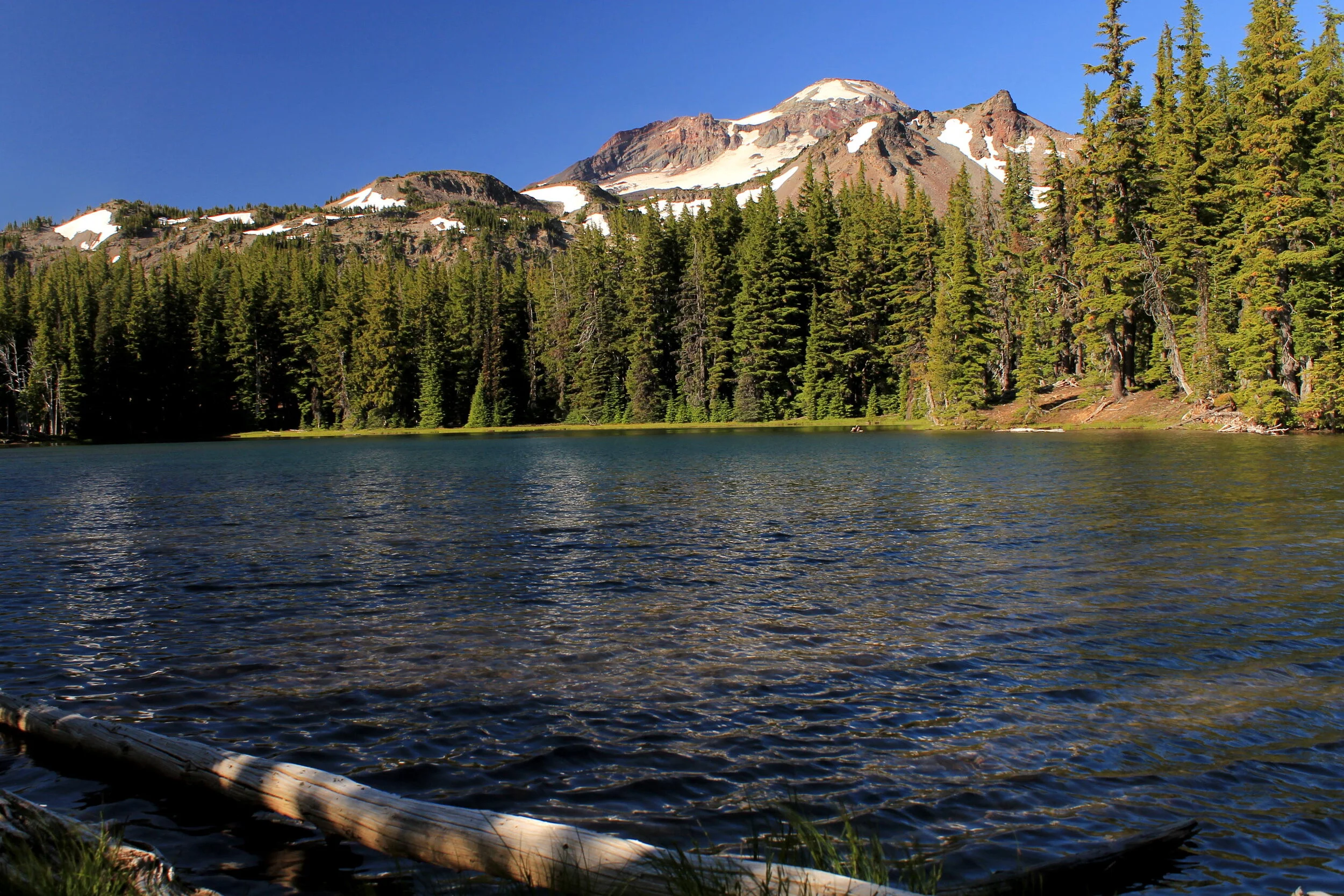
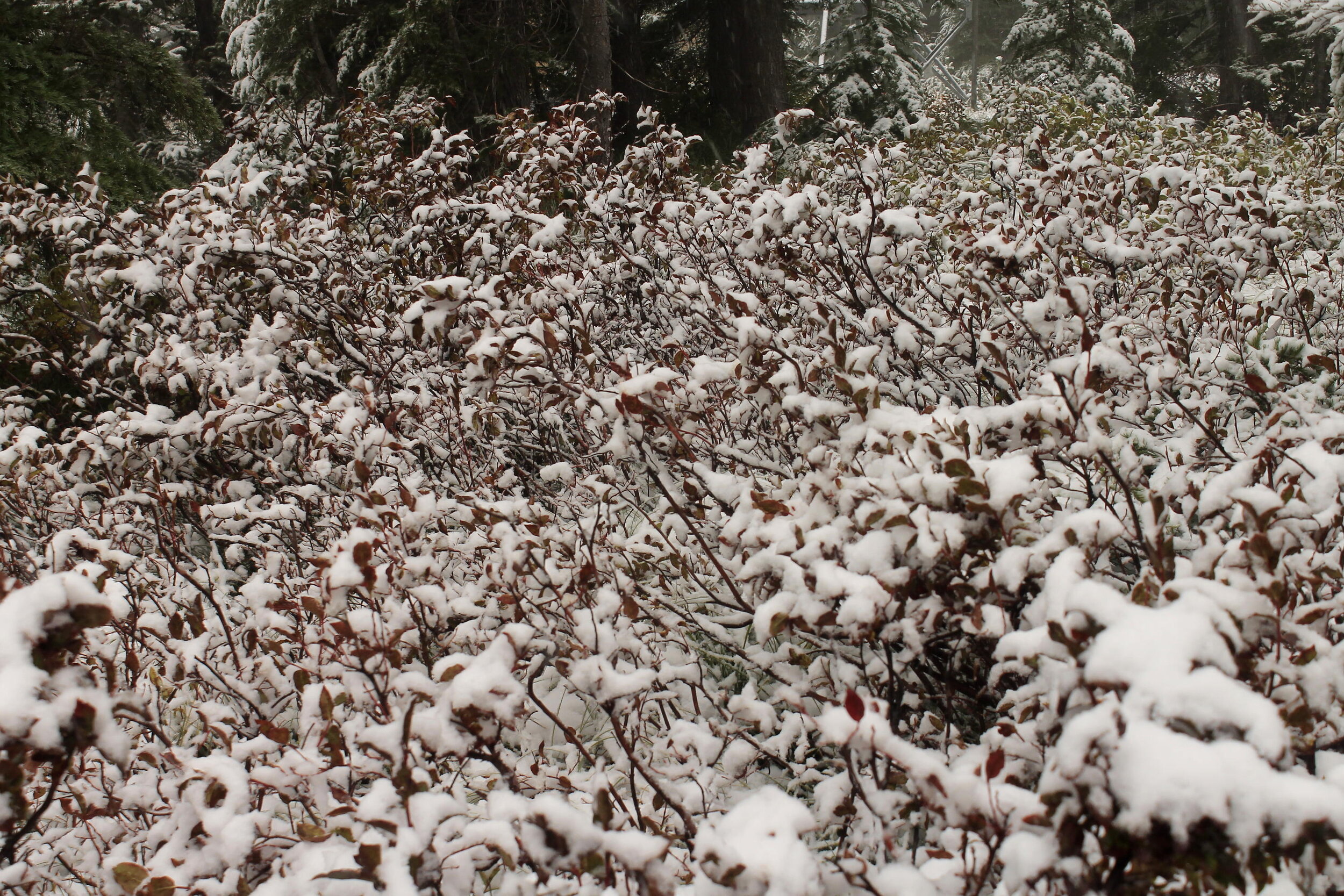
When we woke the next morning, this is what we saw:

Indian Ridge 004 web.JPG

I can’t say we didn’t expect foul weather, considering it was sleeting when we went to bed the night before. We bundled up and went outside to go explore the snowy beauty:

Indian Ridge 008 web.JPG
Indian Ridge 016 web.JPG
Indian Ridge 020 web.JPG

It was so gorgeous outside! Wendy and I aren’t really snow people. We don’t snowshoe very often, we don’t ski and we rarely go anywhere in the snow in general. I think both of us prefer the dry, open spaces of the desert in winter to the snowy mountains. But I do love them once I am there, in the snow. Perhaps I should try harder.

After some time curled up in our sleeping bags back in the lookout waiting for it to warm up, we decided to drive down to the valley below to go hiking. This was always the original plan for the weekend, to stay high and hike low. Cold weather has a way of sapping your motivation though, and we figured we should go explore before we ended up stuck inside the lookout all day.

The nearest hike to the lookout is the French Pete Creek Trail. This is one of the classic hikes of the western slopes of the Three Sisters Wilderness. I first hiked French Pete Creek in March 1992…an eternity ago. This was long before the fires, and long before all the bridges had disappeared from the hike. It was one of the most interesting hikes I had ever done up to that point. The second crossing of French Pete Creek was waist-deep, but we made it to the 5-mile marker. What an adventure! This is what I had to say in my hiking journal:

French Pete Creek 3/22/1992

10.4 miles

1,000 feet elevation gain

Note: Wading that rocky creek is very, very cold!

Yes, I kept a hiking journal. You shouldn’t be surprised.

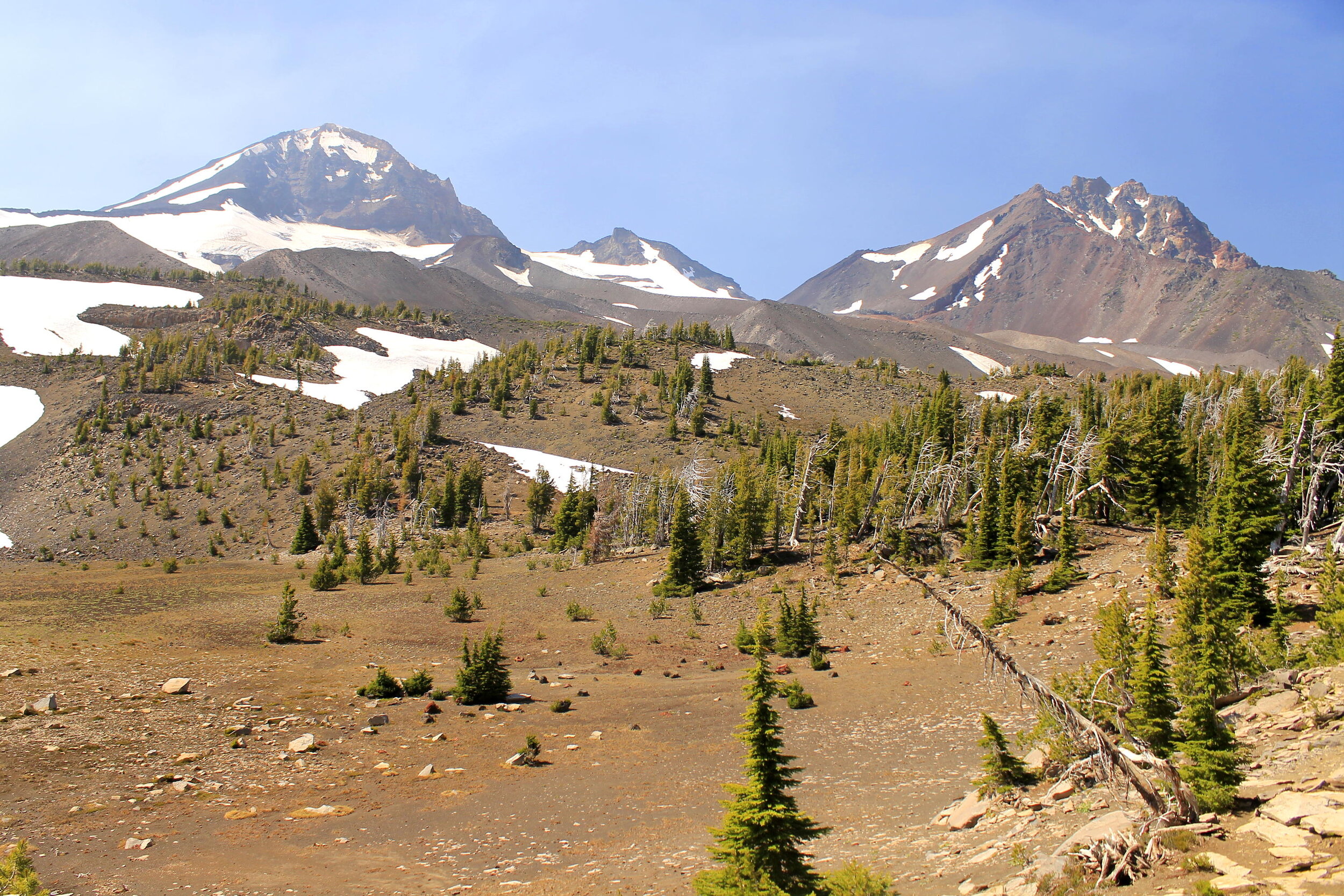
Anyway, it warmed up as we drove back into the valley, and the weather looked pleasant for hiking. We decided to hike only to the first creek crossing before turning around to explore more of the valley. It felt good to be back in the Three Sisters Wilderness again:

Indian Ridge 024 web.JPG

As it was meant to happen, I would end up in the Three Sisters Wilderness again the next weekend. But that’s a different story for a different post.

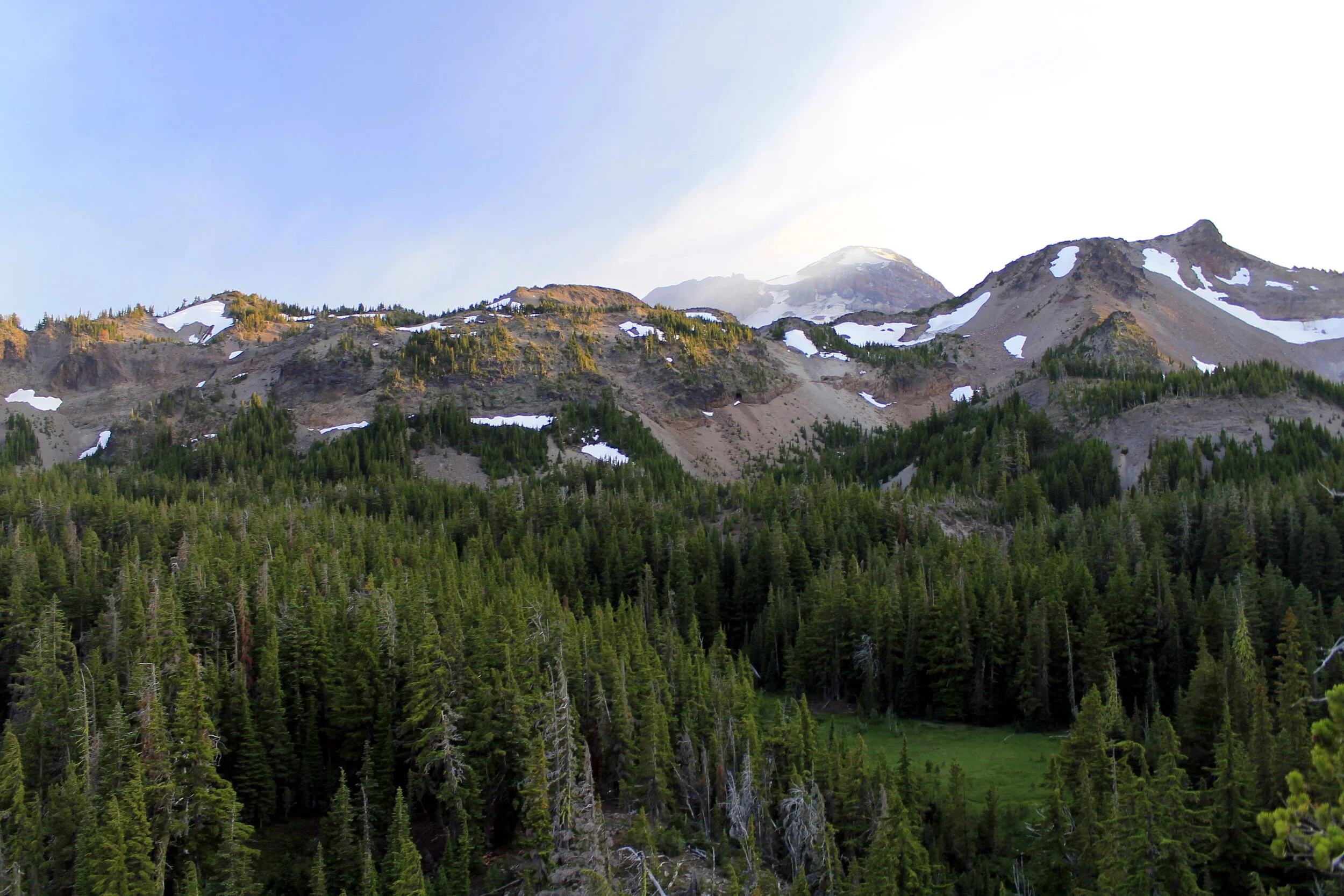
Signs of damage from the 2017 fire were apparent immediately. As I’ve stated repeatedly in my writing, I don’t mind hiking in fire-damaged forest. The damage here did not match my memories of how verdant French Pete Creek was though, and it actually made me a little sad. This is a sample of what the trail looks like now:

Indian Ridge 028 web.JPG

There was still beauty everywhere, though. We sat down for a little while when we reached the first creek crossing and marveled at how beautiful it was in spite of the lost bridge and fire damage:

Indian Ridge 046 web.JPG

I still remember the huge downed cedar that formed the bridge over the creek here. I’ve looked through our photo albums and I can’t find any photos from our hike here in 1992, so it will have to live on in my memory.

Anyway, on the way back Wendy and I lagged behind our friends so I could take some photos of the side creeks. I like how this one turned out:

Indian Ridge 055 web.JPG

The sun started to come out when we got to the trailhead, so we decided to go check out Cougar Hot Springs. Somehow I had never been there before, and of course we didn’t pack anything to go to a hot springs. Our friends went and soaked anyway while Wendy and I sat there and chilled.

Cougar Hot Springs. I made sure to snap this photo while all humans were out of view. There were actually a lot of people here.

Cougar Hot Springs. I made sure to snap this photo while all humans were out of view. There were actually a lot of people here.

After Cougar Hot Springs, we drove back up to Indian Ridge for what figured to be a more pleasant evening. Along the way, we passed a wondrous display of fall color that we hadn’t noticed on our drive in the night before:

Indian Ridge 062 web.JPG

As promised, this evening was far more pleasant than Thursday night had been. We heated up dinner, made a fire and shared some beers. It was still very cold, but at least this time it wasn’t sleeting on us.

Indian Ridge 086 web.JPG

Right before sunset the sun finally came out for good, and it was GLORIOUS:

Indian Ridge 101 web.JPG
Indian Ridge 105 web.JPG
Indian Ridge 119 web.JPG

That night it was a lot warmer inside the lookout, but it was never warm. Let me be clear about this: I am NEVER staying in another lookout this late in the year that doesn’t have a heat source. Thankfully most of them do.

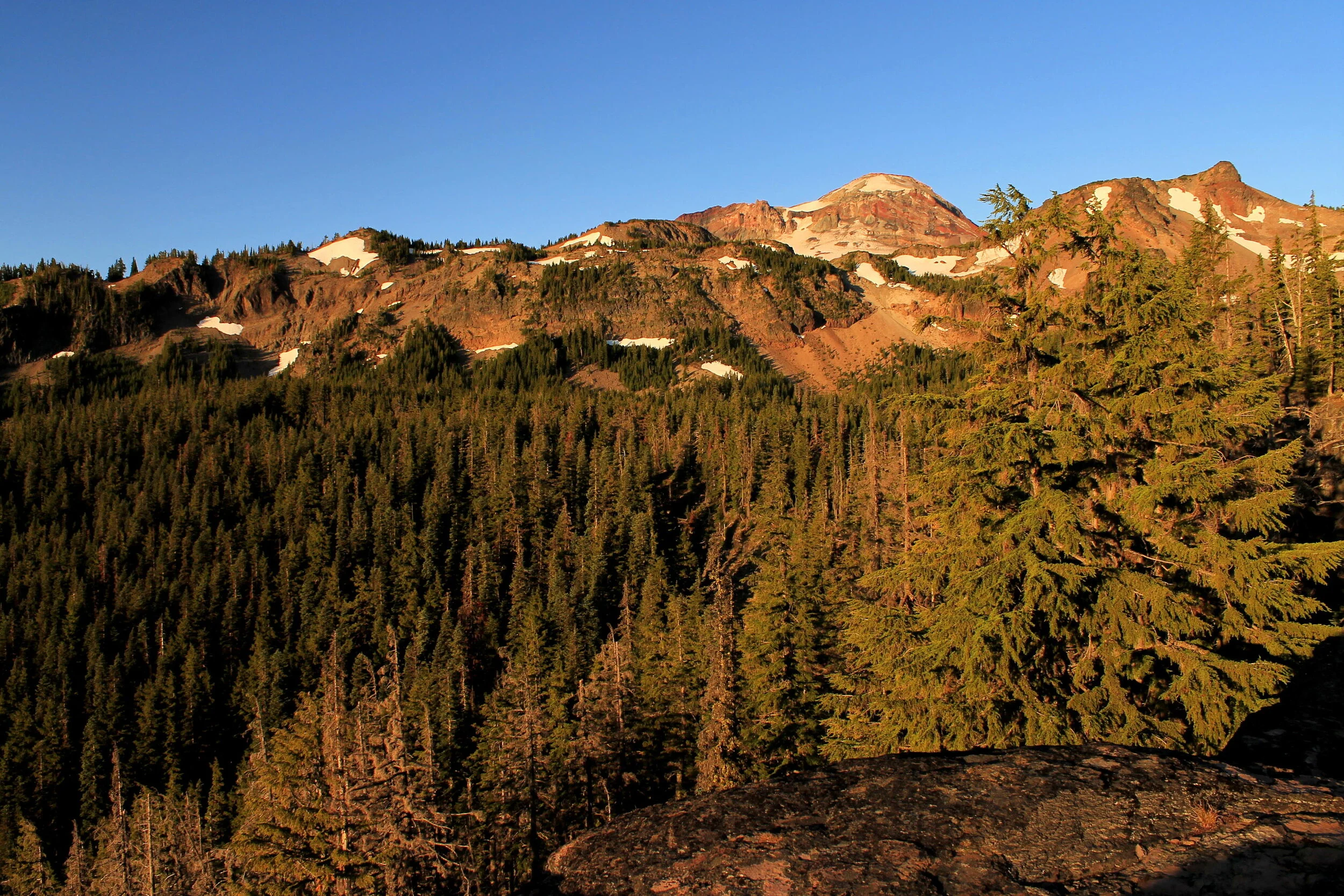
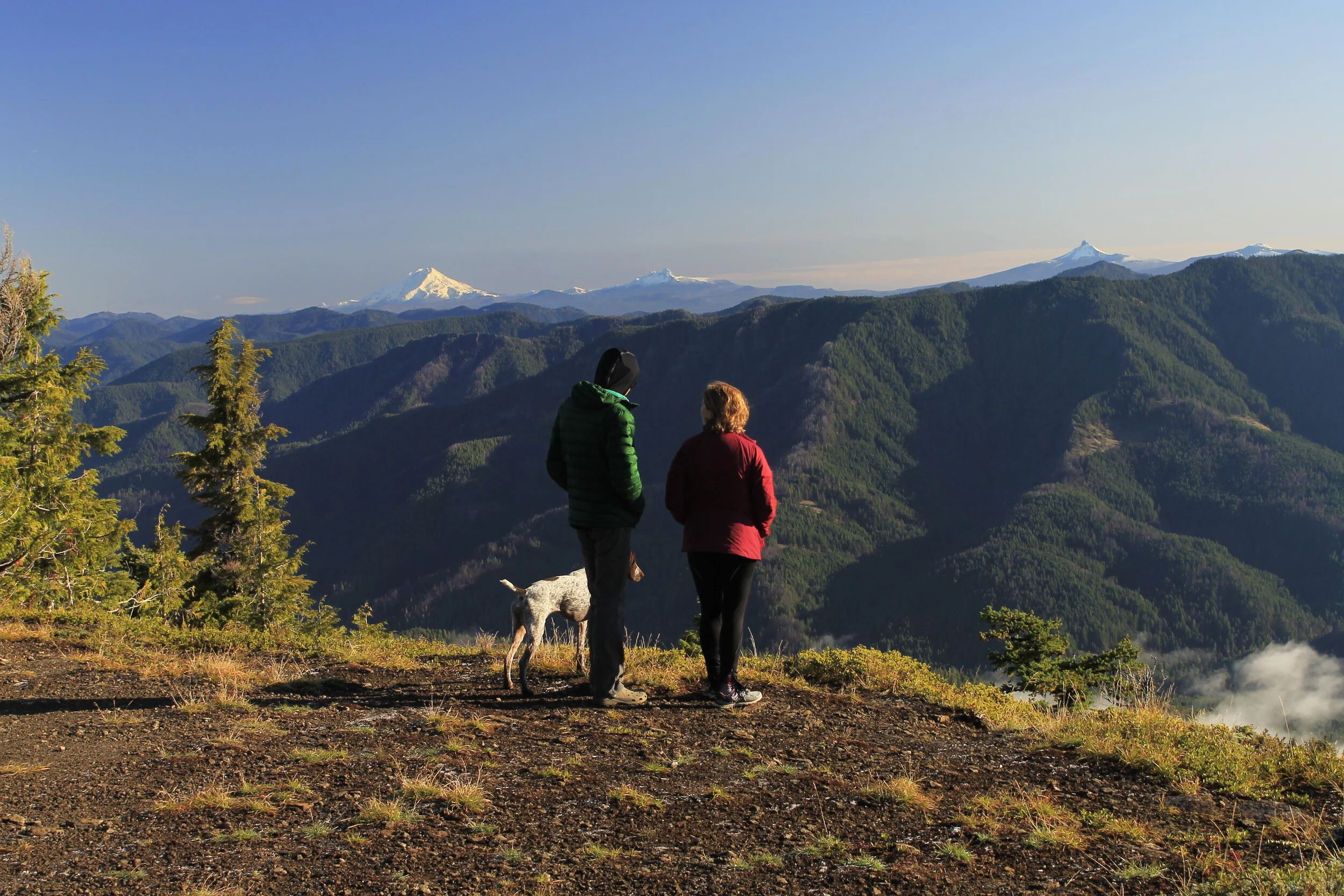
The next morning was bright and beautiful from the start. We had to leave, but the warm and beautiful weather made it tough. Finally, at last, the mountains came out:

Indian Ridge 138 web.JPG
Indian Ridge 144 web.JPG

It was great to see the Three Sisters after two days of knowing they were out there, behind all the clouds. Our friends decided to leave before us to go explore some more. We were sad to see them go, but so happy that they were able to join us. I snapped a photo of them right before they left:

Indian Ridge 143 web.JPG

We love you guys, and we can’t wait to go see you as soon as possible!

After they left, it was up to Wendy and I to close down the lookout. We were sad to go, but we had another adventure ahead of us for that day! We were going to go hike Marion Lake, one of my favorite places in the Mount Jefferson Wilderness. I’ll get to that in my next post. For now, here’s one more photo of Indian Ridge Lookout before we left:

Indian Ridge 147 web.JPG

I managed to snag three lookout towers that fall, and we only ended up staying in one of them. With that being said, let me elaborate on some tricks to booking lookout towers:

  1. Don’t book based on when you want to go, book based on what is available (if anything is).

  2. Be on recreation.gov at 7AM (well, a few minutes before actually), ready to book six months in advance. Reservations go on sale six months in advance, and you need to be ready to snag whatever is available, even if it isn’t your first choice.

  3. Look for cancellations. The only time I’ve managed to stay at Green Ridge, the holy grail of Oregon lookout towers, was on a cancellation that one of my friends snagged.

  4. Have your friends help you. We share lookout tower bookings.

  5. Be willing to book days you don’t need to get the days you want.

  6. Last but not least, be patient!

As luck would have it, I managed to book Hager Mountain Lookout for this weekend. I was pretty excited, as I had never succeeded at booking Hager Mountain before. In response to the COVID-19 pandemic, the lookout is now closed to the public. So it goes.

That’s the thing with lookout towers: cherish them when you’re able to stay there. As I said at the start of this post, staying in a lookout tower is one of the finest experiences you can have in the mountains. It doesn’t happen very often…savor the experience.

Demaris and Camp Lakes - July 2019 by Matt Reeder

Demaris Lake 177 web.JPG

We don’t go backpacking very often. For those of you who follow my writing and my hikes, this might be hard to believe. But my wife and I work very different work schedules (at least we did, before the pandemic), and getting away for a whole weekend can be a challenge for us. So when we do go backpacking, we try to make it somewhere special. Our only backpacking trip in 2019 was to Camp and Demaris Lakes, in the Three Sisters Wilderness. What a wonderful adventure this was!

Over the course of 2019, I made it a point to try and visit the Mount Jefferson and Three Sisters Wilderness Areas as much as possible. Starting in 2020 (at least, this the plan), many trailheads will require a limited entry permit, and all overnight trips will require a permit. As of this writing the details of this plan are still somewhat fluid, but you can follow along at this link. We wanted to make sure to get one more backpacking trip in the Three Sisters Wilderness before the permit system.

We initially looked into camping off-trail somewhere on the slopes of North Sister before deciding on Demaris Lake. I had never been to Camp Lake and I really wanted to make sure to get there before the permit system, but Demaris Lake looked inviting and not that crowded. This turned out to be the correct decision.

We spent the night before at Three Creek Lake, which was much busier than expected. The following morning we drove back through Sisters and down to the Pole Creek Trailhead, where we started the hike.

North Sister from the Pole Creek Trailhead.

North Sister from the Pole Creek Trailhead.

The first few miles of the Pole Creek Trail pass through terrain recovering from the Pole Creek Fire. Indeed, the fire here in 2012 started not far from the trailhead. My buddy Keith was along for this trip, and he remembered the hike in being a “dusty hellscape” when he hiked through on the way to Middle Sister several years before. As it turned out., it wasn’t that bad:

Demaris Lake 010 web.JPG

The next few miles through the burn passed by pretty fast, as the trail was not all that difficult. A little over 3 miles from the trailhead, we abruptly left the burn and entered the friendly confines of a high mountain forest.

At 4 miles from the trailhead, the trail crosses the North Fork of Whychus Creek. I was expecting a difficult crossing, but it turned out to be pretty easy:

Demaris Lake 011 web.JPG

The trail meets the junction with the Demaris Lake Trail immediately after the crossing. Here, we turned left to hike down to Demaris Lake.

Up to this point we’d seen a lot of other hikers and climbers, but once on the trail down to Demaris Lake we didn’t see anyone. I guess it’s worth pointing out at this point that Demaris Lake does not enjoy the sparkling reputation that Camp Lake and the Chambers Lakes do. Pretty much the only thing I knew about Demaris Lake up to this point was this note in William L. Sullivan’s classic book 100 Hikes in the Central Oregon Cascades:

Demaris Lake is a somewhat closer goal. Though less spectacular, this lake is a good choice on days when wind or threatening weather make the Chambers Lakes uninviting. A sign at the North Fork of Whychus Creek indicates the 0.8 mile side trail. Round-trip distance from the Pole Creek Trailhead is 10.8 miles.

When we reached the lake, we found it to be quite pleasant. There was a somewhat obstructed view of South Sister from the head of the lake, and a few mediocre campsites. With a lot of time on our hands, we decided to circle the lake and look for the best campsite possible. We found exactly what we were looking for on the opposite side of the lake, where there is space enough for several tents. We set up camp and then took a nice long lunch. After lunch, it was time to go check out Camp Lake.

We made our way back to the main trail and began the final climb into the Chambers Lakes basin. The views began to open up south towards Broken Top:

Demaris Lake 072 web.JPG

North and Middle Sister towered over us, close at hand:

Demaris Lake 018 web.JPG

The last half-mile or so to Camp Lake seemed like it took forever, but we finally made it there. It was every bit as beautiful as I had heard:

Camp Lake

Camp Lake

As he always does, Keith had to go swim in Camp Lake. I’ve never seen him pass up a chance to swim, and even though I could see snowdrifts on the far end of the lake, I knew he’d go for it.

Keith swimming in Camp Lake. He said it wasn’t as cold as it looked. I don’t believe him.

Keith swimming in Camp Lake. He said it wasn’t as cold as it looked. I don’t believe him.

When he was done with his swim, the three of us went exploring a bit. Camp Lake is located at an elevation of around 7,000 feet so I wasn’t surprised to see snow all over the place still.

This snowbank is the South Fork of Whychus Creek. Keith actually crawled into the snow cave there. He’s a braver man than me!

This snowbank is the South Fork of Whychus Creek. Keith actually crawled into the snow cave there. He’s a braver man than me!

Camp Lake was busier than I expected. It’s 7.5 miles into the lake, and many folks continue further into the basin. It looked cold and windy up there, and I was glad we were camped at Demaris Lake instead. We had to stop at the lakeshore before we left for more photos:

Demaris Lake 054 web.JPG
Demaris Lake 067 web.JPG

As we left, the photo lighting kept getting better and better. I have seen some truly spectacular photos of Camp Lake, and I’m sure it would have been amazing to be up there that night. But as I mentioned, it was also crowded, and it would have almost certainly been cold. I think we made the right choice.

Back at Demaris Lake, we had lots of time to explore. As it turned out, Demaris Lake sits in a small basin ringed by cliffs. Just 100 yards or so from our campsite we reached the edge of a cliff. From here, we turned and followed the cliffs a bit to an amazing view of South Sister:

Demaris Lake 088 web.JPG

I’m not sure what was blowing over South Sister, whether it was smoke or dust. This was a phenomenal view. We explored the cliffs up here for awhile, looking for a view, any view of the waterfall we could hear in the vicinity. We never found even an obstructed view of the falls. A friend of mine gave me directions for getting to the base of the falls, but that wasn’t in the cards for this evening.

We went back to camp and made dinner, and went to bed early, tired and happy.

The next morning I had every intention of sleeping in. Wendy woke up early, as she always does, and went down to the lakeshore. She came back to let me know that the sunlight was lighting up North Sister, visible across the lake. I hauled myself out of bed to take some photos:

Demaris Lake 097 web.JPG

We followed the trail back out to the cliffs, so we could see the morning light illuminate South Sister:

Demaris Lake 109 web.JPG
Demaris Lake 106 web.JPG

I could have spent a couple of days just exploring this little basin, looking for views and trying to make my way down to the base of the falls here. But as mentioned, we didn’t have any time left. So we packed up camp and hit the trail by 10AM. On our way out we stopped at the lake’s outlet again to marvel at the view of South Sister across the lake:

Demaris Lake 177 web.JPG

It was breathtaking. If I’m being honest, I know everyone loves Camp Lake, but I loved Demaris Lake even more. I would absolutely come back here and camp again, with more time to explore the area.

As it turned out, I ended up at the Pole Creek Trailhead again the next weekend…but that’s a different story for a different day.

Skylight Cave - May 28, 2019 by Matt Reeder

Central Oregon 237 web.JPG

I have friends who are just as adventurous as me. Actually, I have friends who are more adventurous than I am, in many ways. Over the years some of my more adventurous friends had invited to go see Skylight Cave several times, and I had always passed them up because it seemed like a long drive for not much of a hike. Granted, it looked amazing - a cave where sunlight shined through holes in the roof, but only at a certain time of day at a certain time of year. But as much as I love a good adventure, I needed to be in the area to make it work.

Last year we finally made it work. I decided to take a couple days to go on a short road trip through Central Oregon. At the time I was only working two days a week, so Memorial Day Weekend gave me several uninterrupted days off. I found a yurt at Tumalo State Park for the night of Memorial Day, so I built a two-day trip around that, with the goal of meeting Gene to go explore Skylight Cave.

Over the course of two days I explored a lot of Central Oregon, going on several short hikes. I’ve written about the Jefferson Lake Trail and Downing Creek Falls already; both are linked here.

Anyway: I met Gene in Sisters and he drove us through the labyrinth of forest roads to the trailhead. Here’s a sampling of the drive:

Central Oregon 158 web.JPG

I couldn’t find the cave again if I tried. As such, I will not be giving directions because I don’t remember how to get there. I’m sure you could find directions if you looked hard enough!

On the drive there was an excellent view of Mount Washington, Central Oregon’s forgotten beauty:

Central Oregon 160 web.JPG

Eventually we reached the unofficial trailhead. We climbed the ladder down into the cave, where we saw a single sunbeam shining through a hole in the roof. It was breathtaking! In late May and early June, the sun lines up at such an angle that three sunbeams shine through the roof onto the floor of the cave. I had seen photos before, and I was intrigued.

Of course, it reminded me of that scene in Raiders of the Lost Ark when Indy drops down into the Well of the Souls to find the true location of the Ark of the Covenant:

Indiana Jones (Harrison Ford) in the Well of the Souls, an iconic scene in Raiders of the Lost Ark.

Indiana Jones (Harrison Ford) in the Well of the Souls, an iconic scene in Raiders of the Lost Ark.

We needed to wait a little while for all three sunbeams to appear through the holes in the roof. It gave us lots of time to try different photo compositions:

Gene didn’t realize I was shooting on a 30 second exposure here. I love the result!

Gene didn’t realize I was shooting on a 30 second exposure here. I love the result!

Inside Skylight Cave.

Inside Skylight Cave.

Eventually all three sunbeams appeared through the roof. I’ve never seen anything like it. I will let the pictures do the talking:

Central Oregon 211 web.JPG
Central Oregon 214 web.JPG
Central Oregon 233 web.JPG

We had to get a photo of the sunbeam shining down on Gene:

Central Oregon 237 web.JPG

I prefer to stay behind the camera, but I couldn’t resist doing a self-portrait in the sunlight:

Central Oregon 236 web.JPG

Standing in the sun, in a cave, is an experience I will never forget.

Eventually the sunbeams began to dim as the sun moved away from the skylights, and we left to go explore another little-known corner of central Oregon. You can read about that adventure here.

Mack's Canyon - November 17, 2019 by Matt Reeder

The Deschutes River downstream from Mack’s Canyon.

The Deschutes River downstream from Mack’s Canyon.

Like so much of the Deschutes River canyon, the stretch from Mack’s Canyon down to the lower reaches of the Deschutes River had long intrigued me. Over the years I’ve made it a habit of spending many of my winter days basking in the sunshine in the Deschutes canyon. Due to the long drive and supposed difficult access, I had never hiked Macks Canyon. In the few years before quarantine, I began to feel as though I had been everywhere (which of course is not true)…so I figured it was time to finally start exploring the places I had left unexplored.

I decided to organize a trip to Macks Canyon through the Adventurous Young Mazamas, with whom and for whom I lead hikes in saner times. I wasn’t sure what kind of group I would have who wanted to spend the entire day in a remote corner of the Deschutes canyon, but a lot of people signed up. We ended with a group of 8-9 folks ready to explore.

The drive into Macks Canyon was not nearly as difficult as I had been led to believe. We drove to Sherars Bridge and turned onto the 17 mile gravel road that follows the river north into its terminal canyon. The road was in excellent shape, with only a little rockfall and not too much washboarding. Every mile or two we would pass a campground or day use site, most of which were full of people. So it turns out this canyon is not as remote or little-known as I thought. We didn’t reach the end of the road until about 9:30 AM, but this still left plenty of time to explore. Although we had seen plenty of folks on our drive in, we were the only hikers on the trail.

Shortly after departing from the Macks Canyon Trailhead, we reached our first side canyon. The trail along the Deschutes River here is what remains of a railroad from the early 20th Century. The trestles are long gone, and hiking along this upper stretch requires scrambling down into gullies and then scrambling back out. There are trails through each of the gullies, but they are steep and crumbly. This first one wasn’t so bad:

Mack's Canyon 010 web.JPG

Beyond this point, the old rail trail clings to the steep slopes above the river. Lower in the Deschutes Canyon the trail is a gravel road, but up here you’re walking on what’s left of the rail line.

Mack's Canyon 025 web.JPG

Here is something you probably did not know about me: when I moved back to Illinois as a teenager, we didn’t have any hiking nearby to keep me distracted. We lived far out in the country, and I didn’t have a car or know how to drive. So instead, I walked the rail line near our house when I wanted to go for a walk. Trains used, and still use the line regularly. But I needed somewhere to walk.

Walking over railroad ties does not bother me in the slightest.

Mack's Canyon 030 web.JPG

As we hiked further into the canyon, we passed over railroad ties, climbed over barbwire fence and picked our way in and out of side canyons. About 3 miles back, we passed an absolutely spectacular display of columnar basalt:

Mack's Canyon 049 web.JPG
Mack's Canyon 060 web.JPG
Mack's Canyon 046 web.JPG

This was a basalt formation worthy of a thousand photos, and I marveled at how I had never seen a photo of it before. In many ways it reminded me of Giant’s Causeway in Northern Ireland, which I visited in 2008 with my friend Amy on my way home from my year in France:

Giant’s Causeway in Northern Ireland, July 2008.

Giant’s Causeway in Northern Ireland, July 2008.

Of course, it would be hard to imagine a place less like Northern Ireland than the Deschutes River canyon.

Anyway: after about 4.5 miles, we reached a rough spot in the canyon, at a deep gully tucked away in a river bend. We could see what appeared to be the end of the maintained trail on the far end of the bend, but it was already well past noon and we needed to turn around. What a wild place this was:

Mack's Canyon 066 web.JPG

As we worked our way back upstream towards the trailhead, the daylight waned, presenting us with some wonderful photo opportunities:

Mack's Canyon 098 web.JPG
Mack's Canyon 102 web.JPG
Mack's Canyon 104 web.JPG

The sun was already setting behind the canyon walls when we neared the trailhead, a reminder that November days are oh so short.

Mack's Canyon 136 web.JPG
Mack's Canyon 143 web.JPG

We reached the trailhead late in the afternoon, where we took a few minutes to explore a little more and bask in the sun. In November, you need to embrace sunny days…it might be a long while until you see another one.

I had grand plans for Mack’s Canyon for 2020, or at least the makings of grand plans. I was thinking about backpacking this canyon on my own in early spring; or I thought about doing this one-way downriver as a shuttle; or perhaps I would just come here and camp by myself for some peace and quiet. Now that COVID-19 has altered our plans, it’s hard to say if I will have that opportunity, even in fall. This would be a great place to socially distance, if you can find it.

When I’m out in a remote canyon somewhere, or out on a rugged ridge in the clouds, I often stop to just take it all in. Months or years later, when I am sitting on my computer at home, those feelings come back to me and I feel an immense gratitude for having had the experience…for having stopped, to appreciate how satisfied I was in the face of overwhelming beauty.

Thank you for reading.

Breitenbush Falls - July 8, 2018 by Matt Reeder

Breitenbush Falls Bushwhack 019 web.JPG

It’s been a tradition for me to invite a group of friends hiking to celebrate my birthday for many years now (see my 2019 trip to Opal Creek Falls). The past few years I’ve tried to organize an off-trail waterfall hike, such as last year on the aforementioned trip to Opal Creek Falls. My birthday trips are a chance to explore, a chance to go see one of the wildest places on my bucket list, in the company of friends. This trip to a waterfall we’ll call Breitenbush Falls was one such adventure.

My friends Tim and Melinda seek out waterfalls with the passion of the most serious collector. Together they have discovered countless waterfalls, and changed what we thought we knew about the best and most beautiful waterfalls in the Pacific Northwest. Those of us who are privileged enough to know them feel grateful to be invited on one of their adventures. Sometime in 2017 or 2018, Tim and Melinda explored a side canyon on the north side of Mount Jefferson and came back with a fantastical story about a waterfall with a huge cavern behind it, where huge cedars grew almost into the falling water above. It sounded almost too good to be true, and I knew that I had to take them up on the offer when they invited me to join them on a return trip. I figured it would be great to make this my birthday hike for 2018. Good call!

The day begin on a trail I know and love. I was excited, so much so that I found myself hiking faster than the rest of my group - I’m still sorry about this, friends! It is true that sometimes excitement causes people to lose their sense of perspective, and I knew I had to slow down because in reality I wasn’t the leader of this particular trip. After a couple miles, Tim directed us off trail and down into the canyon.

Breitenbush Falls Bushwack 001 web.JPG

Now, about “Breitenbush Falls” - if you know the Majestic Mount Jefferson Region, you have a fairly good idea of where this is. But as always when describing an off-trail location, I am not going to give directions or spend any time describing how to find this place. I can say that this is a different waterfall than Breitenbush Cascades - but beyond that, you’ll need to read between the lines and think about the Majestic Mount Jefferson Region to find this one.

After some time spent bashing our way downhill, Tim directed us around a narrow rock band and over some huge downed trees, until we could hear the sound of falling water. We carefully negotiated our way down a rocky slope, and around the corner the waterfall came into view. It was every bit as spectacular as advertised:

“Breitenbush Falls”

“Breitenbush Falls”

As mentioned above, the falling water has worn away a rocky cavern behind the falls, where cedar trees grow into the falling water. Unlike the caverns behind the falls at Silver Falls, the cavern here looked fairly unstable. It was not a place I wanted to linger:

Behind the falls

Behind the falls

Looking through the trees into the falling water was almost an optical illusion, as it was very dark behind the falls and incredibly bright in the canyon beyond.

Breitenbush Falls Bushwhack 013 web.JPG

We carefully worked our way behind the falls and around the other side, where at last the full waterfall came into view:

Breitenbush Falls Bushwhack 016 web.JPG

We sat here at the base of the falls and shared summit beers - the summit of course being the base of the falls, a place few have ever visited. After lunch we explored a little further downstream, finding some neat photo compositions:

Breitenbush Falls Bushwhack 023 web.JPG

The day was getting hot, and we knew we had a steep climb out of the canyon ahead…but it was hard to leave:

Breitenbush Falls Bushwhack 030 web.JPG

On the way out we found the slopes steeper and looser than expected. As I said with Opal Creek Falls, I cannot recommend this to somebody who isn’t committed to wandering up and down steep, crumbly slopes and navigating extremely rough terrain.

Leaving the falls

Leaving the falls

Eventually we made our way back out of the canyon and onto the trail. When we got back to the trailhead, we decided to stop at one of my favorite spots on the road in to explore a little more, and cool off a little:

Breitenbush Falls Bushwhack 076 web.JPG

All in all, it was another wonderful day with friends in my favorite place. Thanks to everyone who came along that day, and thank you to all who enjoy reading about my adventures!