Aiken Lava Bed - July 18, 2019 by Matt Reeder

Aiken Lava Bed 086 web.JPG

Mount Adams is often visible on the horizon from Portland, seemingly floating on the clouds far beyond the Gorge. We don’t get there very often, even though it isn’t really that far from Portland. In truth, it’s no farther than Mount Jefferson is, but I didn’t grow up visiting Mount Adams and I didn’t write a guidebook about it as I did Mount Jefferson. So I’ve decided I need to visit more often.

I had been eyeing a loop around the Aiken Lava Bed on the south side of Mount Adams for a long time. The lava beds are geologically recent, dating back to sometime between 4,500 and 6,000 years ago. I had crossed the lava beds on a trip to Bird Creek Meadows in 2017, a memorable trip that was my first time on this side of Mount Adams. Accessing the south side of Mount Adams is tough; the roads to the South Climb and Bird Creek Trailheads are poor at best, and since the Cougar Complex Fire in 2015, Bird Creek Meadows has been closed for the vast majority of the time. So with a lot of free time last summer, I decided it was finally time to go check out the A.G. Aiken Lava Bed Loop.

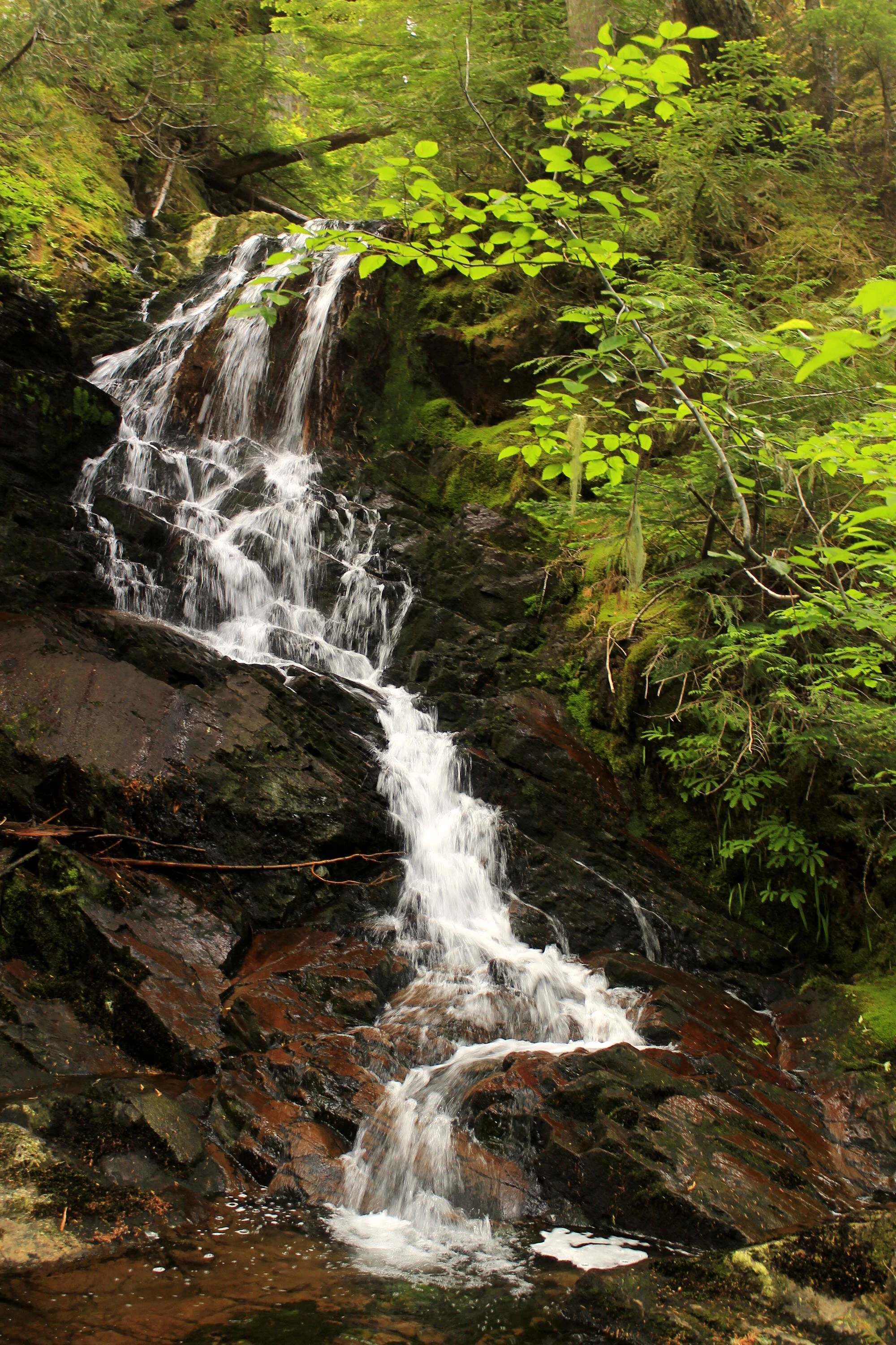
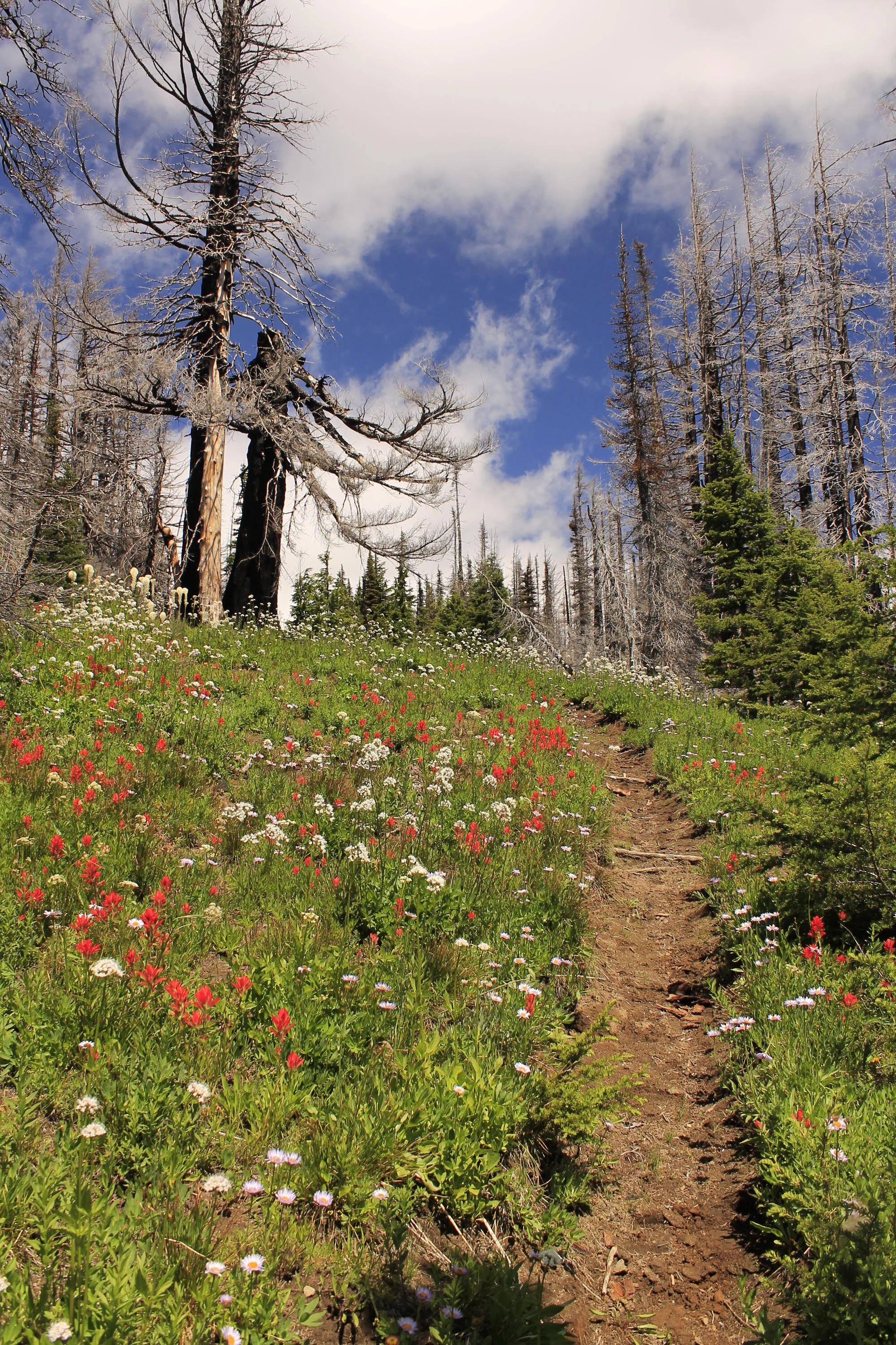
The Snipes Mountain trailhead was surprisingly easy to find, and at 2 hours from my house, really not that far away. This area has been torched in multiple fires over the past dozen years or so, and signs of fire are everywhere. The trail climbs away from the trailhead and quickly begins following the lava bed through open forest, most of it burned. Some of this is wildly scenic:

The Snipes Mountain Trail follows the Aiken Lava Bed for miles.

The Snipes Mountain Trail follows the Aiken Lava Bed for miles.

That’s nice! A lot of the trail, however, looked like this:

Aiken Lava Bed 047 web.JPG

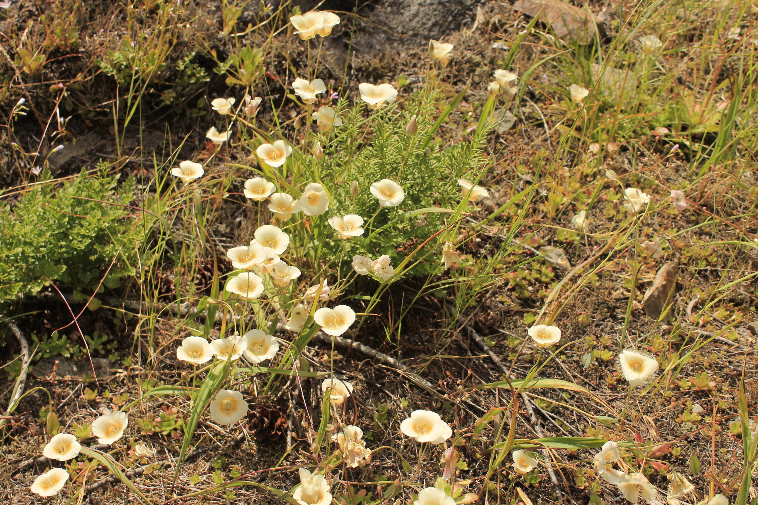
Now, I’m not one to reject a trail just because it has long stretches of unpleasant terrain. I loved the Snipes Mountain Trail for its wild and rugged character, even as parts of it were fairly tedious and poorly-maintained. Wildflowers are thriving in the open forests in the wake of the fire. Here are three of my favorite specimens from the hike along the lava bed:

Scarlet gilia (aka Skyrocket) along the Snipes Mountain Trail, July 2019.

Scarlet gilia (aka Skyrocket) along the Snipes Mountain Trail, July 2019.

Asters along the Snipes Mountain Trail, July 2019.

Asters along the Snipes Mountain Trail, July 2019.

Tiger lilies!

Tiger lilies!

Occasionally the trail would grow faint, but never so much that I ever got worried. The trail mostly follows the lava bed, so all I really needed to do was keep the lava bed to my left.

After 5.5 miles or so of trudging up the mountain, I came to a gate that is supposed to keep cattle out the fabled meadows along Gotchen Creek:

Aiken Lava Bed 054 web.JPG

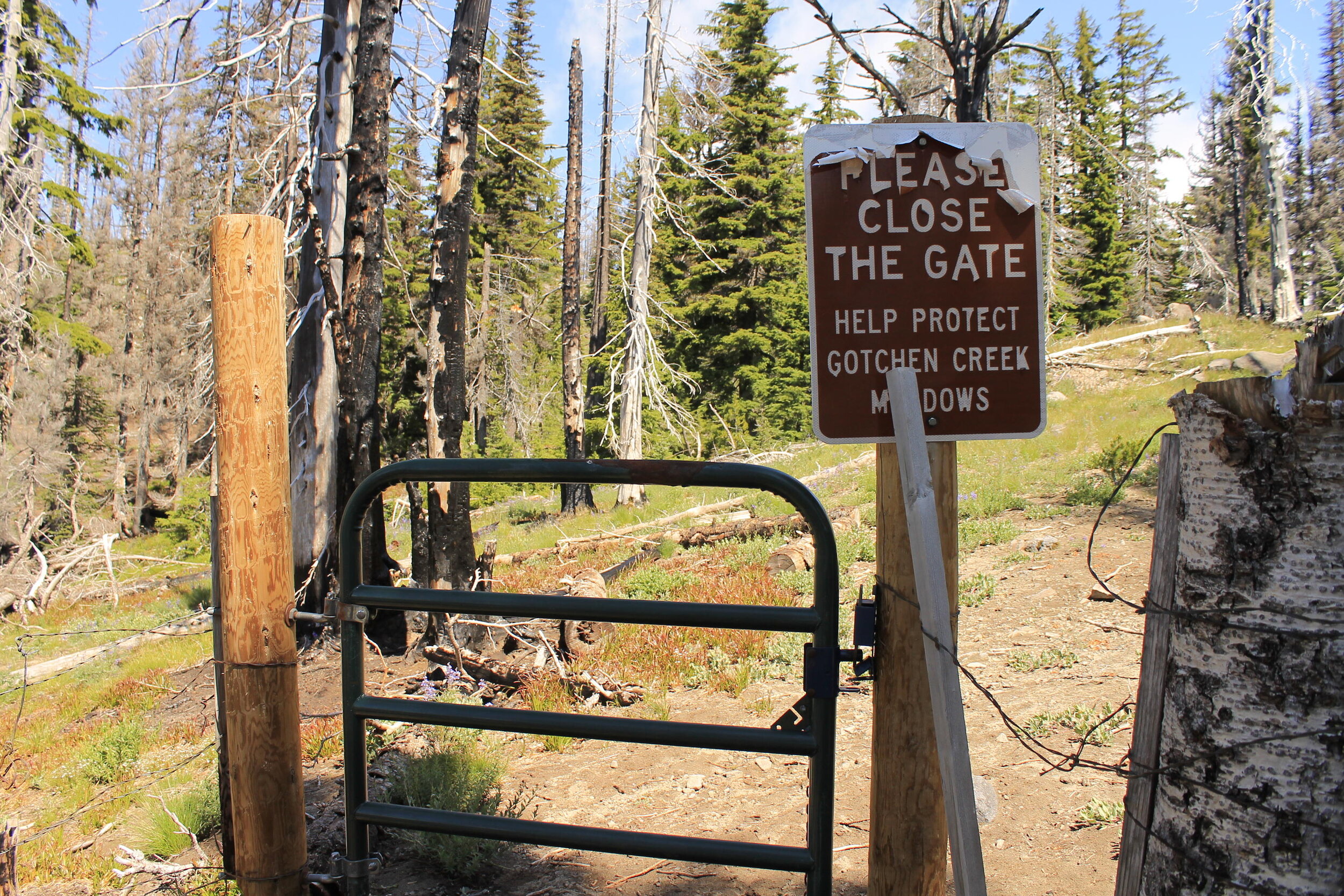
I learned that this gate was not doing much, and that cattle were regularly seen in the meadows after the 2015 fire. Bummer. Now, about Gotchen Creek, something perplexing: my trail up was the Snipes Mountain Trail, which follows Gotchen Creek, while my return route was the Gotchen Creek Trail…which goes nowhere near Gotchen Creek. Sometimes I think we need to just start renaming almost everything in the outdoors.

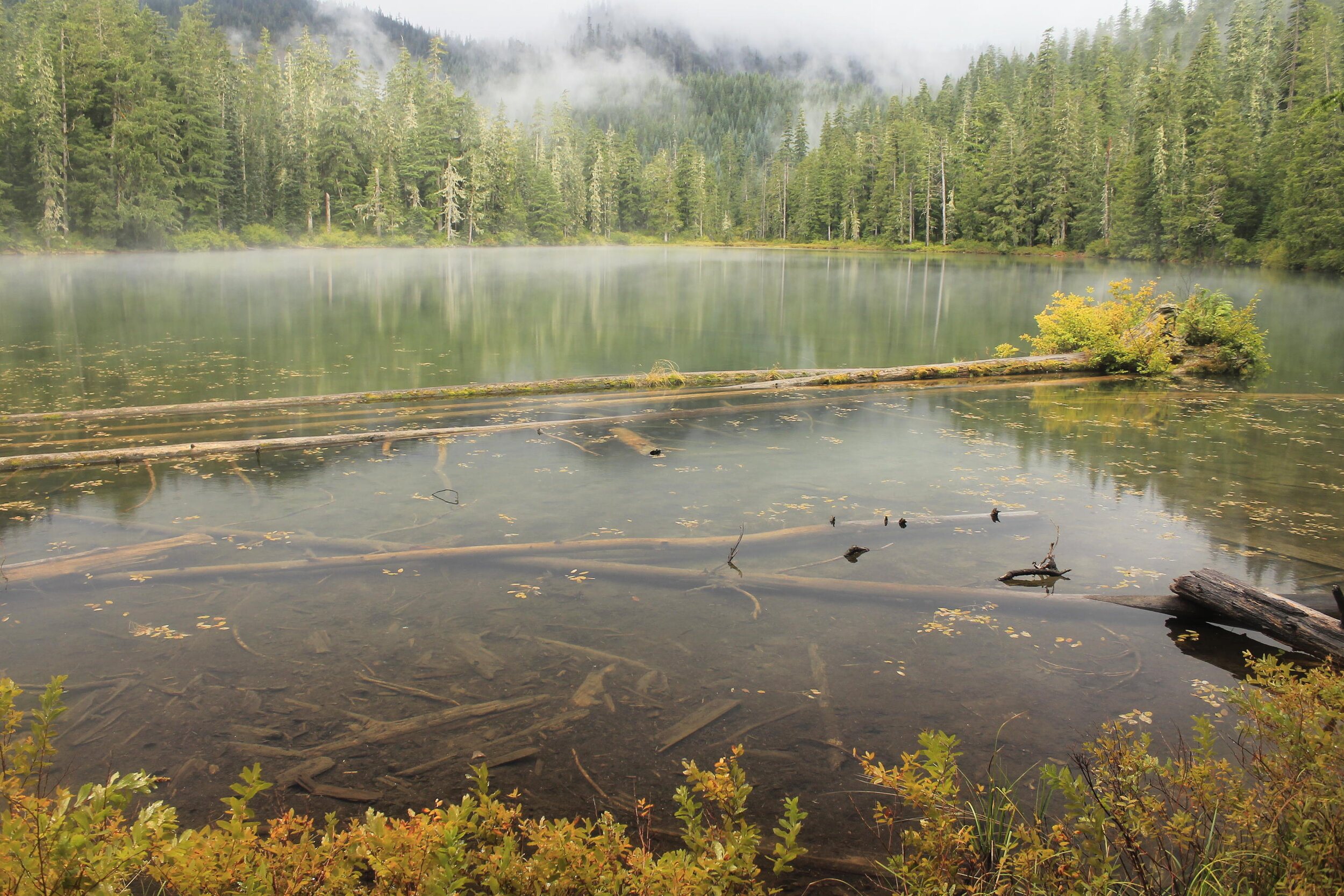
Anyway, before long I came to Gotchen Meadows, where I stopped for an early lunch of dolmas, crackers and fruit. Mount Adams was hiding in the clouds, but soon they began to part, revealing the glory of Washington’s second highest peak:

Gotchen Creek Meadows, July 2019.

Gotchen Creek Meadows, July 2019.

I carefully picked my way across the meadow, doing my best to leave as little of a trace as possible. With such overwhelming beauty, it’s hard not to be careless. But you must! Here Gotchen Creek meanders through boggy meadows, backed by Mount Adams. The mountain is the gift that keeps on giving, and this was another present I was delighted to unwrap. I spent much of my time at the horseshoe bend pictured above, and below:

Aiken Lava Bed 076 web.JPG

But I sought out other shapes too as I followed the sinewy creek as best I could:

Aiken Lava Bed 086 web.JPG

I’m not sure how long I spent at the meadow, but it was probably an hour. Time was wasting away and I still had many miles to cover. I seriously contemplated just turning around from here, so I could spend more time in the meadows…but nah, I couldn’t do that. I had a loop to complete!

Once I could say goodbye to the meadow, I continued uphill for another half-mile to the junction with the Round the Mountain Trail. The flowers in this stretch were fantastic:

Aiken Lava Bed 096 web.JPG

The Snipes Mountain Trail meets the Round the Mountain Trail at the very edge of the Yakima Reservation. A right turn here will lead you in very little time to Bird Creek Meadows, one of the most beautiful places anywhere. There’s a sign at the junction welcoming hikers:

Aiken Lava Bed 099 web.JPG

I need to turn left here, towards the South Climb Trailhead, to continue my loop. This next stretch of trail I had hiked before, as I had followed the Round the Mountain Trail on my trek to Bird Creek Meadows. At first the views of Mount Adams are spectacular, as it rises above the head of the lava bed:

Aiken Lava Bed 110 web.JPG

Before long, however, the trail leaves the views of Mount Adams behind to cross the lava bed and its rocky ramparts. Instead you get views south to Mount Hood, a nice trade. The trail across the lava bed is neat in its own way:

The Round the Mountain Trail across Aiken Lava Bed.

The Round the Mountain Trail across Aiken Lava Bed.

I met the South Climb Trail some 2 miles from the Snipes Mountain junction. It was at this junction that I saw my first hiker of the day, who was headed east towards Bird Creek Meadows. He would not be the last person I saw all day. Over the next mile or so down to the South Climb Trail, I saw a few dozen folks trudging uphill with dreams of climbing Mount Adams (this is the primary route up the mountain). Many of them asked me if I’d been to the summit already; when I responded that I’d come from the east, up a lonesome valley, many of those same would-be climbs looked at me with a mixture of confusion and admiration. This is true back in Portland when I talk about Mount Adams; for many in the mountaineering community in the Portland area, the only time they’ve been to Mount Adams was to climb the mountain.

Some twenty minutes later, I wandered into the crowded and entirely unappealing South Climb Trailhead. I took a short break here to look at my map and read my directions. I was looking for the Cold Springs Trail, which would eventually take me to the Gotchen Creek Trail. It turns out the Cold Springs Trail is located on the far eastern end of the South Climb Trailhead, tucked away and not all that noticeable.

It also turns out the Cold Springs Trail has not received much, if any maintenance in quite some time. The next few miles were some of the most uncomfortable hiking I’ve had in some time, as long stretches of the trail were so faint I began to wonder if it would just disappear altogether. Here’s a nicer stretch:

The Cold Springs Trail, looking back towards Mount Adams, July 2019.

The Cold Springs Trail, looking back towards Mount Adams, July 2019.

This was a less-nice stretch:

The Cold Springs Trail, July 2019. Somebody send in the trail crew!

The Cold Springs Trail, July 2019. Somebody send in the trail crew!

Now, I’m not usually one to complain about trail conditions. I seek out faint and wild trails to explore, and to escape the crowds found on more well-known trails. But when you’re in mile 10 of a 15 mile loop, you happen to be alone and haven’t seen another hiker on your trail, and you begin to wonder if you will need to bushwhack over dead trees for miles to find your car…well, it’s enough to give a person some anxiety. Thankfully the trail mostly stayed where it was supposed to, and even when there was no tread, I was able to follow old cut logs in the faintest stretches. Eventually things got better.

Aiken Lava Bed 131 web.JPG

After what seemed like an interminable descent, I finally met the Gotchen Creek Trail something like 13 miles into my hike. Here I turned left on a much wider and obvious trail, and hiked a mile to a signed trailhead in what seemed like a pretty random location. To be fair, a lot of the trails on Mount Adams feel like they are located in random locations. So all that was left was to walk roads for about a mile back to my car.

Not even 200 yards from my car, I came across a roadblock:

Aiken Lava Bed 147 web.JPG

I don’t see cows very often on hikes, and these guys were blocking the route back to my car. So I had to yell and dance and jump up and down for about 30 seconds until the five or six cows got the idea and plunged into the brush. Not even 2 minutes later, I was back at my car, beaten up and happy to be done with my hike and desperate for some salty snacks and caffeine. It was a fascinating and long day full of surprises! I am not sure if I will ever do this loop again, but if nothing else I will definitely return to Gotchen Creek Meadows. There’s never a dull moment when you’re exploring Mount Adams…and I am hoping to do more of it this summer.

Distance: 15.1 mile loop

Elevation Gain: 3,061 feet

Drivetime from Portland: 2 hours each way

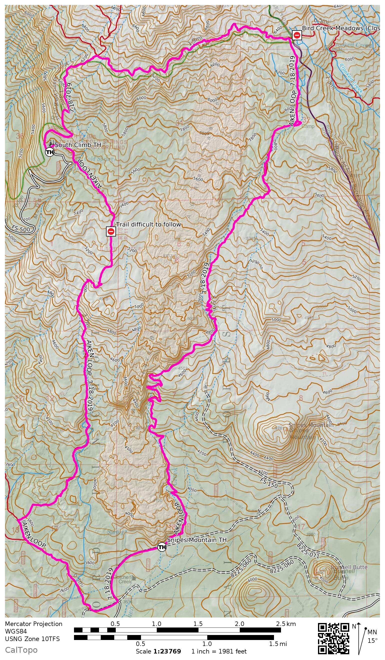
Here’s a map of my loop. For more information on this hike, see this link (which was also linked above).

Hike Map 2019-07-18.jpg

Downing Creek Falls - May 28, 2019 by Matt Reeder

After mostly taking a few years off from the Mount Jefferson area after the publication of 101 Hikes in the Majestic Mount Jefferson Region in 2016, I decided to go back and begin exploring the area again in 2019. I will be writing about some of these experiences here.

Downing Creek Falls, May 2019.

Downing Creek Falls, May 2019.

When you’re driving south on Oregon Highway 22 towards Santiam Pass, you cross Downing Creek not terribly far before the turnoff to Duffy Lake. If you look really, really closely out of the corner of your eye (don’t look too close, you’re driving!), you can see a waterfall back in the woods along Downing Creek. Being a huge fan of all things Mount Jefferson, this waterfall had long intrigued me. But for whatever reason, I never stopped to check it out.

Over time the various waterfall explorers of the internet did stop to check it out, and came back with an interesting story: what you can see from the highway is not Downing Creek Falls, and indeed the real Downing Creek Falls is further upstream. I was intrigued.

As it happened, I never really had a chance until I found myself with a couple hours to kill on my way back from Central Oregon. Earlier in the day I met my buddy Gene in Sisters so we could go explore Skylight Cave. After this, we made our way to the Jefferson Lake Trail to check out the scene there. You can read about this adventure in the blog post linked here.

Our day ended a little earlier than expected, and I found myself with a little extra time. So I pulled up my phone and navigated my way through the internet to the set of directions I had for Downing Creek Falls. You can find them with a little internet sleuthing; I won’t link to them here.

So I found myself driving down Highway 22 heading north, and I knew that I had to turn off the highway onto a barely noticeable road and drive a little ways until I could park. This was easier said than done; with cars behind me and me not knowing where I was going, it ended up being difficult. The driver behind me honked at me as I turned. I’m sorry!

After a little bit on this forest road, it got so narrow I just decided to park and walk the rest of the way. It turns out I could have driven a little further but I was enjoying myself! Once off the highway I was all alone here. So I walked down the road, on my way to a waterfall deep in the woods.

Central Oregon 298 web.JPG

My directions said I would eventually come to some roadblocks, and sure enough, the road was no longer navigable after about a half-mile from where I parked. From here I picked up a trail and continued into the woods. Before long I came to Downing Creek, and not long after that, the falls came into view. It was every bit as beautiful as I had heard:

Downing Creek Falls.

Downing Creek Falls.

The falls stands about 35 feet tall, plunging into a bowl so lush and verdant that it glows. The sun came out not long after I got here, and I sat in the sun by myself just taking it all in.

The falls presents a variety of compositions, from close up (see above) to further back. After poking around a bit, I decided that I loved the angle of the falls from a bit further back, along the creek:

Downing Creek Falls, May 2019.

Downing Creek Falls, May 2019.

Eventually I had to turn around and drive back to Portland. But on my way back from the falls, I did stop and explore the banks of Downing Creek some more. I found a small pocket of intensely blue water not far downstream from the falls:

Central Oregon 320 web.JPG

And not far from where the user trail returns to the narrow access road, I found this stunning scene along Downing Creek:

Central Oregon 335 web.JPG

It was the perfect end to a long and fascinating day spent in the mountains. Now…if only I could remember how to get there again. ;)

Coffin Mountain and Bachelor Mountain - June 28, 2019 by Matt Reeder

After mostly taking a few years off from the Mount Jefferson area after the publication of 101 Hikes in the Majestic Mount Jefferson Region in 2016, I decided to go back and begin exploring the area again in 2019. I will be writing about some of these experiences here.

An ocean of beargrass on the slopes of Coffin Mountain, June 2019.

An ocean of beargrass on the slopes of Coffin Mountain, June 2019.

Sometimes you just get lucky. I’ve been to Coffin Mountain twice, and both times were during the peak of its magnificent beargrass show. I’m not sure how regular the beargrass show is, but both times I went, the flower show was absolutely jaw-dropping.

The first time was during the summer of 2014. While I was working on 101 Hikes in the Majestic Mount Jefferson Region, I was also very busy with other commitments at home and at work. My trips to the area were limited to mostly dayhikes, with a few multi-day trips included. One of these multi-day trips was to Riverside Campground near Marion Forks, which I used as a base camp to explore several hikes in this part of the Cascades. The weather was incredibly hot on this weekend, and I had to start my hike up Coffin Mountain very early in the day.

Coffin Mountain, July 2014.

Coffin Mountain, July 2014.

It was a Saturday morning and I started early in the morning, but I still saw only one other person during my hike. The wildflowers overwhelmed my senses, and left me wondering how it was that I could be almost alone here (keep this in mind for later in this post). When I reached the summit I saw that the lookout was staffed, so I snapped a few photos and set off downhill again in order to leave the staffer in peace. On my way downhill I turned around and photographed the summit plateau one last time:

Coffin Mountain’s summit plateau.

Coffin Mountain’s summit plateau.

Now, perhaps you were wondering why it is called Coffin Mountain? Viewed from the north, the mountain appears to be a flat, coffin-shaped table:

Looking south to the Cascades from the summit of Dome Rock. Coffin Mountain is the flat-topped peak just to the right of Three-Fingered Jack.

Looking south to the Cascades from the summit of Dome Rock. Coffin Mountain is the flat-topped peak just to the right of Three-Fingered Jack.

As you would imagine, this is an excellent place for a fire lookout. The eastern and northern flanks of the peak are mostly sheer cliffs. Even from nearby Bachelor Mountain, the lookout on top of Coffin Mountain looks high and almost out of reach:

Coffin Mountain as seen from the Bachelor Mountain trailhead.

Coffin Mountain as seen from the Bachelor Mountain trailhead.

I also hiked Bachelor Mountain, just a mile to the east on that day in 2014, and found it to be as good as Coffin Mountain, if not better. By this point in the day, it was extremely hot. I just looked it up: the high in Salem that day was 95, and on the exposed slopes of Bachelor Mountain, it felt that hot. The flowers and views were amazing:

Mount Jefferson looms over the slopes of Bachelor Mountain, July 2014.

Mount Jefferson looms over the slopes of Bachelor Mountain, July 2014.

While the beargrass display on Bachelor was less impressive than on Coffin Mountain, the overall flower diversity on the hike up Bachelor was amazing. I counted something like 30 species of wildflowers before I got tired of counting. This was my favorite of all the wildflower photos I took that day:

Two butterflies sit on a Cascade lily on the slopes of Bachelor Mountain, July 2014.

Two butterflies sit on a Cascade lily on the slopes of Bachelor Mountain, July 2014.

Sometime not long after noon I stumbled onto the summit of Bachelor Mountain in a state of near heat stroke. The exposed slopes were radiating heat and the air was more humid than I’d experienced in a long time. I was completely exhausted after what is normally a fairly easy hike. I sat under a tree on the summit and drank as much water as I could; I also poured some over my head, and tried to cool off as best I could. Eventually I cooled off, and by the time I started back down the mountain, I was feeling fine. I snapped this excellent photo of Mount Jefferson, just seven miles to the east, on the way down:

Riverside 167 web.JPG

Believe it or not, I ended up doing another hike after this (well, actually three short hikes, but who’s counting?), meaning that I covered three of the 101 hikes in my book in one day. The heat finally broke that night, and thunderstorms swept over the Cascades early the next morning. I went out exploring anyway, but that’s a different story for a different day. Here’s a photo of Mount Jefferson from that morning if you want an idea of what it was like:

Riverside 280 web.JPG

Anyway, I never made it back to Coffin Mountain before I finished 101 Hikes, or after. I love this area, but I had many other areas to explore.

So fast-forward to June of last year. Somebody went to Coffin Mountain, found it at the height of its beargrass bloom, and posted the photos to social media. And chaos ensued. Within a week of the first post, I saw more Coffin Mountain reports on Instagram and Facebook than I’d seen in the 5 years previous. Of course, we had to go back and see too. Wendy had never been, and neither had many of my other hiker friends. So a trip was organized for late June.

After the long drive from Portland to the trailhead, we pulled into our parking spot at about 9:30 in the morning to find several cars already there. We had a taste of the flower show on the drive in, but our first view of the flowers up close was utterly breathtaking:

The slopes of Coffin Mountain, June 2019.

The slopes of Coffin Mountain, June 2019.

We were all overcome with joy. How could you not be? The beargrass display was better than anything we had ever seen, and it was even better than I saw in 2014. While the beargrass drew everyone’s attention, there were many other flowers all around that begged to be seen if you could take your eyes off the beargrass:

Coffin and Bachelor 001 web.JPG
Coffin and Bachelor 012 web.JPG
Coffin and Bachelor 090 web.JPG

We wandered uphill, at times quickly and at times slowly, as we took in everything around us. On the way up we encountered several other hikers, who were just as awestruck. When we made the summit, we felt a need to celebrate. The lookout was not staffed yet, and we had the summit to ourselves for a bit.

When we started down, we began to encounter a great many hikers heading uphill. Word spreads quickly on social media, and this was the new hiking experience everyone had to see for themselves. I later wrote an article about the explosion in popularity on Coffin Mountain for the Statesman Journal. You can read the article here.

On the way back to the car, it was impossible to avoid looking backwards to take it in one more time…and one more time…and one more time.

Coffin and Bachelor 084 web.JPG

Once we had returned to the trailhead, we noticed that it was totally full. Not only were there cars everywhere, there were also cars waiting for someone to leave so that they could park. It was bananas.

It was here that we split up. Some of our group went to go exploring closer to Mount Jefferson, while the rest of us went to go hike up Bachelor Mountain. In 2014, I found Bachelor to be as beautiful as Coffin…maybe more. This year it was hard to top Coffin, but Bachelor was plenty beautiful!

The trail to the summit of Bachelor Mountain passes through shady forest on the way up, a nice contrast t the open slopes of Coffin Mountain.

The trail to the summit of Bachelor Mountain passes through shady forest on the way up, a nice contrast t the open slopes of Coffin Mountain.

As you can see in the photo above, the trail up Bachelor Mountain is more forested, a nice change after the open slopes found on Coffin Mountain. The most interesting contrast came in the flowers! While the flowers at Coffin were clearly at peak, the flower show on Bachelor was still a couple of weeks away. There were tons of flowers, but overall it was far more sparse than it had been in 2014. There were lots of scarlet gilia (aka skyrocket), one of my favorite flowers:

Scarlet gilia, or skyrocket, on the slopes of Bachelor Mountain, June 2019.

Scarlet gilia, or skyrocket, on the slopes of Bachelor Mountain, June 2019.

And of course, the view was just as amazing as always:

The view east to Mount Jefferson from Bachelor Mountain. You can see the fresh snow on the mountain here; a cold front passed through the day before, dropping snow in the mountains. The green meadows in the foreground are Minto Mountain, one of the …

The view east to Mount Jefferson from Bachelor Mountain. You can see the fresh snow on the mountain here; a cold front passed through the day before, dropping snow in the mountains. The green meadows in the foreground are Minto Mountain, one of the more mysterious places in the Mount Jefferson Wilderness.

Everyone who visited Coffin Mountain that summer had similarly wonderful experiences to us. As we drove home that day, I wondered if this will become a more popular hike every year, or if this was just a phenomenon of June and July 2019. After all, beargrass doesn’t bloom like that every year, and with the pandemic ruling our daily lives, I can’t see Coffin Mountain being as popular this year as last.

But when people see pictures like these, it makes you wonder. Only time will tell.

Lower Metolius River - September 15, 2019 by Matt Reeder

After mostly taking a few years off from the Mount Jefferson area after the publication of 101 Hikes in the Majestic Mount Jefferson Region in 2016, I decided to go back and begin exploring the area again in 2019. I will be writing about some of these experiences here.

The Metolius River roars through its remote lower canyon.

The Metolius River roars through its remote lower canyon.

Sometimes the best laid plans fall through at the last minute, and you’re left to figure out how to proceed. I should know better by now than to plan a mountain trip in September, but due to the peculiarities of my work schedule (long story short: I’m a community college professor, and we’re always off the first three weeks of September), September is when I have to explore. And like clockwork, every year when I plan a mountain trip in September, the rains come in to spoil my fun. To be fair, it doesn’t happen every year, but it’s happened enough for me to start to believe in such things as curses.

Anyway, I had planned a solo trip to Bend to explore the Three Sisters in September. The crux was to finally hike the Green Lakes Trail before the permit system takes hold. So of course, as soon as I had much of my trip planned, my head full of mountain dreams, the forecast came down calling for massive amounts of rain in the Cascades for the week of my trip. Nuts. It’s a good thing I’m pretty skilled at figuring out a backup plan.

It goes without saying that I love every square inch of the Majestic Mount Jefferson Region, but there are few places I love more than the Metolius River canyon. One of the more intriguing aspects of the Metolius canyon is that it’s the mirror opposite of most river canyons; while most mountain rivers flow out of a rugged wilderness into more-populous and less rugged valleys, the Metolius flows past cabins and campgrounds in its upper reaches into a rugged inner canyon that not many people take the time to see.

Looking at the forecasts was maddening, so I decided I to take my Bend trip day by day. For the first day of my trip, I figured that my best chance of staying dry was to hike into the inner canyon of the Metolius, which is located deep in the rain shadow created by Mount Jefferson. It turns out that I chose wisely…well, for the most part.

The day began with the long drive over Mount Hood and into central Oregon. Once I reached Madras, I followed signs to Cove Palisades State Park, where I had a cabin reserved for the evening. From there, I drove west along the Metolius Arm of Lake Billy Chinook until I reached the remote south side of Lake Billy Chinook. Eventually I reached the unmarked trailhead for Balancing Rocks, a natural rock formation on the south side of Lake Billy Chinook that was uncovered in a fire.

Balancing Rocks, September 2019.

Balancing Rocks, September 2019.

From there, I continued driving along the Metolius Arm until I reached what was said to be a rough stretch of gravel road. It turns out the road was not as bad as expected - a pleasant surprise! It was rocky, yes - but nothing my Impreza couldn’t handle.

I finally arrived at Monty Campground sometime late in the morning. After so much driving it was nice to finally see the Metolius River and not just Lake Billy Chinook. The trailhead for the Lower Metolius River Road is just beyond Monty; continue driving on the dirt road past the campground until you see a gate. Park near the gate, but don’t block it. I packed up my gear and set off following the road, not really knowing what to expect. My planned goal was to hike the road to the Shut-In Trail, the rough trail that connects the two disconnected roads that follow the Metolius through its inner canyon.

Not far past the trailhead, I came to a fantastic view of the river:

The Metolius River near Monty Campground.

The Metolius River near Monty Campground.

From there, I followed a wide trail down to river level. The trail took me along the Metolius for at least a half-mile before dead-ending, forcing me to scramble back to the gated road to continue my hike.

Now, about that gated road: some roads are wildly scenic, and some are fun walks; this one was neither. Much of my hike along the road looked like this:

The Lower Metolius River Road.

The Lower Metolius River Road.

At one point I passed some private property, where I could hear the sound of construction equipment. The road avoids the Metolius for a stretch of at least two miles, and I began to get discouraged. But it wasn’t raining, and I was enjoying myself in spite of the boring hike.

After about 3.5 miles, the road drops back to the river, arriving at a spectacular viewpoint of the Metolius:

Metolius River 030 web.JPG

This spot was so beautiful I seriously contemplated declaring victory and turning around here. It was around this time that it started to rain, and I sat there thinking it might be a good idea to just turn around. So I sat on a rock, mesmerized by the colors of the Metolius below:

Metolius River 025 web.JPG

The rain passed after only a few minutes, and the sun came out, and so I decided to keep going until road’s end…and possibly beyond. I felt good, and up to this point the weather was better than expected. Looking at the map, I figured road’s end wasn’t very far away.

Not long after this viewpoint, I indeed came to road’s end. The road just…ends. Here, I saw a trail diving down the road bank to the right, towards the river bank. This was the Shut-In Trail. So I kept going.

The trail follows the Metolius River closely for much of its length. I was expecting the trail to be brushy, but I always keep clippers and a saw in my bag. I ended up not needing either much, at least for a while. Most of the trail was very scenic, and stayed close to the river.

Not far past road’s end, you come to a viewpoint of the Whitewater River where it flows into the Metolius:

The confluence of the Whitewater River with the Metolius River.

The confluence of the Whitewater River with the Metolius River.

It didn’t take long to see why it is called the Whitewater River. The source of the river is the Whitewater Glacier on Mount Jefferson, some 10 miles to the west. The river flows through a remote part of the Warm Springs Reservation (the Metolius forms the southern boundary of the reservation for a considerable distance), down from Mount Jefferson and into the Metolius. The color comes from glacial silt, a common trait of glacier-fed streams. Just downstream of here I had noticed how the Metolius River seemed to be split in two, with one side white and the other blue:

Metolius River 036 web.JPG

Much to my surprise, the stretch of trail above the Whitewater confluence was in good shape, and the river surprisingly mellow through here. So I kept going, and going…and going. I had read before my trip that the Shut-In Trail was 1.5 miles long. When I passed 1.5 miles, I wondered when it would end. It turns out it was more like 2.5 miles. This last mile was in worse shape, and I started to wonder if I had made a huge mistake. By this point it was well into the afternoon, I was by myself and 7 miles from a remote trailhead deep in a remote canyon. But I kept going…and eventually, I stumbled upon a series of campsites. At the last of these, I came upon maybe the most surprising thing I’ve ever encountered on a hike deep in the wilderness:

Metolius River 044 web.JPG

Yes indeed: that is an apple. There was an apple tree here, completely loaded with little green apples:

Metolius River 045 web.JPG

It dawned on me that this must be a homestead site. It turns out I was right! I went home and looked through my maps. After exhausting the official maps, I pulled out my Metsker maps (a series of hand-drawn maps that were sold in Oregon in the 80s and 90s) and sure enough, I came across a reference to a homestead:

Jefferson County Metsker Map.jpg

If you look closely at that map, you can see a reference to “Smith Cabin Historical Site”. I’ve spent awhile researching more information on this, and I’ve found nothing. At any rate, I took an apple and ate it. It was absolutely delicious.

At this point, I figured I must be close to the end of the Shut-In Trail, so I kept going. After just a few more minutes, the terrain began to look familiar. I’ve been to this end of the Shut-In Before. In 2015, my buddy Karl and I backpacked along this end of the Lower Metolius during Spring Break. We hiked from Lower Bridge to this end of the Shut-In, before camping about 6 miles downriver from Lower Bridge. We did a lot of exploring on this trip. Among other things, we were looking for a fabled rock pinnacle known as the Shepard Tower of the Metolius. We never found it, but we did find this excellent viewpoint of the Metolius Canyon:

Lower Metolius 040 web.JPG

Karl and I had to turn around at the Shut-In Trail, so we never made it any further downriver. So at last, after four and a half years, I had hiked through the entire inner canyon of the Metolius!

I turned around here and made my way downriver, along the Shut-In Trail towards the lower trailhead. Along the way back I decided to do some trail maintenance, clipping out some brush and sawing out a few small logs. Most of the trail looked like this:

The Shut-In Trail.

The Shut-In Trail.

While I was hiking my return trip along the Shut-In, it began to get dark. Very dark. Still, I continued doing my part to maintain the Shut-In to the best of my abilities.

There is one really neat spot near the eastern end of the Shut-In, where the trail passes directly next to the river:

Metolius River 062 web.JPG

This is a dramatic spot! The river is right there, flowing almost over the trail. I wonder if this spot floods? I have heard the Metolius never floods, but even so, one would think the river would occasionally wash over this spot. At any rate, it’s neat to be this close to the river.

Not long after, I left the Shut-In Trail behind and hiked up to the road again, where I had 4 miles of mostly boring hiking back to my car. Along the way the skies finally opened, and I hiked the last few miles back to my car in a pouring rain. I wasn’t even that upset! After all, I had enjoyed a fun and fascinating day up to this point. Given the forecast, it was as good as I could have expected.

It absolutely dumped rain on my drive back to Cove Palisades. I was very grateful to have a cabin for the night, as it ended up raining all night. But listen: I managed to get a full day of hiking in one of my favorite places, without getting rained on until the boring part of my day. Given the circumstances, I could not possibly ask for more. Now, about that rainy weather in September…hopefully this year will be different. I am sure I say this ever year!

Hike distance: 14.4 miles out and back

Elevation gain: 1,155 feet

Drivetime from Portland: longer than it looks

Attached below is a map of my hike. The road portion of the hike is marked in purple, the Shut-In Trail is marked in hot pink, and the route of my 2015 backpacking trip with Karl is marked in orange. Also marked are the various landmarks referenced in this post. This is such a fascinating area…there is always more to explore!

Metolius River Hike 2019-09-15.jpg

Opal Lake and Opal Creek Falls by Matt Reeder

After mostly taking a few years off from the Mount Jefferson area after the publication of 101 Hikes in the Majestic Mount Jefferson Region in 2016, I decided to go back and begin exploring the area again in 2019. I will be writing about some of these experiences here.

Lower Opal Creek Falls.

Lower Opal Creek Falls.

We used to go to Opal Creek a lot when I was a kid. At some point around this time I first heard a rumor of a huge waterfall on Opal Creek near its source, near Opal Lake. Details were scarce, other than it was somewhere around 200 feet tall, and difficult to access. In the summer of 1993, we hiked the steep, rough trail down to Opal Lake, which we found to be beautiful. We never made it back to Opal Lake.

I moved back to Illinois in 1997, and it would be eight years before I got to visit Opal Creek again. When I moved back to Oregon in 2005, I visited Opal Creek as soon as I possibly could. It didn’t take me too long before I started to fantasize about finally visiting Opal Creek Falls. Around this time a number of explorers online began posting about their adventures exploring off-trail waterfalls, and I joined a number of these trips. The idea of making a trip to Opal Creek Falls began to look more and more plausible, especially once I finished grad school and found myself with a lot more time.

In the summer of 2007 I organized a trip to attempt to reach Opal Creek Falls from below, from Opal Creek. I had heard anecdotally that it was a lot easier to reach the falls from above, but I decided it would be a lot of fun and extremely rewarding to reach the falls from below, bushwhacking up Opal Creek. It ended up being an exhausting day, but also an exhilarating one. We never reached the falls, but we made it fairly close. Here are some photos from that day:

Life got in the way for a few years after this; I went to France for a year, the economy crashed, I had trouble finding a job, and so on. It wasn’t until late in 2015 that I made it back to Opal Lake, while I was putting the finishing touches on 101 Hikes in the Majestic Mount Jefferson Region.

We made it down to Opal Lake on a nasty, cold, rainy day. It was just as beautiful as I remembered:

Opal Lake, September 2015

Opal Lake, September 2015

Actually, it looked a lot more like this:

Look closely and you can see the raindrops!

Look closely and you can see the raindrops!

Over the past few years, I’ve organized adventurous bushwhacks with friends for my birthday. In 2019, I decided we needed to make an attempt at Opal Creek Falls. I had information from one of my fellow off-trail hikers on how to reach the falls, so I figured it was finally time.

Much to my surprise, I discovered that there was a well-developed, brand-new trail down to Opal Lake in place of the old scramble trail down. When I was working on 101 Hikes, I noticed this new trail alignment on the map, but I figured it was an error made by the Forest Service. It turns out that they were building a new trail, and had removed the old trail alignment from the map.

The new trail is really nice! It is well-graded, passes through some tremendous ancient forest, and completely skips the marsh and tangled brush on the west side of Opal Lake. We made it down to the lake in no time, where I was able to recreate the photo from above, taken on that nasty day in 2015. Here’s the photo from last year:

Opal Creek Falls 031 web.JPG

Compare this to the photo from 2015 above!

From there, we followed a brushy trail along the outlet of Opal Creek, here a mere trickle. Eventually we came to a rocky outcrop near the band of cliffs at the edge of the narrow basin that holds Opal Lake. This was a neat spot. Were it not for the falls below, I could have just sat here at the top of the cliffs for hours.

Cat’s Ears (Mariposa Lilies) near Opal Creek Falls.

Cat’s Ears (Mariposa Lilies) near Opal Creek Falls.

From here, we made our way over to Opal Creek, where we found a beautiful little spot not far from the top of Opal Creek Falls. Just as with the spot near the cliff edge, I could have sat here for hours:

Opal Creek Falls 052 web.JPG

Once across Opal Creek, we made our way down an incredibly loose, steep and somewhat dangerous slope. I’m not going to describe our route in more detail because truth be told, it wasn’t exactly safe. I cannot recommend this to anyone not trained in using ropes and scrambling down slopes so steep it was hard to keep upright. In other words: don’t go down this way unless you happen to love a challenge and are sufficiently equipped for one.

On our way down we passed the top tier of Opal Creek Falls. It was stunning!

The top of Opal Creek Falls, or Upper Opal Creek Falls; take your pick.

The top of Opal Creek Falls, or Upper Opal Creek Falls; take your pick.

One thing we noticed right away was that the flow of the creek was pretty low, much lower than I expected. Another thing we noticed was that there weren’t any deep green pools here, such as are found downstream. Still, it was an absolutely beautiful scene.

After crashing our way down an absurdly deep slope, we finally arrived, still intact, at the bottom of the canyon and at the base of Opal Creek Falls. What we found was astonishingly beautiful:

Opal Creek Falls 089 web.JPG

After taking some time at the lower falls, it was time to make our way back out of the canyon. We decided not to go back the way we had come, as it was far too steep and treacherous. Instead, we opted to climb out the opposite side of the creek, which, looking at our topo map, seemed like it might be a little less steep. It turned out to be less steep, but very brushy. On our way up, we passed by some absolutely huge trees. Opal Creek has a reputation for its old growth, but the trees in this canyon and near Opal Lake were some of the largest I’ve ever seen in this part of the Cascades.

Opal Creek Falls 103 web.JPG

We scrambled uphill, away from the lower falls. Over the past few hours of exploring, I had been wondering if we would ever come across a view of the main part of the falls. On our way down we passed the upper tier of the falls, and we arrived at the base of the lowest tier. The middle tier is the tallest of the three, and we were forced to traverse away from it to avoid the cliff bands near the falls. I had seen a photo of the middle tier years ago and it looked spectacular, so I was feeling somewhat unsatisfied as we made our way up.

After some scrambling, Neil called out that he had found a view of the middle tier at last. So up and over we went, finally arriving at the long-promised view of the main tier of Opal Creek Falls. It was breathtaking:

The middle tier of Opal Creek Falls.

The middle tier of Opal Creek Falls.

It was the waterfall I had always dreamed it would be, even in spite of the low flow. We were all amazed. Keith in particular found it awesome; as per his custom, he had to swim in the pool at the base of the falls:

Opal Creek Falls 124 web.JPG

Keith loves exploring, so he scrambled halfway up the falls to get a better look at the upper ramparts of Opal Creek Falls…

Opal Creek Falls 145 web.JPG

…only to scramble back down:

Opal Creek Falls 148 web.JPG

As I sat there hoping he wouldn’t trip and fall on his way down, I also felt fortunate to be in such a rugged, wild place almost devoid of human influence. People do on occasion make their way down from Opal Lake to Opal Creek, but not many see Opal Creek Falls due to how steep and narrow the canyon walls are near the falls. In the years that I had been dreaming of this adventure, I had only ever seen a small handful of photos of Opal Creek Falls before I finally was able to see it in person. I feel very fortunate and grateful to be one of those rare adventurers who have seen it, and I feel even more fortunate and grateful to have some great friends with me on the adventure.

After the falls, we still had to negotiate our way out of the canyon and back up to Opal Lake. We knew the way up would be steep and tangled in brush, but we hoped it would be easier than the ordeal it was making it to the bottom of the canyon. While the way up was steep and brushy, it was not as bad as our way down. After 45 minutes of steep climbing, negotiating downed trees and climbing over narrow ribs of rock, we finally made our way out of the canyon and back into Opal Lake’s basin. Hooray! From there, we passed over some enormous downed trees as we headed in the direction of the Opal Lake Trail, which we reached after another 20 minutes of bashing through the brush. Feeling victorious, we hiked uphill and out the new Opal Lake Trail with smiles on our faces. As with any outdoor adventure, the sense of accomplishment one feels usually goes hand in hand with how hard you had to work to accomplish the feat - and with how long you’ve been dreaming of the accomplishment. I had been dreaming of seeing Opal Creek Falls since I was a kid, and for me it was a dream come true even though it was much, much more difficult than I imagined it would be.

Heading out of Opal Lake’s valley after our bushwhack.

Heading out of Opal Lake’s valley after our bushwhack.

Once we were back at the trailhead, it was time to make our way back to Portland. On our drive back along the French Creek Road, we passed the most spectacular Cascade Lily I’ve ever seen:

A Cascade Lily (Lilium washingtonianum) along the French Creek Road, July 2019. The Cascade Lily is also known as the Santiam Lily, the Mount Hood Lily, and the Washington Lily (this last being the official name).

A Cascade Lily (Lilium washingtonianum) along the French Creek Road, July 2019. The Cascade Lily is also known as the Santiam Lily, the Mount Hood Lily, and the Washington Lily (this last being the official name).

This fortuitous sighting of my favorite wildflower felt like a fitting end to such a wonderful, fulfilling day. I’m not sure when, or even if I’ll ever bushwhack to Opal Creek Falls again, but I am so grateful that we made it happen. I couldn’t have done it without Keith, Neil, Sarah and Sarah. Thanks friends! You made it the best birthday present possible!

One more special message to go: here’s a map of our adventure, with the main tiers of Opal Creek Falls marked on the map. The new trail down from the 2019 adventure is marked in purple while the old scramble trail down is marked in orange. I decided not to mark the route we took to the falls, in the interest of leaving no trace but also in interest of public safety. If you’re planning on visiting Opal Creek Falls, I would recommend ropes or webbing, and a lot of time. It took us all day to cover 3.8 miles. This is a serious adventure and I cannot recommend it to anyone who isn’t prepared for it.

Thanks for reading!

Opal Creek Falls Map.JPG