Explorations

Aiken Lava Bed - July 18, 2019 by Matt Reeder

Aiken Lava Bed 086 web.JPG

Mount Adams is often visible on the horizon from Portland, seemingly floating on the clouds far beyond the Gorge. We don’t get there very often, even though it isn’t really that far from Portland. In truth, it’s no farther than Mount Jefferson is, but I didn’t grow up visiting Mount Adams and I didn’t write a guidebook about it as I did Mount Jefferson. So I’ve decided I need to visit more often.

I had been eyeing a loop around the Aiken Lava Bed on the south side of Mount Adams for a long time. The lava beds are geologically recent, dating back to sometime between 4,500 and 6,000 years ago. I had crossed the lava beds on a trip to Bird Creek Meadows in 2017, a memorable trip that was my first time on this side of Mount Adams. Accessing the south side of Mount Adams is tough; the roads to the South Climb and Bird Creek Trailheads are poor at best, and since the Cougar Complex Fire in 2015, Bird Creek Meadows has been closed for the vast majority of the time. So with a lot of free time last summer, I decided it was finally time to go check out the A.G. Aiken Lava Bed Loop.

The Snipes Mountain trailhead was surprisingly easy to find, and at 2 hours from my house, really not that far away. This area has been torched in multiple fires over the past dozen years or so, and signs of fire are everywhere. The trail climbs away from the trailhead and quickly begins following the lava bed through open forest, most of it burned. Some of this is wildly scenic:

The Snipes Mountain Trail follows the Aiken Lava Bed for miles.

The Snipes Mountain Trail follows the Aiken Lava Bed for miles.

That’s nice! A lot of the trail, however, looked like this:

Aiken Lava Bed 047 web.JPG

Now, I’m not one to reject a trail just because it has long stretches of unpleasant terrain. I loved the Snipes Mountain Trail for its wild and rugged character, even as parts of it were fairly tedious and poorly-maintained. Wildflowers are thriving in the open forests in the wake of the fire. Here are three of my favorite specimens from the hike along the lava bed:

Scarlet gilia (aka Skyrocket) along the Snipes Mountain Trail, July 2019.

Scarlet gilia (aka Skyrocket) along the Snipes Mountain Trail, July 2019.

Asters along the Snipes Mountain Trail, July 2019.

Asters along the Snipes Mountain Trail, July 2019.

Tiger lilies!

Tiger lilies!

Occasionally the trail would grow faint, but never so much that I ever got worried. The trail mostly follows the lava bed, so all I really needed to do was keep the lava bed to my left.

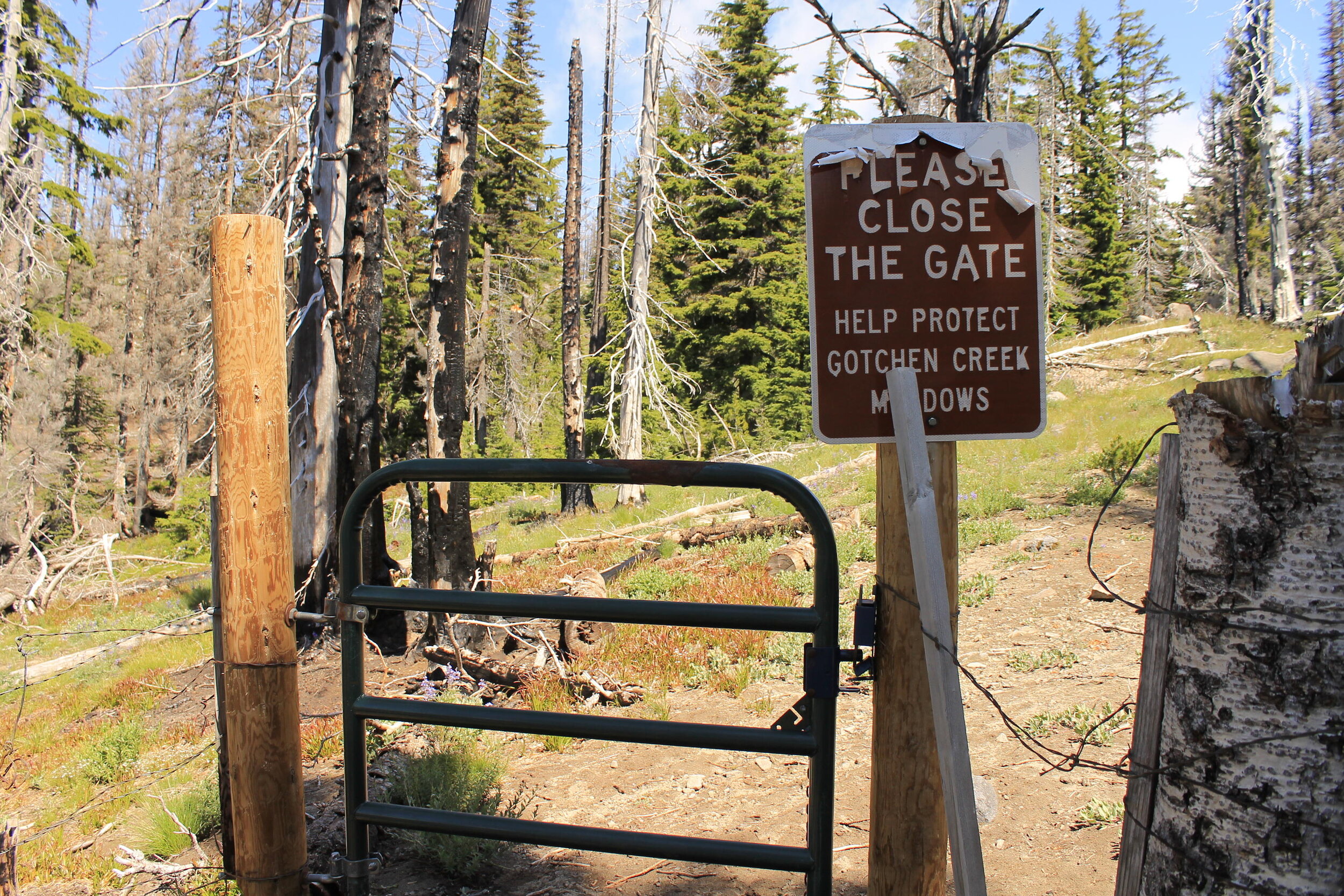
After 5.5 miles or so of trudging up the mountain, I came to a gate that is supposed to keep cattle out the fabled meadows along Gotchen Creek:

Aiken Lava Bed 054 web.JPG

I learned that this gate was not doing much, and that cattle were regularly seen in the meadows after the 2015 fire. Bummer. Now, about Gotchen Creek, something perplexing: my trail up was the Snipes Mountain Trail, which follows Gotchen Creek, while my return route was the Gotchen Creek Trail…which goes nowhere near Gotchen Creek. Sometimes I think we need to just start renaming almost everything in the outdoors.

Anyway, before long I came to Gotchen Meadows, where I stopped for an early lunch of dolmas, crackers and fruit. Mount Adams was hiding in the clouds, but soon they began to part, revealing the glory of Washington’s second highest peak:

Gotchen Creek Meadows, July 2019.

Gotchen Creek Meadows, July 2019.

I carefully picked my way across the meadow, doing my best to leave as little of a trace as possible. With such overwhelming beauty, it’s hard not to be careless. But you must! Here Gotchen Creek meanders through boggy meadows, backed by Mount Adams. The mountain is the gift that keeps on giving, and this was another present I was delighted to unwrap. I spent much of my time at the horseshoe bend pictured above, and below:

Aiken Lava Bed 076 web.JPG

But I sought out other shapes too as I followed the sinewy creek as best I could:

Aiken Lava Bed 086 web.JPG

I’m not sure how long I spent at the meadow, but it was probably an hour. Time was wasting away and I still had many miles to cover. I seriously contemplated just turning around from here, so I could spend more time in the meadows…but nah, I couldn’t do that. I had a loop to complete!

Once I could say goodbye to the meadow, I continued uphill for another half-mile to the junction with the Round the Mountain Trail. The flowers in this stretch were fantastic:

Aiken Lava Bed 096 web.JPG

The Snipes Mountain Trail meets the Round the Mountain Trail at the very edge of the Yakima Reservation. A right turn here will lead you in very little time to Bird Creek Meadows, one of the most beautiful places anywhere. There’s a sign at the junction welcoming hikers:

Aiken Lava Bed 099 web.JPG

I need to turn left here, towards the South Climb Trailhead, to continue my loop. This next stretch of trail I had hiked before, as I had followed the Round the Mountain Trail on my trek to Bird Creek Meadows. At first the views of Mount Adams are spectacular, as it rises above the head of the lava bed:

Aiken Lava Bed 110 web.JPG

Before long, however, the trail leaves the views of Mount Adams behind to cross the lava bed and its rocky ramparts. Instead you get views south to Mount Hood, a nice trade. The trail across the lava bed is neat in its own way:

The Round the Mountain Trail across Aiken Lava Bed.

The Round the Mountain Trail across Aiken Lava Bed.

I met the South Climb Trail some 2 miles from the Snipes Mountain junction. It was at this junction that I saw my first hiker of the day, who was headed east towards Bird Creek Meadows. He would not be the last person I saw all day. Over the next mile or so down to the South Climb Trail, I saw a few dozen folks trudging uphill with dreams of climbing Mount Adams (this is the primary route up the mountain). Many of them asked me if I’d been to the summit already; when I responded that I’d come from the east, up a lonesome valley, many of those same would-be climbs looked at me with a mixture of confusion and admiration. This is true back in Portland when I talk about Mount Adams; for many in the mountaineering community in the Portland area, the only time they’ve been to Mount Adams was to climb the mountain.

Some twenty minutes later, I wandered into the crowded and entirely unappealing South Climb Trailhead. I took a short break here to look at my map and read my directions. I was looking for the Cold Springs Trail, which would eventually take me to the Gotchen Creek Trail. It turns out the Cold Springs Trail is located on the far eastern end of the South Climb Trailhead, tucked away and not all that noticeable.

It also turns out the Cold Springs Trail has not received much, if any maintenance in quite some time. The next few miles were some of the most uncomfortable hiking I’ve had in some time, as long stretches of the trail were so faint I began to wonder if it would just disappear altogether. Here’s a nicer stretch:

The Cold Springs Trail, looking back towards Mount Adams, July 2019.

The Cold Springs Trail, looking back towards Mount Adams, July 2019.

This was a less-nice stretch:

The Cold Springs Trail, July 2019. Somebody send in the trail crew!

The Cold Springs Trail, July 2019. Somebody send in the trail crew!

Now, I’m not usually one to complain about trail conditions. I seek out faint and wild trails to explore, and to escape the crowds found on more well-known trails. But when you’re in mile 10 of a 15 mile loop, you happen to be alone and haven’t seen another hiker on your trail, and you begin to wonder if you will need to bushwhack over dead trees for miles to find your car…well, it’s enough to give a person some anxiety. Thankfully the trail mostly stayed where it was supposed to, and even when there was no tread, I was able to follow old cut logs in the faintest stretches. Eventually things got better.

Aiken Lava Bed 131 web.JPG

After what seemed like an interminable descent, I finally met the Gotchen Creek Trail something like 13 miles into my hike. Here I turned left on a much wider and obvious trail, and hiked a mile to a signed trailhead in what seemed like a pretty random location. To be fair, a lot of the trails on Mount Adams feel like they are located in random locations. So all that was left was to walk roads for about a mile back to my car.

Not even 200 yards from my car, I came across a roadblock:

Aiken Lava Bed 147 web.JPG

I don’t see cows very often on hikes, and these guys were blocking the route back to my car. So I had to yell and dance and jump up and down for about 30 seconds until the five or six cows got the idea and plunged into the brush. Not even 2 minutes later, I was back at my car, beaten up and happy to be done with my hike and desperate for some salty snacks and caffeine. It was a fascinating and long day full of surprises! I am not sure if I will ever do this loop again, but if nothing else I will definitely return to Gotchen Creek Meadows. There’s never a dull moment when you’re exploring Mount Adams…and I am hoping to do more of it this summer.

Distance: 15.1 mile loop

Elevation Gain: 3,061 feet

Drivetime from Portland: 2 hours each way

Here’s a map of my loop. For more information on this hike, see this link (which was also linked above).

Hike Map 2019-07-18.jpg

Jefferson Lake Trail - May 28, 2019 by Matt Reeder

After mostly taking a few years off from the Mount Jefferson area after the publication of 101 Hikes in the Majestic Mount Jefferson Region in 2016, I decided to go back and begin exploring the area again in 2019. I will be writing about some of these experiences here.

Central Oregon 253 web.JPG

One of these days I’ll hike the entire Jefferson Lake Trail.

This trail has been on my mind for years, just sitting there, taking up space. I’ve been to the trailhead to look around, to hike a short distance, to take in the views on the road in…to just be there. This corner of the Mount Jefferson Wilderness is seldom traveled, but beloved by those who know it well.

I first visited this area in July 2012, while Wendy and I were camping along the Metolius River. After hiking the Metolius River Trail upstream from Wizard Falls in the morning, we drove out to the Jefferson Lake Trailhead to go check out the huge trees in the afternoon. Driving into the area, it felt like were passing into a different world, one forgotten after the B+B Fire ravaged the area in 2003. The views on the drive in are almost alien; I can’t think of another place in Oregon that really looks like this:

Driving towards the Jefferson Lake Trailhead, July 2012.

Driving towards the Jefferson Lake Trailhead, July 2012.

All we were able to do that day was to visit the two enormous Rocky Mountain Douglas firs along the trail, not even 200 yards from the trailhead. Not long after we visited, my friend Brad came here and managed to make it all the way to Table Lake, and back. His report on Portland Hikers stayed with me, and paradoxically made me want to hike this trail even more. It’s worth reading if you’ve got some time; it’s a fantastic piece of Type 2 fun.

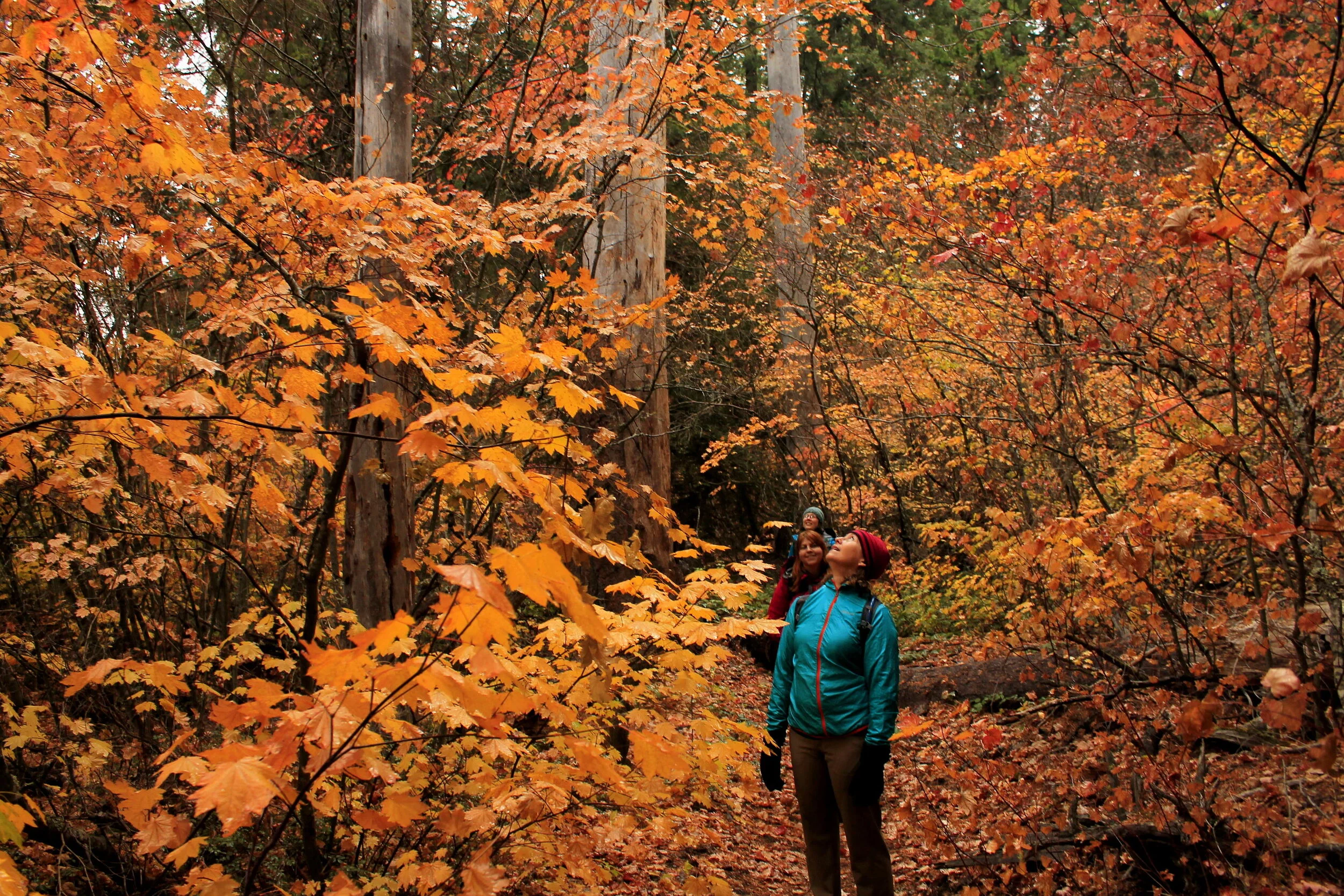
I returned in 2015 to hike as much of the trail as I could. We were staying along the Metolius River, and spent the first day of our trip exploring Green Ridge. Rainy, cold weather drifted in on day 2 of our trip, and we were lucky to get a window to go explore the Jefferson Lake Trail. To my surprise, we found the trail in good shape for the first mile or so from the trailhead. Brush began to encroach on the trail as followed it through the lava, and by the time we made it to Cougar Spring, it was clear that we needed to turn around. The trail was getting faint, and the weather was letting us know in no uncertain terms that it was time to get out of the mountains. On our way out, however, we did manage to stop and take a few photos of what was an excellent display of fall color:

Magnificent fall color on the Jefferson Lake Trail.

Magnificent fall color on the Jefferson Lake Trail.

I was grateful to make it as far as Cougar Springs (2.2 miles from the trailhead) before what turned out to be a torrential rain began to pour on us. I wrote about this stretch of trail in 101 Hikes in the Majestic Mount Jefferson Region, hoping that others would go check out what trail still existed and help save it from the encroaching tide of snowbrush (ceonothus) that was threatening to overtake the trail for good. Around this time, the Deschutes National Forest proposed permanently decommissioning the Jefferson Lake Trail, cutting off this entire corner of the Mount Jefferson Wilderness from the public.

In the few years after I published 101 Hikes, I would occasionally receive updates from folks who went to explore the Jefferson Lake Trail and found it in better shape than ever. One day, I received word that a citizen group had adopted the trail and was fixing it up. Later on, I received another email telling me that the entire trail, from the Jefferson Lake Trailhead to Patsy Lake, had been brushed out and was again passable (the spur trail to Jefferson Lake itself is believed to still be lost to the brush). Glorious news this was! So I can’t wait to go backpacking here, to Table Lake, to hike this newly saved trail.

So on Memorial Day weekend last year, Gene and I decided to meet up in Sisters to go visit Skylight Cave. I’d never been there before and Gene knew the way. After we visited the cave, I suggested we go explore some of the Jefferson Lake Trail to go see what the wildflower show looked like there. I knew we wouldn’t make it to Table Lake, but I wanted to go see the trail just the same. So we set out on the same route along the Metolius and into Jefferson Creek’s long, brushy canyon. Once we started our hike, I was shocked and dismayed to see that the two enormous Rocky Mountain Douglas firs near the trailhead had fallen in a storm:

Central Oregon 247 web.JPG

This was a shock and a great sadness to me. The tree in the photo was believed to be the largest Rocky Mountain Douglas fir in the country, and it was with profound sadness that I walked through the huge gap between the tree that had been sawed out. That the tree had been sawed out here was also quite surprising; for more information see the article in this link.

We found the trail in excellent shape, as expected. Once we reached the lava field, I was hoping to see flowers growing along the trail. Unfortunately, it seems we were either too early for flowers, or there weren’t any to begin with. Regardless, this is a neat stretch of trail, unique to this corner of the Mount Jefferson Wilderness:

The trail winds through the Forked Butte Lava Flow.

The trail winds through the Forked Butte Lava Flow.

Mount Jefferson and the Forked Butte Lava Flow.

Mount Jefferson and the Forked Butte Lava Flow.

The Forked Butte Lava Flow is geologically recent, believed to be only 6,500 years old. Forked Butte itself is a peak near the Cascade crest south of Table Lake, near the head of the Jefferson Lake Trail.

As we hiked along our merry way, Gene was less enamored with the Jefferson Lake Trail than I was. He liked lakes and water features, and this stretch of trail might be the driest place in the entire Mount Jefferson Wilderness. So we decided to turn around, and leave me to go explore the Jefferson Lake Trail another day.

So it goes; there’s a beautiful trail that is seldom traveled through the remote eastern corner of the Mount Jefferson Wilderness, and I’ve only hiked a little over 2 miles of it. One of these days I’ll make it there, once and for all. One of these days…

Three Pools and Henline Falls (in the snow!) - February 17, 2019 by Matt Reeder

After mostly taking a few years off from the Mount Jefferson area after the publication of 101 Hikes in the Majestic Mount Jefferson Region in 2016, I decided to go back and begin exploring the area again in 2019. I will be writing about some of these experiences here.

Franziska of Hike Oregon and I had been talking about finding a good winter hike for awhile. A series of snowstorms in January and February of last year gave us a chance to meet up for a winter exploration, that ended up being more than was expected. Winter adventures are some of the most fun you can have outside, so long as you are prepared for almost any kind of conditions.

We met up at the junction with the Little North Fork Road and carpooled up the canyon to the Willamette National Forest boundary, where winter plowing ends. Here we parked. There was about 2 feet of snow on the road, at least six inches of it fresh snow. When I was growing up in Salem, we spent a lot of our time in the winter exploring the Little North Fork Canyon, and I’ve certainly seen this area in the winter many times before. But it never gets old, and this was one of my better winter explorations here.

Once on the road, we made our way up the road to the junction with Forest Road 2207, which branches off towards Three Pools, Cedar Creek, and eventually, Detroit Lake.

The junction of Forest Roads 2209 (which goes to Opal Creek) and 2207 (which goes to Shady Cove and beyond) in the snow.

The junction of Forest Roads 2209 (which goes to Opal Creek) and 2207 (which goes to Shady Cove and beyond) in the snow.

Winter in the lower elevations of the mountains is a funny thing; a small difference in elevation can mean a huge difference in snowfall. As we began to walk down the road towards Three Pools, the snow depth got lower and lower. By the time we reached Three Pools, we were down to several inches, which made for easier walking conditions. I’ve been to Three Pools many times, but up until this day I had never been there in this much fresh snow. It was a dream come true in some ways, even though the bright skies made for more challenging photography conditions.

Three Pools with a coat of fresh snow.

Three Pools with a coat of fresh snow.

After a long time spent taking photos, we walked back up the road to the 2209 junction and and turned right. It’s only 100 yards or so to the Henline Falls Trailhead from here. As we began to trudge through increasingly deep snow, it quickly became apparent that this was not going to be as easy as the walk down to Three Pools. See what I said above about small differences in elevation meaning huge differences in snowfalls; as we hiked the Henline Falls Trail, some parts of the trail were buried in as much as three feet of snow. Thankfully not all of the trail was like this; other spots were fairly easy going.

The Henline Falls Trail in about a foot of fresh snow.

The Henline Falls Trail in about a foot of fresh snow.

Thankfully, it isn’t a very long ways to Henline Falls, and before too long we found ourselves approaching the falls. Here the trail got a little sketchy, as snow had been falling from the narrow canyon walls and piling up next to the trail. Franziska and I both strongly believe in safety, so we stayed a good distance back from the falls. We found a nice spot to stand and photograph the mesmerizing winter scene. I had never been to Henline Falls in this much snow before, and it was a sight to behold:

Franziska at Henline Falls.

Franziska at Henline Falls.

After taking a lot of photos, we had to make our way back to her car. It was a nice walk back in the snow, full of good conversation and planning. Cherish good company when you have it!

I’ve been to this area so often in my life that you would think I take it for granted, but I never do; there is something so magical about the Little North Fork canyon. And every time I go back, the magic takes hold of me and I am captivated once again.

It was another excellent day in one of my favorite places.

French Creek Ridge - November 3, 2019 by Matt Reeder

After mostly taking a few years off from the Mount Jefferson area after the publication of 101 Hikes in the Majestic Mount Jefferson Region in 2016, I decided to go back and begin exploring the area again in 2019. I will be writing about some of these experiences here.

French Creek Ridge 037 web.JPG

I have always had a bone to pick with the French Creek Ridge Trail. When I was working on 101 Hikes, the area took a backseat until very late in the process of writing the book. Rumors of terrifying roads and rough trail always led me to push it down the pile, until I had no excuses left. I finally made it there in October 2015, but found the rumors to be mostly true. I was glad to knock the hike off my list, but bummed I didn’t have more time to spend in the area.

In 2019, I was brought onto a project to help map out what I refer to as the Majestic Mount Jefferson Region. One of the trails that needed mapping was the French Creek Ridge. How exciting! I decided to bring a group along this time, to make the experience a little less intimidating. So we took one of the last really nice days in the fall to go explore this trail, which had always felt like unfinished business.

I went into this area twice last year (the other trip was to Opal Lake), and in the years since I first published 101 Hikes, the road to the French Creek Ridge Trailhead was in the best shape I’d ever seen. Even the stretch along the cliffs before you reach the trailhead was not as scary as I remember it. Maybe I’ve seen much worse since the first time? In any case, it felt good to get back onto the trails here.

The rocky crags of Marten Buttes, not far from the trailhead.

The rocky crags of Marten Buttes, not far from the trailhead.

Upon starting our hike, we very quickly discovered that the trail had received some long-overdue maintenance. Not long after I learned that a local trail crew has adopted the length of the French Creek Ridge Trail from Elkhorn Ridge through to Beachie Saddle (although the trail changes names several times, it is a continuous trail), and is in the process of fixing up the trail. I brought along my saw and clippers, and for the first two miles of the trail I barely needed either. The weather was gorgeous as well, cold and crisp with views at almost every turn. Trail maintenance began to taper off after about 2 miles, but it was still in much better shape than it had been in 2015.

The French Creek Ridge Trail as it crosses a talus slope.

The French Creek Ridge Trail as it crosses a talus slope.

We reached the junction with the Byars Peak Trail at 2.4 miles. I never got around to hiking the Byars Peak Trail before I finished 101 Hikes, so it was tempting to suggest we follow it down to its trailhead. After a bit of discussion, we decided to continue on towards Mount Beachie. From this point on brush became something of an impediment, but not as much as it had been the previous time. Shortly after the Byars Peak junction the trail begins to descend rapidly away from the rocky crest of the ridge, into the dark forests below the western flanks of Mount Beachie. We followed the trail through the bush and back out, where we arrived at the spot where I turned around in 2015. We stopped for a snack here, while Sarah decided to scramble up to the rocky ridgecrest. With some time to spare, we decided to continue onward to the summit of Mount Beachie.

To my surprise and delight, the trail was in decent shape and was relatively easy to follow, all the way to the trail’s high point at around 4 miles from the trailhead. Sure, there were times when the trail became faint, but at each turn the way was never in doubt. I knew that to find the summit of Mount Beachie you had to bail off the trail and find a faint path to the summit; we missed this faint path, and ended up bushwhacking to the summit, which was quite easy. The view at the summit was not as expansive as I had hoped it would be, but we could still see down to Elk Lake, and southeast to Mount Jefferson. After all these years, it was great to finally stand on the summit of Mount Beachie!

Looking out to Mount Jefferson from the summit of Mount Beachie.

Looking out to Mount Jefferson from the summit of Mount Beachie.

With the lack of daylight in early November, any thoughts of further exploration were set aside. Our return trip was wonderful, with the sun shining in our faces and different views to the area all around. We made it back to the car with daylight to spare, feeling full of wonder at the beauty of this corner of the Majestic Mount Jefferson Region. I hope to make it back sometime this year to continue exploring the trails and peaks I have yet to explore. Make it so!

Hike stats:

  • Hike distance: 8.2 miles out and back

  • Elevation Gain: 2,100 feet

  • Drivetime from Portland: 1 hour and 50 minutes each way

Map of our hike, with the trail in purple.

Map of our hike, with the trail in purple.