After mostly taking a few years off from the Mount Jefferson area after the publication of 101 Hikes in the Majestic Mount Jefferson Region in 2016, I decided to go back and begin exploring the area again in 2019. I will be writing about some of these experiences here.

I have always had a bone to pick with the French Creek Ridge Trail. When I was working on 101 Hikes, the area took a backseat until very late in the process of writing the book. Rumors of terrifying roads and rough trail always led me to push it down the pile, until I had no excuses left. I finally made it there in October 2015, but found the rumors to be mostly true. I was glad to knock the hike off my list, but bummed I didn’t have more time to spend in the area.
In 2019, I was brought onto a project to help map out what I refer to as the Majestic Mount Jefferson Region. One of the trails that needed mapping was the French Creek Ridge. How exciting! I decided to bring a group along this time, to make the experience a little less intimidating. So we took one of the last really nice days in the fall to go explore this trail, which had always felt like unfinished business.
I went into this area twice last year (the other trip was to Opal Lake), and in the years since I first published 101 Hikes, the road to the French Creek Ridge Trailhead was in the best shape I’d ever seen. Even the stretch along the cliffs before you reach the trailhead was not as scary as I remember it. Maybe I’ve seen much worse since the first time? In any case, it felt good to get back onto the trails here.

The rocky crags of Marten Buttes, not far from the trailhead.
Upon starting our hike, we very quickly discovered that the trail had received some long-overdue maintenance. Not long after I learned that a local trail crew has adopted the length of the French Creek Ridge Trail from Elkhorn Ridge through to Beachie Saddle (although the trail changes names several times, it is a continuous trail), and is in the process of fixing up the trail. I brought along my saw and clippers, and for the first two miles of the trail I barely needed either. The weather was gorgeous as well, cold and crisp with views at almost every turn. Trail maintenance began to taper off after about 2 miles, but it was still in much better shape than it had been in 2015.

The French Creek Ridge Trail as it crosses a talus slope.
We reached the junction with the Byars Peak Trail at 2.4 miles. I never got around to hiking the Byars Peak Trail before I finished 101 Hikes, so it was tempting to suggest we follow it down to its trailhead. After a bit of discussion, we decided to continue on towards Mount Beachie. From this point on brush became something of an impediment, but not as much as it had been the previous time. Shortly after the Byars Peak junction the trail begins to descend rapidly away from the rocky crest of the ridge, into the dark forests below the western flanks of Mount Beachie. We followed the trail through the bush and back out, where we arrived at the spot where I turned around in 2015. We stopped for a snack here, while Sarah decided to scramble up to the rocky ridgecrest. With some time to spare, we decided to continue onward to the summit of Mount Beachie.
To my surprise and delight, the trail was in decent shape and was relatively easy to follow, all the way to the trail’s high point at around 4 miles from the trailhead. Sure, there were times when the trail became faint, but at each turn the way was never in doubt. I knew that to find the summit of Mount Beachie you had to bail off the trail and find a faint path to the summit; we missed this faint path, and ended up bushwhacking to the summit, which was quite easy. The view at the summit was not as expansive as I had hoped it would be, but we could still see down to Elk Lake, and southeast to Mount Jefferson. After all these years, it was great to finally stand on the summit of Mount Beachie!

Looking out to Mount Jefferson from the summit of Mount Beachie.
With the lack of daylight in early November, any thoughts of further exploration were set aside. Our return trip was wonderful, with the sun shining in our faces and different views to the area all around. We made it back to the car with daylight to spare, feeling full of wonder at the beauty of this corner of the Majestic Mount Jefferson Region. I hope to make it back sometime this year to continue exploring the trails and peaks I have yet to explore. Make it so!
Hike stats:
Hike distance: 8.2 miles out and back
Elevation Gain: 2,100 feet
Drivetime from Portland: 1 hour and 50 minutes each way
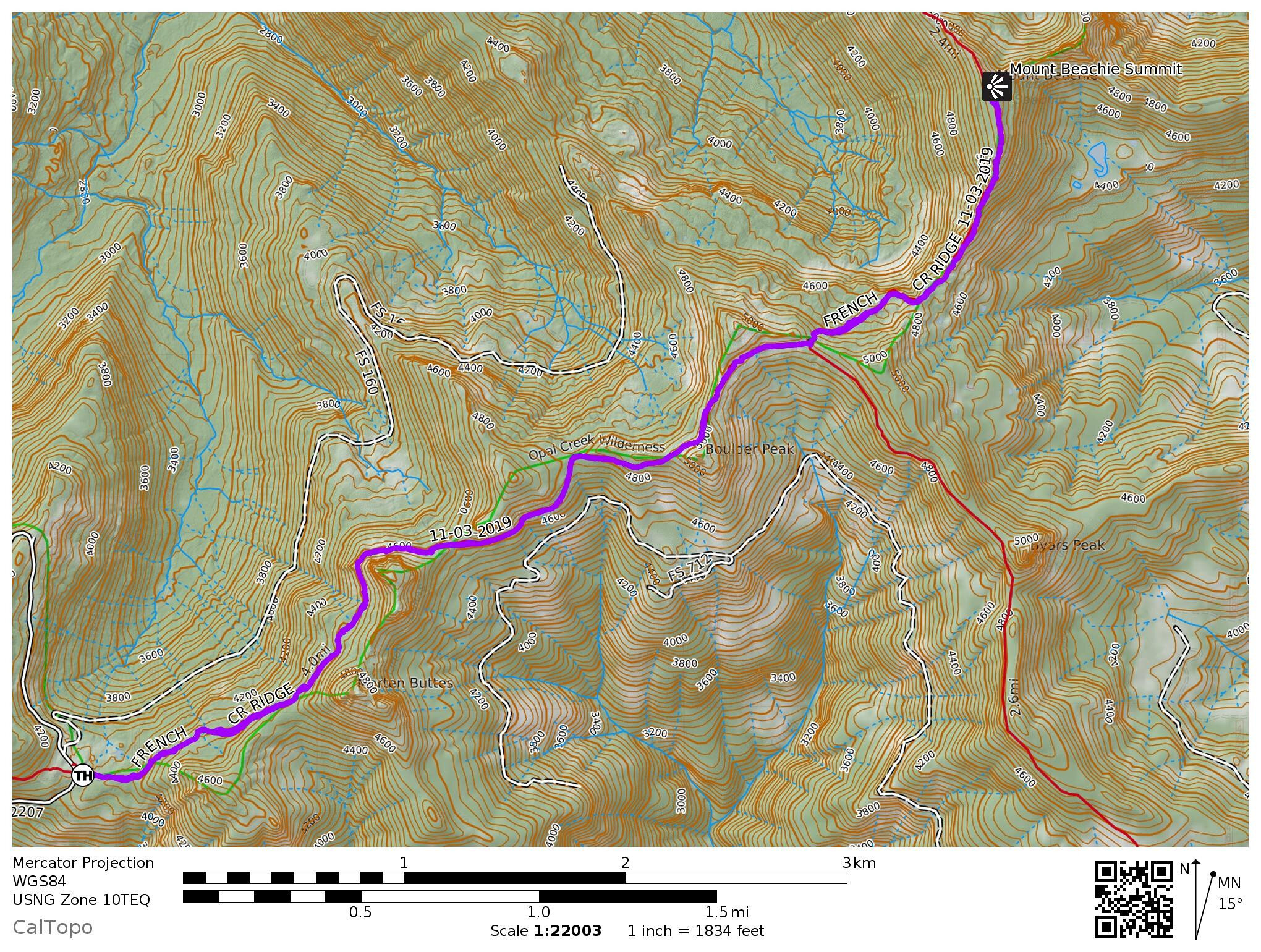
Map of our hike, with the trail in purple.