After mostly taking a few years off from the Mount Jefferson area after the publication of 101 Hikes in the Majestic Mount Jefferson Region in 2016, I decided to go back and begin exploring the area again in 2019. I will be writing about some of these experiences here.

I’ve been coming to Jefferson Park for a long, long time. At some point, I lost track of how many times I’ve been but it’s at least ten. My first visit was in 1993, via the Whitewater Trail. I was 12. Here are my notes from my hiking journal that I kept:
Jefferson Park - October 26, 1993
10 miles
1,800 feet elevation gain
Note: View of Mount Jefferson was awesome!
I added the emphasis there, because I know my 12 year-old self would have done that. Growing up in Salem, we could see Mount Jefferson from the kitchen window of our tiny little house in south Salem, and it didn’t take too long for my stepdad and I to go exploring the area.
We went back two years later, in 1995, to hike into Jefferson Park via the South Breitenbush Trail. Again, here are my notes:
South Breitenbush to Jefferson Park - October 1995
11 miles
2,400 feet elevation gain
Notes: Snow, snow, snow. Got lost near Mount Jefferson. Great views though.
This time we brought along our camera, so I can present to you a few photos from that day:


That last photo was taken after we lost the South Breitenbush Trail in the snow about 5 miles from the trailhead. I know the exact spot, and I’ve noted it every other time I’ve hiked the trail since then. Where the trail curves around Park Ridge before dropping into the park, we couldn’t find the trail anymore in the snow. So we just headed uphill, where we saw the view in the photo above. All things considered, I think I like the result here even better. The fall color, as you can see, was excellent as well.
So why did we keep going to Jefferson Park in the fall? Because I spent my summers in Illinois visiting my dad. So our hiking time was mostly concentrated in fall, with a little in winter and spring.
We went back again at the beginning of September 1996, and this time we finally succeeded in experiencing the glory of Jefferson Park in the summer. Again, we brought along our camera, so you can relive this experience vicariously through me:


It shouldn’t surprise you to learn that Nirvana was then, and still is, my favorite band.
Did I write about this experience in my journal? Of course I did:
South Breitenbush River / Jefferson Park - September 1, 1996
15.2 miles
3,400 feet elevation gain
7 blisters (for Matt)
Notes: Very beautiful hike, and very, very long. Great views of Jefferson. No snow this time around, so we didn’t get lost. Nice wildflowers, clear streams, placid lakes, and tons of people. And to think that this is the least popular of the 4 routes to Jefferson Park. Oh well, it was still a great and long, steep hike. I enjoyed it thoroughly.
It is remarkable to me how much I sound like my current self, nearly 24 years later. This was the last time we were able to visit Jefferson Park before we moved back to Illinois the following year. I didn’t make it back again until a couple of years after I moved back out there. Of course I had to take Wendy here when we were dating, and of course we had to go via the South Breitenbush Trail. And of course I had to go back and backpack the South Breitenbush Trail in 2009. While my friends stayed in their tents as the mosquitoes almost literally ate them alive, I braved the bugs to photograph the single greatest sunset I’ve ever seen in the backcountry:

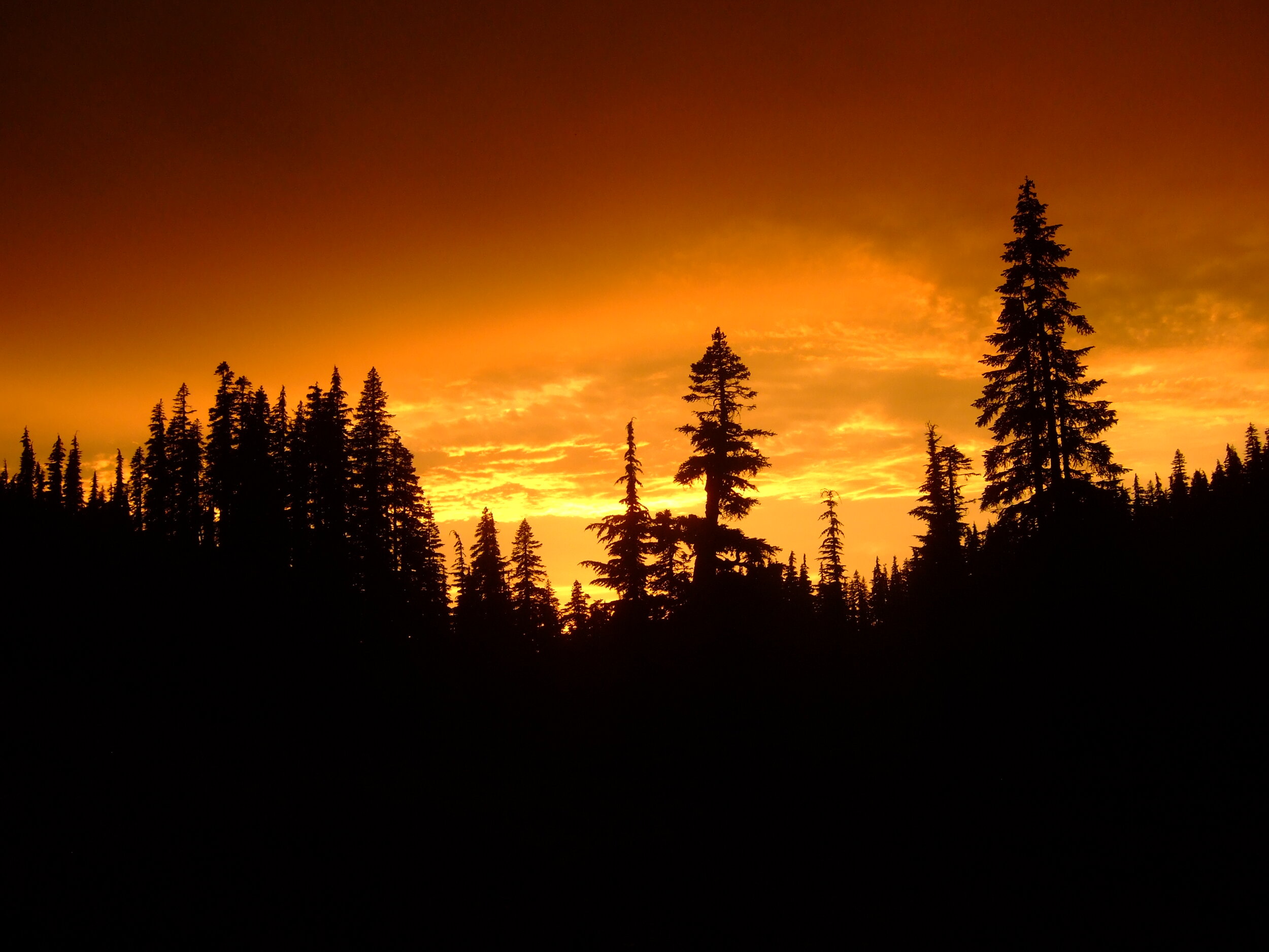

Jefferson Park at sunset, August 1, 2009. The pictures cannot possibly do it justice.
So you see, of course, why I ended up writing 101 Hikes in the Majestic Mount Jefferson Region.
Of course I’ve been to Jefferson Park many times, more than I can count. But I had not been there since the 2017 Whitewater Fire burned to the park’s door. In 2019, the Willamette National Forest announced that Jefferson Park, along with the rest of the Mount Jefferson Wilderness (and Three Sisters Wilderness) would be subject to a limited-entry permit system beginning in 2020 (note: implementation of this permit system has been delayed until 2021 due to the COVID-19 pandemic). I knew I had to get back to Jefferson Park before the permit system made it much harder to visit.
I decided to go for just a day, as my options last September were limited. The forecast for this particular Tuesday said morning clouds, followed by afternoon sunshine. It sounded like my kind of day. So off I went on my merry way to the Whitewater Trailhead.
Driving into the fire-scarred wilderness was shocking, but not surprising. Once I hit the trail, I had to take my customary photo of the wilderness sign:

Things were different indeed.
The Whitewater Trail has never been my favorite approach to Jefferson Park, both due to the crowds and due to the hot, dusty approach that can get kind of tedious on a long, summer day.
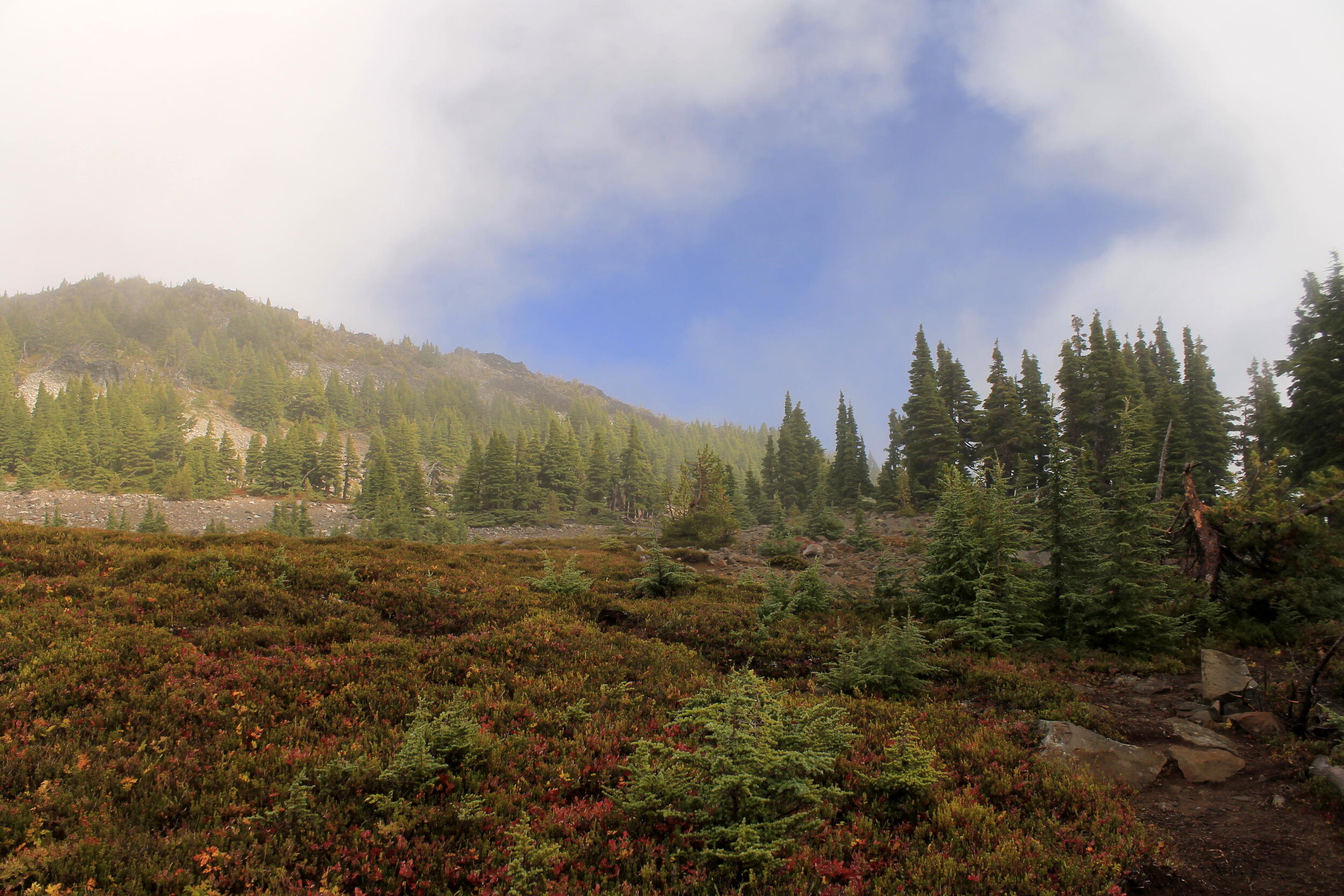
This day was not hot, or dusty. Actually, it was fucking cold. And wet. And almost inhospitable. Sometimes it seemed like the sun was right there above me, just waiting to come out and wash away the rain:

And sometimes it seemed like I was walking through the heaviest of clouds, clouds that wanted to torment me for even considering hiking to Jefferson Park on this day:
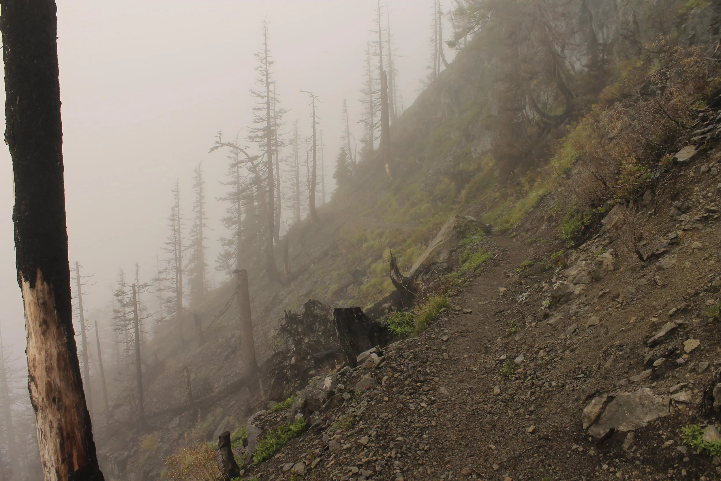
It was so nasty outside I didn’t even have time to really consider the fire damage. Most of my hike in was spent wondering whether the sun would ever come out, whether I was hiking in a cloudy maelstrom just out of the reach of the healing warmth of the sun, and hoping my rain gear was as good as I expected it to be. One thing about hiking through fire damage is that you often pass out of it completely in seemingly an instant. This has everything to do with the fire lines that fire crews make, but it’s still remarkable.
Once in the unburned forest, the sun continued to taunt me:

Of course it wouldn’t be that easy. It never is.
As I hiked into Jefferson Park, the clouds returned with a vengeance, bringing with them a cold, biting wind that really made me start questioning my choices - or even my entire lifestyle. Mount Jefferson was nowhere to be seen:

Here at nearly 6,000 feet above sea level, I debated whether to turn tail and make my way as quickly out of the park as I arrived. But I felt good. In fact, I felt GOOD. That isn’t to say that I was all that happy to be hiking in such repellent weather; it was more that I felt better physically than I had in quite some time. So in spite of the weather, I made a rash decision: I was going to continue hiking into the rain, into the clouds, up to Park Ridge.
I had glorious visions of arriving at the ridgetop, above the clouds, to the absolutely magical view of Mount Jefferson found up there:
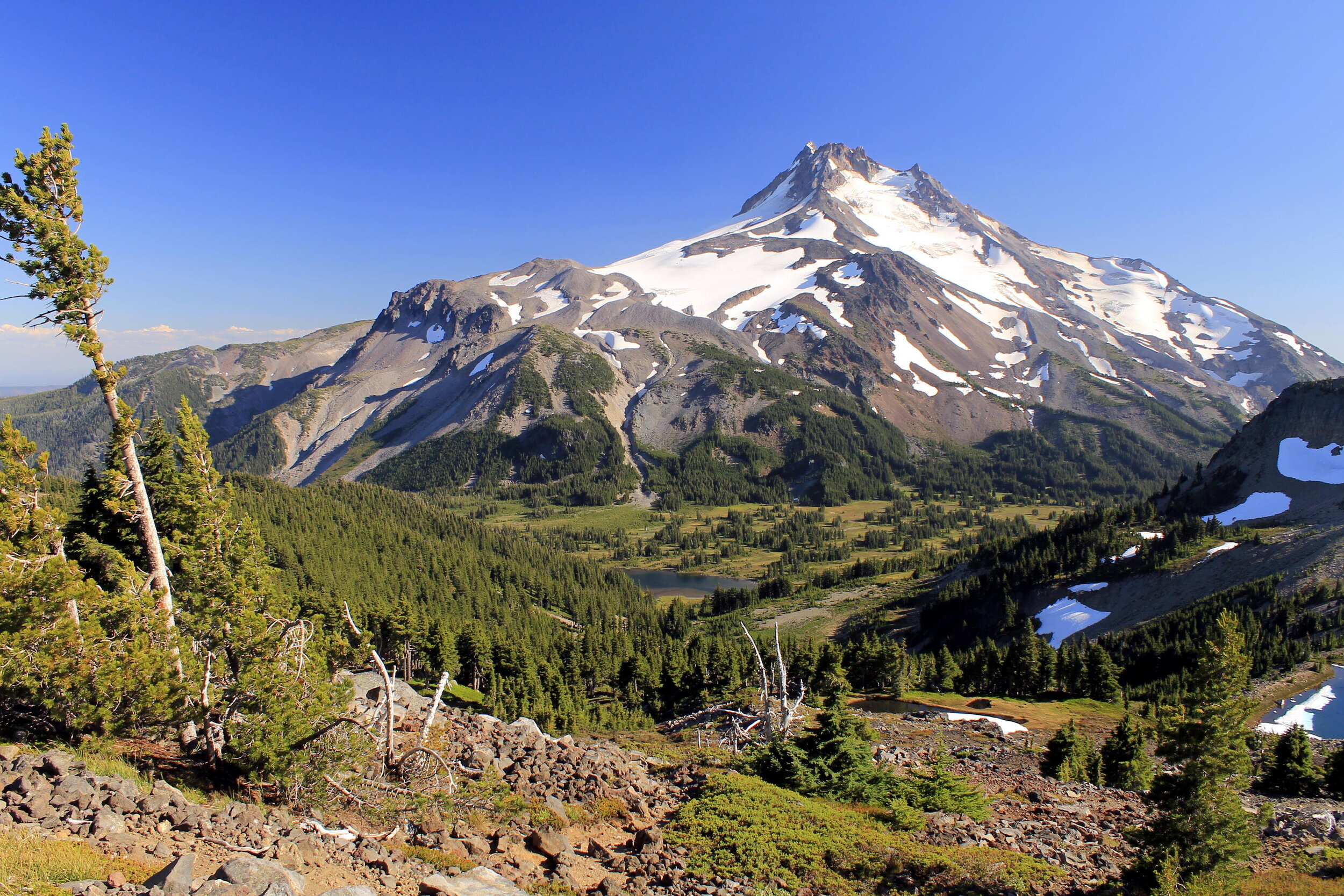
Mount Jefferson from the summit of Park Ridge, August 2016.
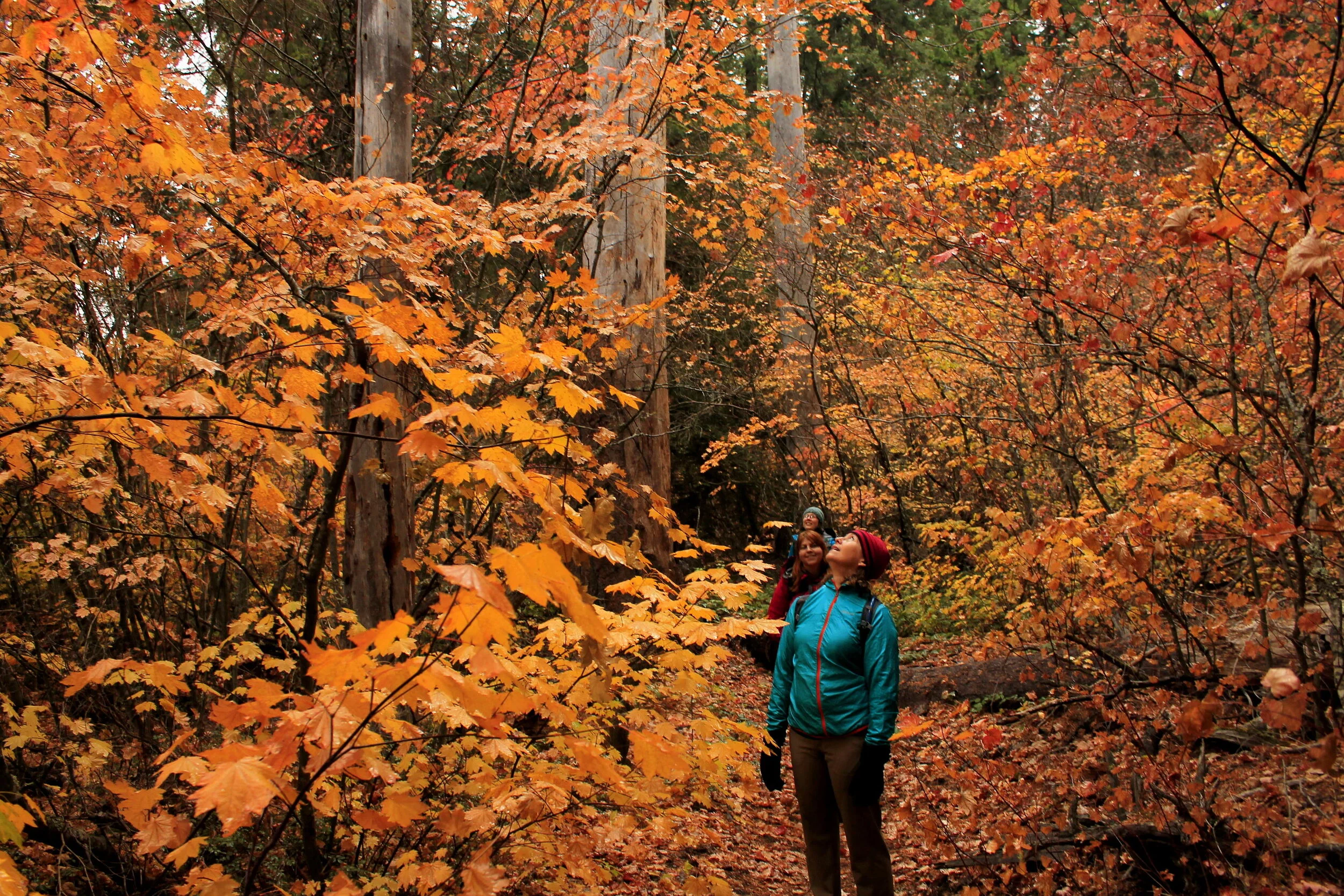
So I kept going. I hiked the Pacific Crest Trail past Russell Lake and began the climb up Park Ridge, my head full of hopes and dreams. The bad weather continued. At least I had the fall color to keep me company:

The further I got up the ridge, the more the sun taunted me. I could see it up there, peeking through the clouds, waiting to give me everything I longed for. At one point the clouds even parted above the summit of Park Ridge, revealing a large slice of blue sky above:
My friend Gene calls this phenomenon a “sucker hole” - as in, you’d have to be a sucker to believe it’s getting any better.
Just a few minutes later, I picked my way up the rocky trail and stumbled onto the summit of Park Ridge. Gene was right:

Contrast the picture above the one I posted from August 2016. I’ve been to Park Ridge many times, and it’s only been clear maybe 2-3 times. The other times I’ve been stuck in the clouds, including just two weeks prior on a long hike up from the Breitenbush Lake side of the PCT (that’s right - I went on very long hikes that culminated in arriving at the summit of Park Ridge, only to find it clouded in, twice in one month). Ugh.
I sat there on the summit of Park Ridge at nearly 7,000 feet above sea level and ate my lunch like a kid in detention who realizes he really screwed up. Now, let me be clear: I was enjoying myself, in spite of everything I’ve written so far. But there’s only so many times a person can hike to the summit of Park Ridge in the clouds before you start to wonder if you should just never try going here in any weather other than the reliably clear days of mid-summer.
At this point I was over 8 miles from the Whitewater Trailhead and it was maybe 1PM, maybe later. It was time to go home, and hope that both the sun and mountain would come out before I left the area. I am, in my heart, a hopeful person. So I started back down the trail, and almost immediately hiked back into the blue sky “sucker hole” referenced above. Not long after, I was able to faintly make out the summit pinnacle of Mount Jefferson for approximately 7 seconds. I considered that a major victory. No, the photo didn’t turn out.
As I continued downhill, the sun began to come out for real, piercing through the clouds with an unexpected brilliance. The skies began to clear above me:

Given how miserable the weather had been earlier in the day, I already considered this a huge victory.
The two miles of the Pacific Crest Trail from Park Ridge to Russell Lake are, in my opinion, the most beautiful two miles of trail in Oregon. As I neared Russell Lake, my spirits were already buoyed by the sun. I stopped at a spot along the trail about a half-mile above Russell Lake to bask in the sun, should I not have another opportunity that day. It was here that it happened. The clouds began to part over Mount Jefferson.
The next fifteen minutes were maybe the happiest fifteen minutes I had in 2019:


Sometimes the mountain will show herself after you’ve proven you’re willing to be patient with her. This was one of those times.
I could barely feel my feet on the trail for the next mile or so. The clouds danced around the summit of Mount Jefferson, sometimes obscuring it anew. It almost felt like the mountain was playing hide and seek with me, daring me to pull out my camera again, only to disappear into the clouds for a few minutes.
Mount Jefferson finally showed herself for good as I neared the junction with the trails to Scout and Bays Lakes:

It was here that I left the park, heading out on the Whitewater Trail back into the fire zone, back to real life.
On my way out, I stopped at the classic viewpoint of the mountain about 2 miles before Jefferson Park. Here I looked back, and found her still dancing in the clouds, looking completely glorious, beckoning me to return soon:


Mount Jefferson from the Whitewater Trail, September 2019. You can see how close the Whitewater Fire came to entering Jefferson Park here. If you look really closely in this photo, you can see two waterfalls, with a third just out of sight in Russell Creek’s dark, foreboding canyon.
It was a glorious end to a glorious hike.
The next few miles went pretty fast, until they didn’t and I started getting tired. By the time I reached my car, I was ravenously hungry - so hungry in fact, that I stopped at Subway in Mill City to devour a 12-inch sandwich. I was still hungry after that.
As for Mount Jefferson, I’m not hungry anymore. The mountain has shown me almost all she can show, and still I’ve gone back for more. There isn’t another place in the world where I feel more at home, and yet I only visit her a few times a year in most years. I cannot ask the mountain to give me any more - she has already given me so, so much. For that, I am eternally grateful.
Majestic Mount Jefferson, indeed.
Thanks for reading.